Lee este anuncio de prensa en español aquí.
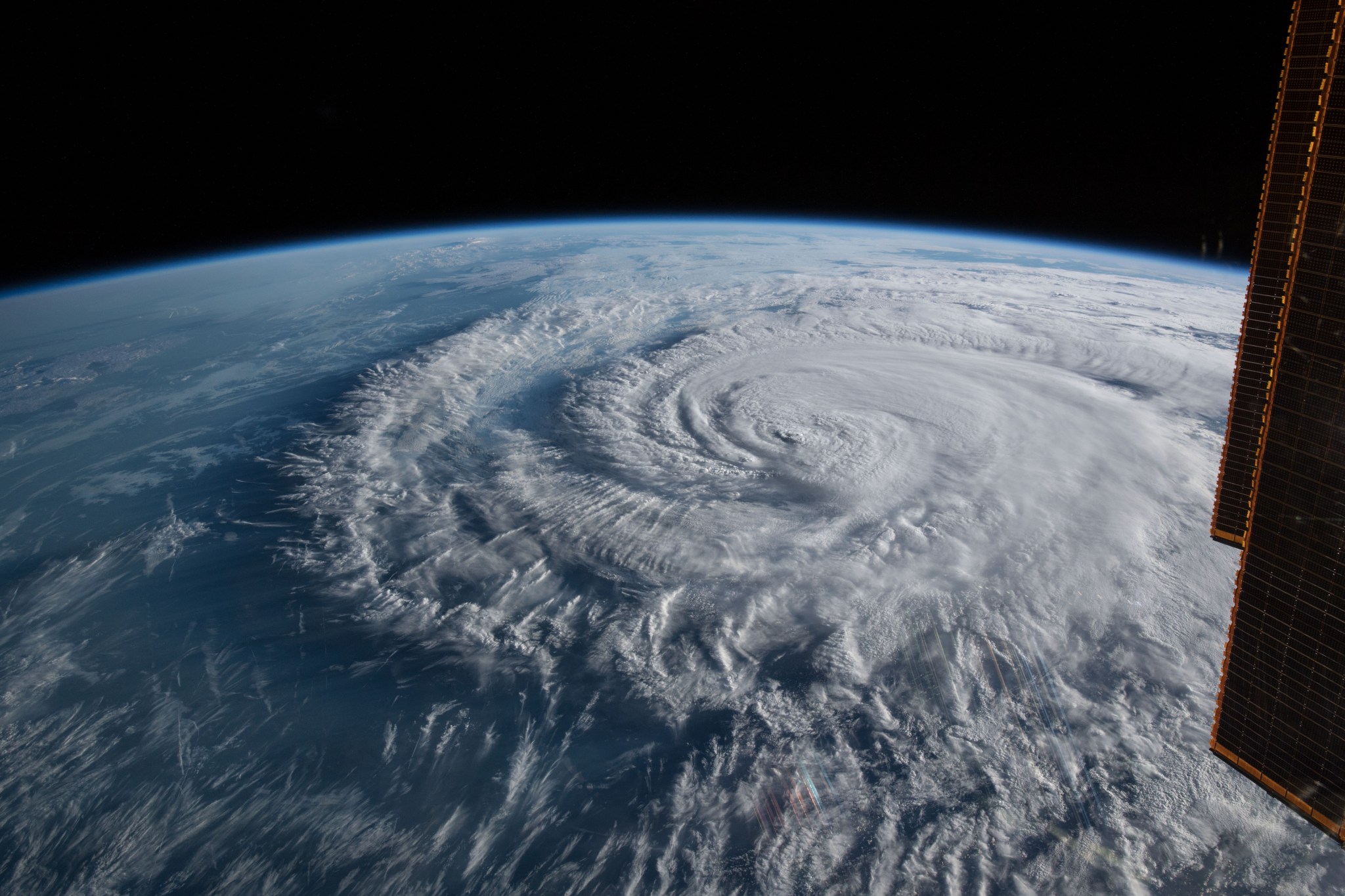
June 1 marked the official start of the Atlantic hurricane season, which officially ends Nov. 30. After 2020 brought a record number of named storms in the North Atlantic basin, NASA is once again prepared to help understand and monitor these storms from the unique vantage point of space and is providing experts to discuss hurricanes and other extreme weather events.
Climate change is increasing the heat in the ocean basins and already making it more likely that storms will intensify faster and become stronger, a phenomenon NASA scientists continue to study.
Using data from its 20-plus earth-observing satellites, NASA plays a foundational role in the science of hurricanes. But when it comes to operational forecasting, the agency’s main role is through its crucial partnership with the National Oceanic and Atmospheric Administration (NOAA). NASA designs, builds, and launches NOAA’s suite of satellites that provide the data that specifically feed numerical weather prediction models.
“NASA’s cutting-edge science helps us answer questions that nobody else can, especially when it comes to understanding hurricanes and their impacts before, during, and after they make landfall,” said NASA Administrator Bill Nelson. “As climate change intensifies and makes natural hazards like hurricanes more damaging, NASA is more committed than ever to innovative Earth science research. Our next-generation Earth System Observatory will build on NASA’s existing capabilities to provide an unprecedented understanding of the Earth from bedrock to atmosphere, so we are better prepared to protect our communities from hurricanes and other extreme weather events.”
NASA’s goal for disaster preparedness, response, mitigation, and recovery is bridging the gap between data and the people who need it. Before, during, and after a hurricane or storm makes landfall, NASA satellites are in prime position to identify impacts.
NASA works with local officials and first responders, federal agencies such as FEMA and the U.S. Army Corps of Engineers, and infrastructure experts to determine what information they need and to supply it in usable formats in real time. Examples include information on infrastructure failures and disruptions, contaminated water supplies and other hotspots for urgent response needs.
NASA welcomes media inquiries about its role in studying and understanding hurricanes. The following NASA scientists, who represent a cross-section of expertise in hurricane science and application, are available for media interviews as scheduling allows:
- Mara Cordero-Fuentes, an atmospheric scientist/meteorologist, fluent in both English and Spanish, with published research in hurricane science, plus 10 years’ experience in data assimilation systems, tropical meteorology, climate interpretation, and weather forecasting
- Scott Braun, a research meteorologist who specializes in using computer modeling to recreate the components of hurricanes, including winds, rainfall, and in-cloud heating
- Dalia Kirschbaum, whose work focuses on rainfall-triggered landslide modeling, monitoring and mapping
- Will McCarty, a research meteorologist at NASA’s Global Modeling and Assimilation Office
- Nadya Vinogradova Shiffer, ocean physicist and program manager of the physical oceanography program at NASA Headquarters, who can speak to sea level rise, ocean warming, and the interplay between the oceans and tropical storms
- Mayra Oyola-Merced, an expert in atmospheric physics, field research, numerical weather prediction, and operational forecasting
- Patrick Duran, who specializes in the synthesis of satellite observations with idealized modeling to explore the dynamics of tropical cyclone intensification
- Tim Hall, a senior researcher at NASA’s Goddard Institute for Space Studies in New York, who specializes in tropical cyclones’ relationship to climate and the hazard they pose to coastal communities
To inquire about interview availability with one or more of these scientists, please contact Peter Jacobs at: peter.jacobs@nasa.gov.
For general NASA hurricane science reference material, visit:
and
The following are some of NASA’s most popular public-domain, open-source imagery products:
- The record-breaking 2020 Atlantic hurricane season, visualized with overlaid tracks:
- Satellite data showing 3D view of Hurricane Zeta’s intense rainfall:
- Latest precipitation analysis and animation of the past seven days (auto-updates):
- NASA “night lights” data shows Puerto Rico’s power outages after Hurricane Maria:
- The 2017 hurricane season, visualized by the movement of dust, smoke and sea salt:
All NASA-created content is in the public domain and free for media usage.
For other Earth science videos, visit:
For all NASA scientific data visualizations and animations, visit:
-end-
Tylar Greene
Headquarters, Washington
202-358-0030
tylar.j.greene@nasa.gov
Jake Richmond
Goddard Space Flight Center, Greenbelt, Md.
301-286-6255
Jacob.a.richmond@nasa.gov

