


From Earth orbit to the Moon and Mars, explore the world of human spaceflight with NASA each week on the official podcast of the Johnson Space Center in Houston, Texas. Listen to in-depth conversations with the astronauts, scientists and engineers who make it possible.
On episode 334, a principal investigator talks about an experiment on board the space station observing the forces that drive space weather. This episode was recorded on January 26, 2024.
![]()
Transcript
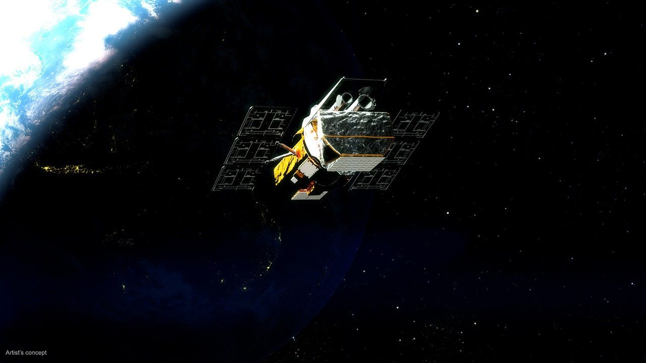
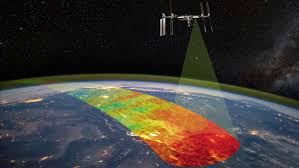
Host (Kenna Pell): Houston, we have a podcast! Welcome to the official podcast of NASA’s Johnson Space Center, Episode 334, “Atmospheric Waves.” I’m Kenna Pell and I’ll be your host today. On this podcast, we bring in the experts, scientists, engineers, and astronauts, all to let you know what’s going on in the world of human spaceflight and more. So we talk a lot about the experiments that take place inside the International Space Station, but the orbiting lab also serves as a platform for observing and studying our home planet from its unique vantage point in low Earth orbit. That’s both hands-on and automated equipment. It’s all about location. And today we’re going to talk about an experiment that makes use of that location, the Atmospheric Waves Experiment, or AWE, that is currently attached to the exterior of the International Space Station on a two-year observation mission.
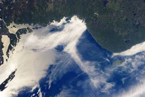
Have you ever seen photos of the Earth and noticed the red, green, purple, or yellow lights that form around our home planet? That’s where AWE comes in. From its space station perch, this experiment focuses on those colorful bands of light in Earth’s atmosphere called “airglow,” to determine what combination of forces drive space weather in the upper atmosphere. Space weather’s important because it can have profound impacts, not only affecting technology and astronauts and space, but can influence our everyday lives here on the ground, such as disrupting radio and GPS communications. There’s a lot to unpack here, and luckily, I’m only here for the color commentary. We are joined by AWE’s ultimate expert, Ludger Scherliess, the investigation’s principal investigator, who will help us understand how the experiment, for the first time, is making global observations of an important driver of space weather, and maybe even sharing an update or two. Alright, let’s get into it.
[Music]
Host: Ludger, thank you so much for joining us on Houston We Have a Podcast today.
Ludger Scherliess: Well, thank you very much for having me today to talk about the Atmospheric Waves Experiment.
Host: We’re so excited to have you and I know we were both at Kennedy Space Center in Florida for the cargo resupply mission that carried AWE to the space station. And one thing that I want to ask, was it the first time you saw a rocket launch in person?
Ludger Scherliess: Well, actually, as a matter of fact, it was not the first one. We were at the Space Center for a week doing outreach activities, talking to the public for an entire week before the AWE launch, and there was another rocket launch two days earlier on the Tuesday night, also a SpaceX launch that I watched from the shoreline at the beach. And that, of course, was very exciting. I saw another launch four years earlier where I was at another meeting at Cape Canaveral, and at that time, the Solar Orbiter was launched. It was a joint NASA/ESA (European Space Agency) mission, and I watched it from the shore from Cape Canaveral. But of course, seeing the launch of AWE, it was just something so spectacular and so different to the two launches that I saw before, simply be because it was so much closer. We got within about three kilometers of the launch. And knowing that our instrument was on top of that rocket was just spectacular to watch.
Host: Absolutely. And now, every time when you head to the Space Coast, I’m from the Space Coast and it’s so commonplace, it happens all the time, but one thing that we always say is that it never gets old and it’s spectacular each time. And it’s funny you say Solar Orbiter. Today, I noticed when I was driving, I had a Solar Orbiter pin in my car. I helped with that mission down there at Kennedy, and it was spectacular as well.
Ludger Scherliess: Yeah, yeah. It was four years ago. Right before the pandemic.
Host: Well, I guess let’s get into it. You are the principal investigator, PI for short, of the Atmospheric Waves Experiment. And so to our listeners, when you hear the term “investigation,” think synonymous to experiment, so investigation, experiment. Can you describe your role within the investigation and what does being a PI entail?

Ludger Scherliess: Yeah, of course, you know, being a PI on a mission like AWE, for one thing, you’re the front person of that mission. You are, for example, talking to the media very frequently and or you’re invited for podcasts like today, you know, that’s of course really the fun part of it, but there’s of course a lot more to it. You are responsible really for every aspect of the mission. And if you think of a complex mission like AWE, the Atmospheric Waves Experiment, you know, there are of course many aspects to it. You know, there is the engineering aspect, there is the science aspect, there is the interaction with NASA, the financial aspects and all of these. Where as PI, you have the final responsibility for all of this. So what this entails and is a lot of coordination between the engineering team with the science team, coordination within the engineering team, coordination within the science team, you know, and then with NASA, for example, if you think of the science team, that’s not just one entity. We have seven different science teams involved in the AWE mission, three universities are involved. Utah State University, there’s Embry-Riddle, Aeronautical University and University of Colorado in Boulder. And then we have national labs, National Center for Atmospheric Research. We have the Naval Research Lab. We’ve got a space flight center involved. And we also have partners in industry at the Gadsden Corporation in Boulder. So there’s a lot of coordination involved, even within the science team, you know, and then you take put on top of that the engineering, and you put on top of that coordination with NASA, you know, with the different centers at NASA, with the ISS. And there’s a lot of work involved in this.
Now, for me being the PI is really a very unique experience here. Since I was not the PI from the start of the mission. I became the PI last year after the kind of the father of the mission, or the brain behind the mission, Mike Taylor, he had to retire as the principal investigator due to health issues. And I really had to come up very quickly, learn the ropes of how to handle this. But luckily, I was by no means alone in this, you know, have a fantastic team behind me of a wonderful program manager, Burt Lamden, at the Space Dynamics Lab. That’s where the instrument was built, you know, just a fantastic person to work with. Incredibly reliable, organized, and dependable. A wonderful deputy PI at the University of Boulder and Jeff Forbes and also a project scientist David Fritz at the Gadsden Corporation now is just a world-renowned expert in gravity waves. So fantastic team behind me, but as the PI, I’m the front person. I’m in charge of managing and coordinating the project a lot to do.
Host: You are so right. And you listing out all those different entities and organizations that are also involved. Needless to say, there is a lot that goes into being a PI, and one of those universities that you mentioned is Utah State University. Can you describe what led you to where you are today? So you have the unique background, you were born in Germany, and you have been teaching, you’re a professor at Utah State University for the past 25 years or so.
Ludger Scherliess: Yes, as a matter of fact, yes, I’ve been working at Utah State University for a little over 25 years, but I’ve been at Utah State University for over 30 years, for 31 years. As you say, I’m originally from Germany and I studied physics at the University of Bond. I did my diploma in physics there that time, somewhat between a bachelor’s and a master’s. And for my thesis that I had to write, I was doing space physics. I got into that. And so matter of fact, I was analyzing some NASA data at the time from the D2 Satellite that flew in the ‘80s. Now, tells you how fast time flies by now, but after finishing that, you know, I had to think about what to do and was just very coincidental. I went on a camping trip with some friends, and a friend of a friend came along and he told me about the space physics program at Utah State University. So I looked a little bit into it, I applied to it, and I thought, “Well, maybe going for half a year, maybe for a year to Utah to work here on some space physics and get some experience that would be a fun thing to do.” Well, and here I’m 31 years later, going through the ranks, initially as a student, as a graduate student, did my PhD here. And I left for a year to work at the National Center Atmospheric Research in Boulder, but then came back to Logan as a postdoc, then as an assistant professor. And I’m now a full professor in the physics department. And tells me you never know what life throws at you.
Host: Absolutely. It is so cool to be talking to you today, and very happy that you ended up in space physics and writing your thesis about it. Writing a thesis is no joke. I just wrote one in the communications realm and not space physics. I do not know how you all do it. It is quite amazing. And I guess I know you started on the experiment, I think, was it around October of last year? And so talking about the whole journey of AWE to the station, right? And kind of the beginnings. I know you started recently and sort of took over in that regard, but can you kind of tell us how it all started? So the idea, how did it come about, and then understanding or thinking of the ISS as possibly being a host for where AWE is taking observations from?
Ludger Scherliess: Yeah, yeah. So, so let me give you a little bit of a background, you know, what we’re observing and how all this all came about, and how we eventually ended up on the space station. So what we are looking at is waves in the atmosphere. You know, we are looking at these waves at the edge of space. Now, I guess we’re going to talk about much more about that a little later. But maybe some of the listeners have seen pictures of the Earth, seen colorful bands around the Earth in different colors. Now, this is called “airglow.” Now this comes from excited atoms that are in our atmosphere, in layers. We’re looking at a layer of hydroxyl molecules that that is located at about 85-kilometer altitudes, and that’s somewhat 55 miles in altitude. And this is a naturally occurring layer that radiates, radiates light at certain wavelengths. There are other layers there also sodium layers, you know, that emit light, for example in the yellow color, and other lights, you know, green and red from oxygen. And people have looked at this for quite some time. In fact, they’ve seen it from the ground for over a hundred years with their naked eye. One can see this under certain conditions when gravity waves that we observe are very intense. That sometimes happens. So they have been seen for over a hundred years, but it took now quite some time for technology to develop before we could actually image these airglow, you know, these waves in the atmosphere. And that started about 50 years ago, initially with TV cameras, you know, that were repurposed to look at the sky and to take observations of these airglow and of these airglow layers and the structures in these layers. So the cameras had to be sensitive enough.
Now, at that time, what people were looking at was the brightness of the sky where they were looking in broad frequencies and saw structures in the atmosphere, you know, light stripes and dark stripes. And the association with waves was made. But it took, again, you know, quite some time for technology to become better, for instruments to become more sensitive. And a big difference, a big strike was made in the mid-1990s when cameras became sensitive enough that one could look at very specific wavelengths of these emissions from the sky. So not just look at a very broad range of frequencies but look at a very specific frequency. And of course, the cameras had to be sensitive enough to do that. And it turns out, if you do this with two frequencies, you do this with two frequencies, then you can determine the temperature associated with these structures. And that made a very big difference. Now, where before when you just looked at the brightness, well, what means you looked at the brightness, you can determine the wavelengths of these structures. You could determine, you know, the period of these structures and the velocity of these structures, but you couldn’t really tell how intense they were, how powerful these waves were. And that changed when we could look at individual more zoomed, frequencies. And we could determine the temperature at that time by not just looking at one frequency but looking at two frequencies and comparing the brightness from these two frequencies. One can infer the temperature, and with that one can infer the power of these waves.
Now, that was done about, well, in the mid-1990s. And another big strike forward, well then made about 15 years later, where technology, again advanced that one could look at these waves in the infrared. And that had two advantages in the infrared. First of all, the brightness was about a factor 70 larger than what was seen before with those cameras. But one could also eliminate a lot of scattered light, for example, from the Moon. So the images were becoming much more crisp. We could, you know, much shorter integration times, and one could determine the temperature much more accurately and without the power in these waves much more accurately. So these cameras then were distributed around the globe, you know, let’s say a handful of locations. They were placed for remote locations, like the South Pole, were placed in Argentina and Chile. They were placed in in Scandinavia. But there was just a handful of observations. So if you wanted to understand the weather on Earth and to take observations at just five locations, you know, there’s just so much you can learn from that, so much information you can get from it. So the next step then was to take this camera, not just place it at one ground location, but instead place it on an airplane. And that was done 10 years ago with the DEEPWAVE campaign, where this camera, it’s called the AMTM, the Advanced Mesospheric Temperature Mapper, was placed on an airplane and was flown over the Southern Alps in New Zealand to look at the waves in the atmosphere and look at the gravity waves. And with that, we could get over the oceans, we could get much more extended observations, spatially extended observations, and that were possible by just looking at one ground station. But of course, was still limited, you know, with an airplane you can just do so many flights.
Ludger Scherliess: So the idea came around, really, what’s needed is to put this instrument in space, you know, to take global observation so that we can understand what these waves are about, you know, what the variation of these waves are in terms of their energy, in terms of their momentum, in terms of their power around the globe. And the idea came around, you know, that the International Space Station would be a very good vantage point to look at these waves for several reasons. First of all, we haven’t talked about these waves in detail yet, but they are generated on the ground in the lower atmosphere by, for example, mountain ranges, you know, by thunderstorms, deep convection in the tropics. And most of these sources for these waves are located within, let’s say, plus minus 55 degrees latitude. And that’s about the range of latitude, so that the International Space Station covers. Now, the altitude of the space station is also ideal. The station is located at about 400-kilometer altitude. That’s 250 miles above the ground. And our instrument has a field of view of 90 degrees, which means if we look from the space station down, we see a field of view that’s about 600 by 600 kilometers and that enables us to see a whole range of different gravity waves. It’s different wavelengths, you know, all the way from about 30 kilometers all the way to 300 kilometers, you know, due to the altitude of the space station.
Host: Ludger, that was a great way to explain the timeline of everything in the sense of how technology became available to even gather these observations in the first place. So with the nineties, the cameras became more sensitive, you could see the frequencies more, and then 15 years later, infrared abilities became more available. Now from airplanes to space station, as you explained, preparing for launch is a huge timeline in itself, the whole launch campaign leading up. Can you give us some insight in the hardware testing and prepping for launch to the space station?
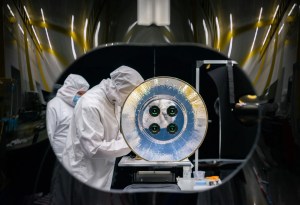
Ludger Scherliess: Yes, of course. You know, there’s a lot involved, once you have designed the instruments, you know, once you have built the instrument, it’s all about testing the instrument to make sure you know that the instrument is doing exactly what is intended to do and that everything is fully understood. Now, there’s vibrational testing involved, for example, there’s thermal testing involved. There’s the calibration of the instrument. And yeah, as I said, you also want to make sure that what the instrument observes is actually what you think it’s observing. So let me just talk a little bit about some of these testing. For example, the vibrational testing, that’s maybe the scariest one. You know, it’s the most scary one because you take your instrument that you so lovingly and so carefully have assembled that you have put together, you have put so much effort into it, you know, I know you put it on a table, a vibrational table and you give it a shake as hard as you can, try to understand what happens. You know, you try to mimic what happens during the launch of the rocket in this experiment. Again, you put your instrument on this vibe table, you turn on the vibration, you turn on this vibe table, and it shakes all around in different frequencies and different amplitudes and tries to go through all kinds of vibrations that it might experience during the launch of the rocket. And what you’re looking for is that nothing breaks, you know, that nothing shifts in the instrument, nothing gets displaced in the instrument. And a very scary, but a very important thing, of course, to do. Similarly, you know, the thermal testing less scary, but you have to understand the thermal behavior of the instrument. You have to make sure that the instrument can regulate its temperature with the AWE instrument. It’s basically a camera.
So it’s an electrical instrument. It gets power from the International Space Station. And just like any electrical appliance, it gets warm as electricity flows through the instrument. So you have to get rid of that heat that’s done by radiating out into space. But you have to make sure that that works properly and that is well designed. And you do that in the thermal testing. Now then comes calibration of the instrument. Calibration entails, for example, that you look at the noise, try to understand the noise in the detectors, try to understand the noise in the instrument. You map out the temperature dependence of the response of the detector. The instrument in space at the space station operates at minus 30 degrees Celsius. But of course, there’s some variation about that. And you need to fully understand, you know, how the instrument reacts to these type of variations.
Then what I said is you also have to make sure that the instrument actually observes what it’s intended to observe. We did that by placing an instrument that is an identical twin of the one that’s on the space station. We placed that on the roof of the Space Dynamics Lab, where the instrument was built and pointed it up into the sky and observed gravity waves from below. At the same time, we placed an instrument where we knew that it was working very well a mile away on the roof of the physics department at Utah State University and we compared the two measurements. So we had a well-characterized measurement from an instrument where we knew that it was working very well. And we compared it with the newly built AWE instrument. So these are all things that you need to do that to make sure the instrument works as expected. You understand everything of the instrument, if the temperature changes, you know what to expect. And all this is done before launch. A lot of work involved there.
Host: So everything from vibe test, thermal, calibration, observing with the engineering model, did these all take place at the same lab?
Ludger Scherliess: Yes. In fact, all this took place at the Space Dynamics Lab here in Utah, in Logan. Space Dynamics Lab is about a mile away from Utah State University. You know, it’s part of the university. That’s where the instrument was built. That’s where it was tested. And that’s where all the engineering was performed.
Host: There’s so much that goes into it to make sure that it’s prepared for the ride to space station. And so how was it install installed on space station? Even me, working at NASA, I had figured before I dove into understanding a bit more about AWE, that maybe I missed this being installed during an EVA or a spacewalk, but that’s not quite how that was installed. Can you explain the installation process and how your team was involved with that?
Ludger Scherliess: Yes. One might think you bring this instrument up to the space station, the astronaut gets outside and installs it, but by no means, that’s not how it went. You know, that’s the instrument. So it was launched on the Falcon 9 on beginning of November. There was a resupply mission to the space station. And the instrument was placed in the Dragon capsule. And so two days after launch, the Dragon capsule arrived at the space station, And then over the course of the next week, it was, basically, pieces were taken out of it. But again, that was not done by astronauts. But in fact, there is a robotic arm installed on the space station. It’s called the Canadarm2, you know, and all the installation was done robotically from the ground with this Canadarm2, you know, so there are operators in Houston at the Johnson Space Center that sent commands to the robotic arm. The arm went into the Dragon capsule, grabbed the AWE instrument, and then placed it outside of the space station.
Now, of course, that placement is just mind breaking. You know, it’s just an amazing thing to watch. It sounds easy, you take it out, you place it there, but there were so many steps involved in it. For example, there was an instrument located at the location before where AWE was going to be placed. So that had to be taken away. It had to be placed somewhere else. Then there was another instrument in front of the AWE instrument inside of the Dragon capsule, the ILLUMA-T instrument, that had to be taken out first, you know, and placed outside on the space station. A lot of different movements of different motions involved in this. Just amazing to watch. I watched an animation of it before. I couldn’t believe that this was going to happen, but then there were cameras outside mounted on the space station where we could watch this live. And it was just fun to watch. Amazing thing.
Host: It’s really all about location. And I think it’s so interesting when you think of an experiment like AWE, right? Where it’s built in Utah with the help of different universities across the United States. You’re testing it in Utah, I understand it’s part of the Explorers Program Office at Goddard Space Flight Center in Greenbelt, Maryland. And then eventually it ends up to Kennedy Space Center to launch, and then now it’s at its home on space station, where it’ll be for the next two years in low Earth orbit. And I want to talk a little bit more about location in what I am breaking down into the what, where, and why to explain everything that listeners might want to know about the AWE investigation. And so, let’s start where, it’s really all about location, right? And we know the experiment was installed as an external payload on the outside of the Space Station, and it’s looking down directly into Earth’s atmosphere. Now, we know space station is about 250 miles above our heads here on Earth but AWE’s going to be making its measurements at the mesopause. Can you explain where the mesopause is?
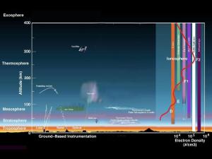
Ludger Scherliess: Yes, absolutely. The mesopause is a very interesting location in our atmosphere. It’s often considered to be the edge of space. It’s located roughly 90-95 kilometers above the ground. So that’s something like six 60 miles up. That’s if you talk to astronauts, you know, that’s when they come back from the space station where they first experience the Earth’s atmosphere. You know, that’s where the space capsule heats up, that’s where it starts to shake. And the astronaut know well, they’re going home, and that’s where they experience the atmosphere. At that altitude, the atmosphere really changes from the way we know it on the ground here. Now, for example, if we look at the composition of the atmosphere on the ground here, we know it’s about 78% nitrogen. It’s about 21% oxygen. And if we would make that measurement near the mesopause, a little bit below the mesopause, we would see, well, 78% nitrogen, 21% oxygen. It hasn’t changed. The density has dramatically changed. Of course, you now, that’s only about a millionth of what it is on the ground, but the composition is the same.
Now, if we go above the mesopause, this dramatically changes. Now above the mesopause, we found that, for example, atomic oxygen will become the most important species. Now, atomic oxygen, that is very different from the molecular oxygen that we find in the lower part of the atmosphere. And it’s created by very energetic radiation from the Sun in the extreme ultraviolet range. So we know ultraviolet range in a very dangerous for your skin, for example, for skin cancer. So this extreme ultraviolet radiation is even more energetic, you know, and it’s so energetic that when it encounters an O2 molecule, it breaks it apart and it creates an atomic oxygen. And that totally changes the composition of the upper atmosphere. This radiation is capable of stripping away an electron from, let’s say, the atomic oxygen. And with that, it ionizes the atmosphere. It’s grading something that we call the ionosphere now. So the atmosphere changes dramatically at the mesopause from what it is below to what it is above. And a lot of the physics that’s going on at that interaction region is really not well understood yet. We still don’t know a lot about it. And that’s really where it AWE comes into the picture.
Now, AWE takes measurement right below the mesopause, there’s a region at about 85 kilometers, 87 kilometer altitude. So that 55 miles above the ground, you know, so a few miles below the mesopause. And there is this layer, the hydroxyl layer. Now, that’s a naturally occurring layer, created by some chemistry that’s going on at that region where ozone reacts with a hydrogen atom to create, OH, it’s an hydroxyl molecule. And that’s located right below the mesopause. And the important thing about that layer is that it is one of these naturally glowing layers. And so it’s kind of like a screen, you know? And when a wave, atmospheric gravity wave, passes through the screen, it creates variations in the brightness of these emissions from the OH layer, from the hydroxyl layer. And that’s what we are observing with the AWE instrument.
Host: So further, breaking down the what, where, and why of AWE, now onto the what. And it’s time to break down the colorful bands of light even further. When you see that colorful airglow, it is actually revealing existence of what is known as atmospheric gravity waves or AGWs. Can you explain more about what AGWs are and how we might see indications of them here on Earth?
Ludger Scherliess: Yes. Of course, so AGWs, that’s really what AWE is all about. You know, that’s what AWE observes. And, first of all, just to make clear you that there is no confusion, you know, there are also gravitational waves. And the atmospheric gravity waves are not gravitational waves. So these are the gravitational waves are the astrophysics waves that Albert Einstein postulated, you know, that are associated, for example, with black holes. Atmospheric gravity waves are very different to that.
So to explain what they are. I think a good way to do that is by first taking the atmospheric away from it, you know, and by looking at gravity waves that we observe on the ground in water, these are very similar waves to the ones that AWE observes. And we’re all familiar with that. I think if you are standing on a pond and you throw a pebble into the pond, what’s going to happen is that from the location of where this pebble hits the water, you see a wave propagating away from the location where the pebble entered the water. Now this is a gravity wave. Very similar to our atmospheric gravity waves. So what happens is that the stone enters the water, it pushes the water down, and then buoyancy will set in, and it will push that water up again. But the water will not stop. It will move up, but it will not stop at the surface of the water, the surface of the pond. But it will overshoot a little bit. It has inertia, and it will overshoot. And then gravity, seasat gravity acts on this water, will pull it down again, and buoyancy will push it up again and so on. So you’re creating this oscillation at the location where the stone or the pebble entered the water. What then happens is that this oscillation, this perturbation, how we call it, will radiate away from its source as a wave. And that’s a gravity wave now. So gravity comes into the picture, it’s the restoring force, how we call it, you know, gravity pulls the water in this case back, and then buoyancy will push it up again. That’s why they also sometimes called buoyancy. Buoyancy, it’s really both things that matter here. So what we need is, in this case, for the water, we need something that pushes the water down and buoyancy pulls it out, pushes it up again, gravity pulls it up, pulls it down again, and the whole thing creates this gravity wave in the water. We are all familiar with that. Seen it many, many times.
So what is an atmospheric gravity wave then? Now for an atmospheric gravity wave, again, we need something that either pulls the air down or it pushes the air up. Now both things will do. And the typical way of how an atmospheric gravity wave is created is by something that pushes the air up. Well, that can have several reasons why that could happen. For example, think of a wind blowing against the mountain range, I think of the Andes Mountains. And there is a wind blowing against these mountains that will push the atmosphere up, will take the air, pushing it up, and then on the other side of the mountain range, it would fall down. Very similar to what happens when you throw that pebble into the water, you know, there you have first down, and then up, now in the atmosphere we have first up and then down, but the same thing happens. So you push it up, gravity acts on it, pulls it down. Buoyancy will push it up again. Gravity will put it down again. You have this oscillatory motion and away from it radiates away. That’s called an atmospheric gravity wave. And you might have seen this, you know, when you look at patterns in the clouds, you might sometimes see this wave structures in the clouds, you know, and these are atmospheric gravity waves, you know, where we have light structure and the darker structure, and then the light structure, the darker structure in the cloud coverage. Now, most of these gravity waves, you know, or the typical way how they propagate then is horizontally. So they just, like in the pond, the wave propagates away the horizontal direction, but in the atmosphere. Which is not possible in the water. In the atmosphere, these waves also can propagate upward. Some of them do, if the conditions are right. That’s really where for us, you know, the interesting things are going to happen because as these waves propagate upward, they will grow in their amplitude. They will come stronger and stronger in a sense, because the atmosphere will become thinner and thinner as we go up in altitude. And to conserve energy and to conserve momentum, the amplitudes of these waves have to get larger and larger, you know, simply to conserve energy. There’s less gas to play with. And if we reach some of these waves, reach the edge of space, reach the mesopause, and even go beyond that. But if they reach the mesopause, the height where AWE is making its measurements, the air is so thin that the amplitude has become so large that the winds, for example, that are created from this wind, from this perturbation, from these waves, exceed the wind speeds of, let’s say a category five hurricane. Now they exceed 250 miles per hour. Very, very strong winds as the result of these perturbations that happened in the lower atmosphere. But then the wind speed increases as the wave propagates upward. And these are the waves that AWE is observing.
Host: Now the further breakdown, the what, where, and why, how AWE is observing these AGWs, or the atmospheric gravity waves, we know what AWE’s looking for. And bonus, I think our listeners would like to know how. Can you break down the components of the hardware and the camera and explain how it really works?
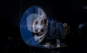
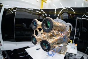
Ludger Scherliess: Yeah. So what has said before, you know, that the AWE instrument, it has its heritage from the Advanced Mesospheric Temperature Mapper, the AMTM instrument, you know, where I talked about before, that what was taken was place on the airplanes over New Zealand. And as you might remember, I talked about, you know, that when you look at two frequencies, two specific frequencies that you can calculate the temperature, you can determine the temperature from this observation, you can also calculate what the momentum, or what the power of these waves are. Now, the AWE instrument on the space station, there’s not just two cameras. In fact, it looks at four different wavelengths. So we have four detectors, four in fact, identical cameras that make up this instrument. Now, the instrument itself is about the size of a small piano. So you think of these cameras, you know, they’re not small cameras as a long lens in front, in front of it, you know, like a telescope in front of it. But at the end, there are four detectors now that look at four different wavelengths. I said before, you know that you need at least two wavelengths to calculate the temperature, to calculate the momentum of these waves, to give you an idea about the power of these waves.
In the front of the instrument, we have something that looks like a big funnel now that’s called the baffle. And that’s there to get rid of stray light to eliminate light that might come from other parts, for example, of the space station that gets scattered from the site toward the instrument. And to make sure that that is not entering the instrument, you know, looking like a big funnel really at the front of it. And then another important part is the filter wheel. You know, that is the only part of the instrument that actually can move. We do not intend to move it. But that filter wheel has four filters now that only let light in certain wavelengths through. So in front of each camera is one filter. Now, that only lets the light enter that into that camera for the specific wavelengths that we want to observe. Each camera then observes at a different wavelengths, again, that’s needed. So we can calculate the temperature of the waves from it. Now, other components are of course, the electronics and the interfaces with the space station, you know, but the main parts are the camera, the sensor, the telescopes or the lenses in front of the cameras, the baffle and the filter wheel. Not too difficult of an instrument.
Host: You did a great job breaking that down. Like you said, there are so many parts and pieces in this complex instrument. But breaking them down into those kind of four main ones was so helpful to understand. And speaking about this complex instrument having so many pieces and parts, there’s so many people that have helped this experiment, have helped or contributed to AWE. Speaking of people, I think our listeners would like to know the why, right? So why is it important for AWE to help us better understand these atmospheric gravity waves? And why does it matter to people on Earth here, the everyday person? How does it affect them?
Ludger Scherliess: The importance of the AWE mission really comes into that we want to understand how the weather on the ground affects space weather. And space weather, you might think, well, that’s not important, for you, you know, who cares what wind is in the upper atmosphere unless you’re an astronaut. But that’s not quite true. Now, if you think of how dependent we are nowadays on technological systems, we are all so dependent on GPS or navigation systems. We are so dependent on communication systems, you know, and communication through satellites now that really are part of our everyday life. And it turns out that these technological systems are very much affected by what happens in space, by space weather. And that is because if you think of a GPS signal, a GPS satellite is located way out there in space, and it’s about 22,000 kilometers above the ground. And how this works is that there is a radio signal coming from the GPS satellite, and you get that with your cell phone, for example. And out of the signal, you can determine where you are on the ground. But this signal has to pass through the outer layers of our atmosphere, has to pass through the ionosphere that I talked about before. You know, this layer that is above the mesopause. Now this ionized layer above the mesopause. Now, gravity waves have a large impact on the ionization in this layer. It can modify the ionization in this layer. And with that, it can modify the waves, the radio waves from the GPS satellites that pass through the layer. And with that, it can make the GPS signal noisy, can make it fuzzy, and can make it in under certain circumstances to per so much that you can’t even use it anymore, and you lose your ability to use GPS for navigation.
Now, of course, with AWE we want to under understand, you know, how this happens, that we can mitigate these negative effects. Now, similarly, if you think of satellite communication, there is a radio wave from the satellite to the ground that passes, again, through this layer in the ionosphere. And very similar to what I said, what I just said. You know, these gravity waves affect the ionosphere, makes this the signal fuzzy. It can make it noisy, and it can introduce errors in the communication signal, so that errors occur in the data transfer from the satellite to the ground, or from the ground to the satellite. Other effects are there’s something that’s called HF communication. That’s High Frequency communication. Maybe most of the listeners are not too familiar with it, but maybe some of you are HAM operators. And these are the radio communication that HAM operators, or HAM users use. So what is done here is that you have a radio that sends out the radio wave, and that gets reflected by the atmosphere, just like a reflection with a mirror. With that, you can speak over or talk over long distances. You can talk over with a radio, for example, from Utah with someone in Brazil. Now, there’s not a direct line, you know, where you could send that radio signal. So you need a reflection somewhere. And that’s provided by the ionosphere, like I said, just like a mirror. But now, as these gravity waves, some of them make their way into the ionosphere, and they perturb the ionosphere that perturbs this mirror now shapes it around different shapes of the mirror. And with that, you lose the ability to communicate via HF. Or, you know, it’s not as accurate as you would like it to be.
You might think, “Well, that’s something for HAM operators, maybe not that important.” But this is, in fact, what first responders rely on. Think of if you have a hurricane going on. The first thing that might go out could be the cell tower. So you cannot use your cell phone anymore during conditions like this. Now could be an earthquake, could be a hurricane. So you need to rely on other ways to communicate. And HF communication is the backup system, you know, that first responders use. So it’s very important for them now. And these gravity waves can largely affect the ability to use this. And we need to know about this. We need to better understand this, and we need to be able to mitigate these effects.
Host: It really always comes down to the why, right? And that why is benefiting life here on Earth, or benefits for humanity. And it’s really cool to hear about AWE, how AWE is doing just that. Now, Ludger, I understand AWE recently sent down its first image. How exciting is that? And for one, we talked about all those tests that the instrument went through, but that really confirms that the instrument is functional and operating as expected. What was that feeling like?
Ludger Scherliess: Well, to tell you the truth, you know, it was a feeling of relief. Really to see that the instrument was doing what it was intended to do. All four cameras worked as they were intended to use. That was a big, big relief. But of course, also the amazement to look at these images, to see the gravity waves in there, to see that what was planned actually panned out. But it was also very interesting. I went to see the first images. I went to the Space Dynamics Lab. Like I said, you know, that’s about a mile away from campus together with my colleague, Mike Taylor, was the original PI on the mission. It was very interesting when we looked at these images, it was just by coincidence that, at the first glance of it, the space station was just passing over England, was passing over Southampton now, a place where Mike is from. And a minute later, it was passing over the region where I’m from in Germany now. And we thought, “Well, what a great coincidence.” Just fun to look at. And, you know, well, it wasn’t planned at all, but also what we saw really was the amount of work ahead of us. You know, of course that we knew about that. For example, when we looked at these images, we watched it for quite some time. We saw how many city lights were in these images as we passed over Europe and then passed over Asia, you know, just a few minutes later. It’s just amazing to see that, we saw all these city lights that of course we knew about. But it’s a very different thing, you know, to know about it and to actually see it. And these need special treatment in our analysis. We were also amazed at the amount of cloud that we saw, you know, and reflections from the clouds. Again, very special treatment in our analysis and to see, you know, all the work that’s ahead of you. It was just an amazing thing to look at. But the main thing was we were very relieved to see that all four instruments we’re working as planned. Basically right from the start, we turned on the instrument and could look at these waves in all glory.
Host: That’s really, really cool. Thank you for sharing that. Well, there’s a lot to look forward to, like you said, and you said you’ve got your work cut out for you. This is planned to be on the International Space Station for about two years or so. And you being the PI, what does the day-to-day entail? Do you get images down frequently? All the time? 24/7? How does that work? And are you the one actually sitting there and observing the images and studying them?
Ludger Scherliess: Yeah. Well, not all the time. No, of course not. But we get the data basically in real-time from the space station. You know, that’s of course another big advantage of the space station is that it has very established communication lines, we are having basically a camera, four cameras, that make up AWE. So if you look at that data, you know, it’s like streaming a movie from the space station. It’s also about the data rate that we have now, six megabytes per second. It’s about like streaming a movie. But we are streaming four movies down, and they come in most of the time, real-time now with a few seconds delay maybe where the space they, where from the AWE instrument the data gets right away transmitted to the space station and from the space station to a satellite system, the TDRSS system. And from there to the ground at Houston, from where we get the data, then at first at SDL, at the Space Dynamics Lab, we have the mission operation center there, the mock that get the data, that look at the data. And of course, I can’t look 24/7 at this data, you know, but there is a monitor and a lot of diagnostics that’s been looked at from the instrument. So that’s happening at the mock on the Mission Operations Center. Then we have the Science Operations Center that’s located at Utah State University. We then get the data from the Mission Operations Center piped to our location at the Mission Operations Center. There is some enhancement done on the data, of course, the geo-located that we know exactly where we are looking, they calibrated so we can compare the different images, we can compare the different instruments, you know, the four cameras. And then it comes to the Science Operations Center. Now where we further analyze the data, so we’re in the process right now to get these pipelines established. Now we’re two months on orbit now and we have kind of received the first images at the Science Operation Center. That’s not an automatic process yet. We’re in the process of getting that lined up, you know, probably in the next week we will get that. And then we have students of course, looking at the observations. We have senior scientists looking at it. I’m looking at it with Mike Taylor, you know, the former PI still involved in the analysis of the data. So the different steps involved in this process.
Host: Ludger, we have learned so much about how and why AWE is observing how you put it, excited atoms that make colors on the edge of space and why it’s important to study them for the benefits of humanity here on Earth. Thank you so much for coming on Houston We Have a Podcast today. I have to say, you have a great ability to break down these complex topics and really make it make sense, right? And I can see why you’ve been a professor for many years, and I’m sure your students love having you.
Ludger Scherliess: Well, thank you very much.
[Music]
Host: Thanks for sticking around. I hope you learned something today, I totally did from Ludger. But hey, check out nasa.gov for the latest, nasa.gov/podcasts, and you can keep up with the AWE mission at NASA Sun on X and NASA Sun Science on Facebook, and follow us on our social media at NASA Johnson, on Facebook, X, and Instagram. And feel free to use #AskNASA on your favorite platform to submit your idea or ask us a question. Make sure to mention Houston We Have a Podcast. This episode was recorded on January 26, 2024. Thanks to Will Flato, Dane Turner, Abby Graf, Jaden Jennings, Dominique Crespo, Destiny Duran, and Denise Hill. And of course, thanks again to our special guest, Ludger Scherliess for taking the time to come on the show. Give us a rating and feedback on whatever platform you’re listening to us on and tell us what you think of our podcast. We’ll be back next week.