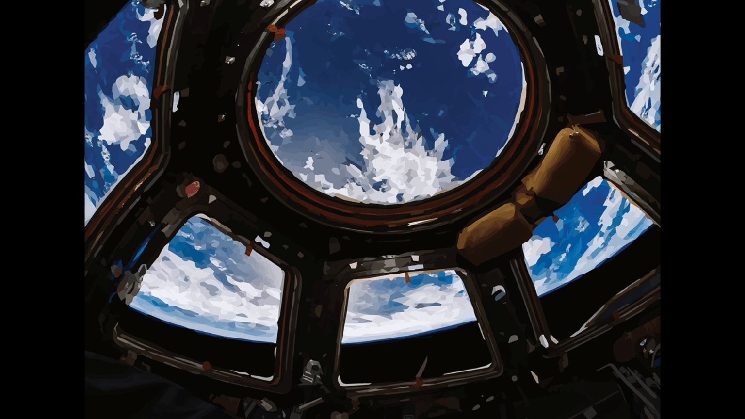
On Earth, we often look toward the sky, longing to know what resides in the rest of the universe. Meanwhile, 402 kilometers (250 miles) above our planet, the International Space Station is looking back. That Earthward gaze is feeding data and imagery back to scientists, farmers, foresters, and others around the world, making a difference for humanity right now.
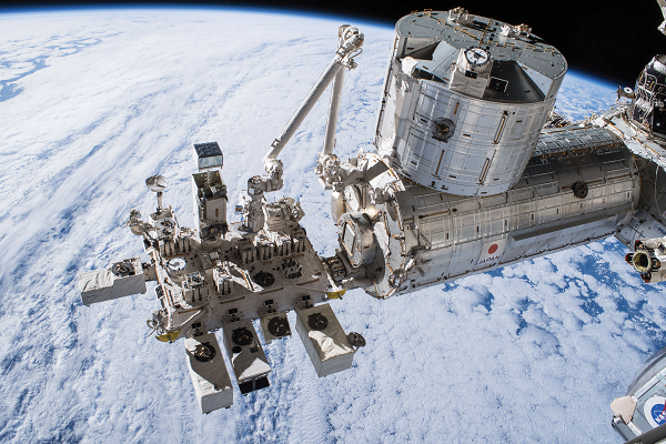
Multiple Earth-observing instruments ride on the exterior of the station above us, including a limb full of cameras, boxes, and tools that hangs off the station’s Japanese Experiment Module. Earth-observing CubeSats regularly deploy from the station’s airlock as well as some of its resupply vehicles. Inside the station, astronauts and cosmonauts take photos of the planet from the windows of the orbiting lab and conduct Earth science experiments. All this work provides insight into our planetary home and how we might prepare for coming changes.
“If you don’t have a good understanding of how things might change, you are in a very poor position to be able to handle it when they do,” says William Stefanov, manager of the Exploration Science Office at NASA’s Johnson Space Center in Houston.
The factors influencing our climate must be tracked over long periods. With more than 20 years in orbit, and counting, the space station is a great place to collect such long-term data. The combined information creates a unique data set that helps us make informed decisions on Earth, and potentially develop solutions to environmental issues.
The space station affords a unique planetary perspective with an orbital path covering 90% of the Earth’s population. Its position in orbit allows astronauts to see the Sun rise and set 16 times each day across the world.
“That orbit allows the space station to pass over different spots of Earth at different times of day or night and collect data. It is a fundamentally different data set than most other remote sensing instruments collect on free-flying satellites,” says Stefanov.
International payloads on the outside of the orbiting laboratory, such as ECOSTRESS, GEDI, OCO-3, DESIS, TSIS (also known as TSIS-1), and HISUI, individually collect climate-related data. The MUSES Earth imaging facility even offers commercial access to a number of Earth observation tools. In combination, all these tools provide a unique set of measurements that could push the leading edge of environmental research.
Although some station experiments are focused on a specific application, many of these Earth-observing payloads provide data for a wide range of applications.
Analysis of the first six months of data from the State Space Corporation ROSCOSMOS (ROSCOSMOS)-Italian Space Agency (ASI) investigation UV Atmosphere – Mini-EUSO indicated that the multipurpose telescope was able to do everything from measuring variations in airglow and ultraviolet emissions from Earth to tracking space debris and cosmic rays. It has now completed more than 40 successful sessions. Part of JEM-EUSO, a larger program involving about 300 scientists from 16 countries who are working to enhance the observation of cosmic rays, the experiment is expected to measure artificial lights above land and oceans, study the impact of energetic cosmic radiation on the Earth’s atmosphere, and register and track space debris in near-Earth orbits. Mini-EUSO has already measured several thousand faint meteor arrivals, allowing scientists to study these events and obtain data on arrival direction, velocity, and brightness.
Data from NASA’s ECOSTRESS payload have also already had many applications. They have been employed in efforts to reduce heat absorbed by city surfaces, better allocate water, reduce fire risk, measure plant stress, search for geothermal energy sources, track mosquitos, help farmers efficiently water their fields, and more.
“ECOSTRESS measures small and subtle changes in temperature to identify plant stress, but those same measurements can also be used to identify extreme heat, such as that produced by fires or lava flows. We can also study movement of warm water currents and heatwaves in cities,” says ECOSTRESS principal investigator Simon Hook. “With data that are valuable across so many science focus areas, researchers around the world are using ECOSTRESS data to produce really exciting results.”
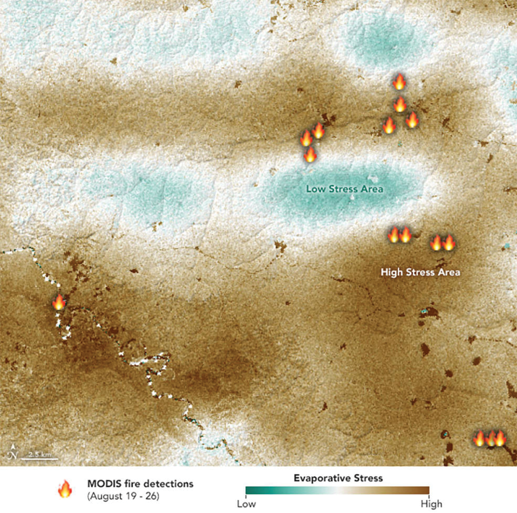
The U.S. Department of Agriculture, thousands of farmers around the world, and numerous water agencies now rely on these data for determining how much water their crops need, which ones are most water-efficient, and which ones are not getting enough water, even before they show visible signs of dehydration. A Los Angeles City pavement project has used the data to monitor the effectiveness of new reflective pavements installed to reduce heat. Forest managers can thin areas of stressed trees to reduce fire risk or at least mobilize fire crews in those areas during high-risk times.
“ECOSTRESS is a small, low-cost mission that has brought together so many scientists with different areas of expertise,” says Hook. “But the core team is very small and has done incredible work.”
The ECOSTRESS team is even looking at collaborating with the research teams of other space station research payloads to provide additional benefits.
“The OCO-3 team wants to understand plants and their role in the carbon cycle,” says OCO-3 project scientist Annmarie Eldering of NASA’s Jet Propulsion Laboratory in Southern California. “It turns out our space station neighbor ECOSTRESS is looking at how plants respond to stress. And then there is GEDI, which is looking at how much plant material is on the ground. Scientists who are thinking about plants and their role in the carbon cycle are super excited. We have heard lots of discussion about how we can use all the data together to better understand plants.”
NASA’s OCO-3 sensor uses sunlight reflections through the atmosphere to measure variations in atmospheric carbon dioxide, observing changes of less than a single part per million.
“Most gases like ozone, carbon monoxide, or water vapor double or triple in atmospheric concentration when they are polluted, so it is pretty easy to detect. But for carbon dioxide, it is uniquely difficult to see the changes,” says Eldering.
Measuring those small changes could be key to answering long-standing questions about atmospheric carbon dioxide.
“Fortunately for us, the plants and ocean absorb about half of human-generated carbon dioxide emissions every year. But there are still mysteries around how they do that, why the amount is different each year, and how absorption is going to happen in the future,” says Eldering. “Our data are meant to help answer those kinds of questions.”
In 2021, using data from OCO-3, researchers released one of the most accurate maps ever made from space of the human influence on carbon dioxide in the Los Angeles metropolitan area. These types of data help decision makers choose the most effective policies to reach goals for cutting emissions and measuring the effectiveness of new regulations.
“Now we’re looking at a lot of other cities,” said Eldering. “And when you look at our data as well as other gases that are measured by other instruments, we are really starting to be able to put together a detailed picture of emissions.”
Carbon storage and removal also has been investigated both inside and outside station. The ESA (European Space Agency) Photobioreactor study cultivated algae to examine whether microalgae could help close the carbon loop in future life support systems, and Kuwait’s Experiment: E. coli C5 studied the effect of microgravity on E. coli bacteria that were modified to consume carbon dioxide as food. Images taken by former space station payload HICO even helped develop an algorithm to detect harmful algal blooms, which can play a major role in the global carbon cycle.
With other devices such as SAGE-III tracking the recovery of ozone, NASA’s ISS-LIS and ESA’s ASIM monitoring lightning, and TSIS tracking the total energy flowing into Earth from the Sun, station experiments advance numerous climate records and models. Solar irradiance represents one of the longest climate data records derived from space-based observations. Researchers have been able to maintain continuity of that record with TSIS.
“Climate change presents what is perhaps humankind’s greatest environmental challenge,” says former TSIS principal investigator and University of Colorado Boulder professor Peter Pilewskie. “Monitoring the energy that flows into, within, and out of the system underpins our ability to understand how the climate system works, recognize that it is changing, and identify those mechanisms responsible for climate change.”
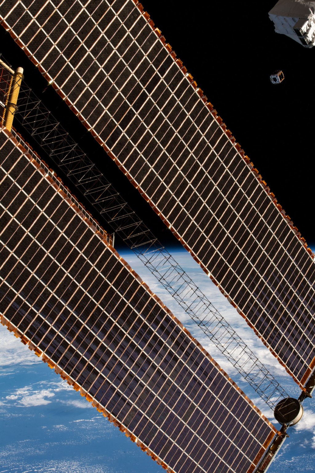
The space station offers a standardized, capable platform to house Earth observation experiments such as TSIS. The size of a football field and equipped with numerous attachment points, plenty of data capacity, and a large power supply, the space station can host a wide variety of instruments simultaneously. The availability of these resources made the space station a great last-minute option for the TSIS team to quickly get its payload into orbit. After some delays, the team was facing potential failure of previous tracking instruments before TSIS could launch.
“It started to get pretty dire, because accuracy of the climate record is maintained at its highest possible level when the data record is continuous,” says Pilewskie. “Because of space station, we were able to continue this record.”
After researchers learn the basics of creating a payload for the space station, they can apply that knowledge to future station projects. Pilewskie is already working on his next experiment, CLARREO Pathfinder.
“The value that we gained from operating an instrument on station that needed to point very precisely cannot be understated,” says Pilewskie. “We have to do the same thing with CLARREO Pathfinder, so we are using some of the same motors that we use to drive the TSIS instruments.”
Scheduled to launch in the next few years, CLARREO plans to study Earth’s climate by taking measurements of sunlight reflected by Earth and the Moon with five to ten times lower uncertainty than measurements from existing sensors.
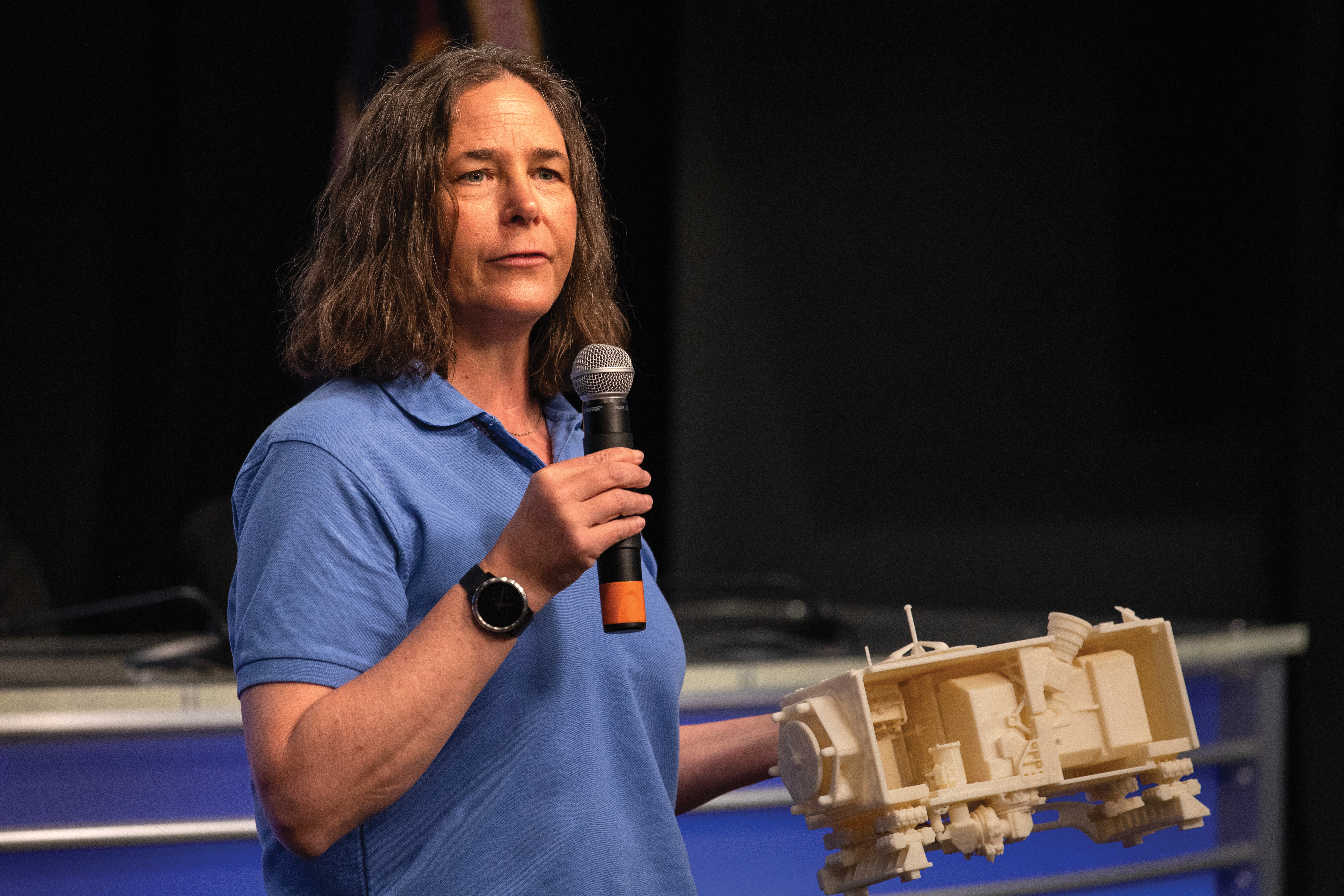
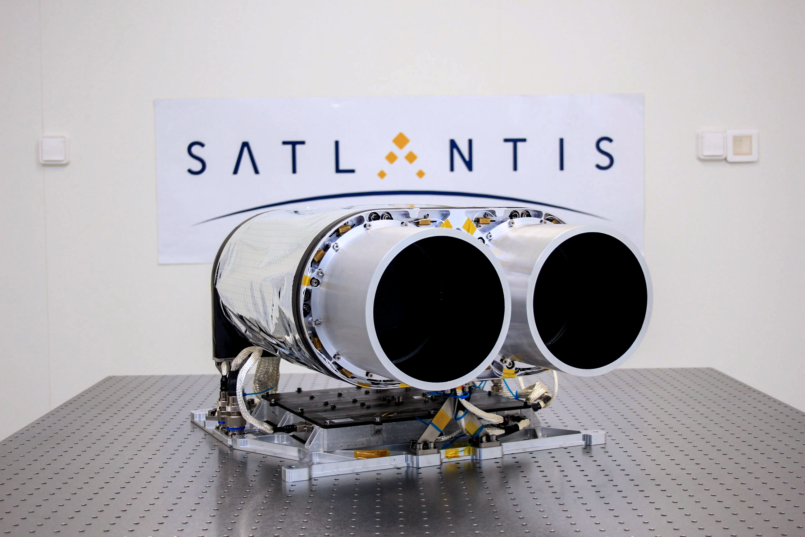
Additionally, the Japan Aerospace Exploration Agency (JAXA)’s integrated Standard Imager for Microsatellites (iSIM), a high-resolution optical binocular telescope developed by Spanish company SATLANTIS, takes images of Earth at less than 1 meter (39 inches) of resolution.
It is not only sensors monitoring our planet from above. People do so as well.
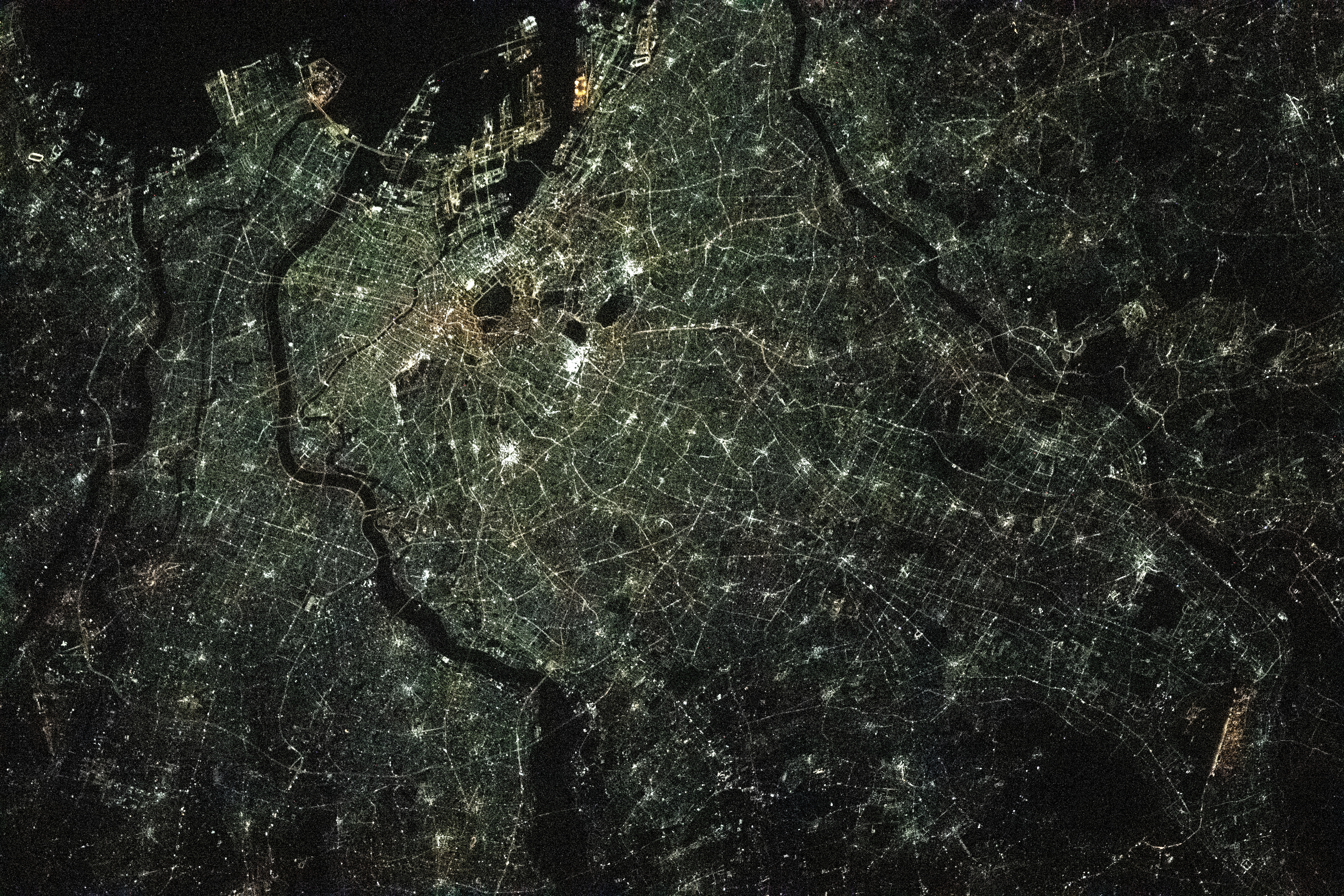
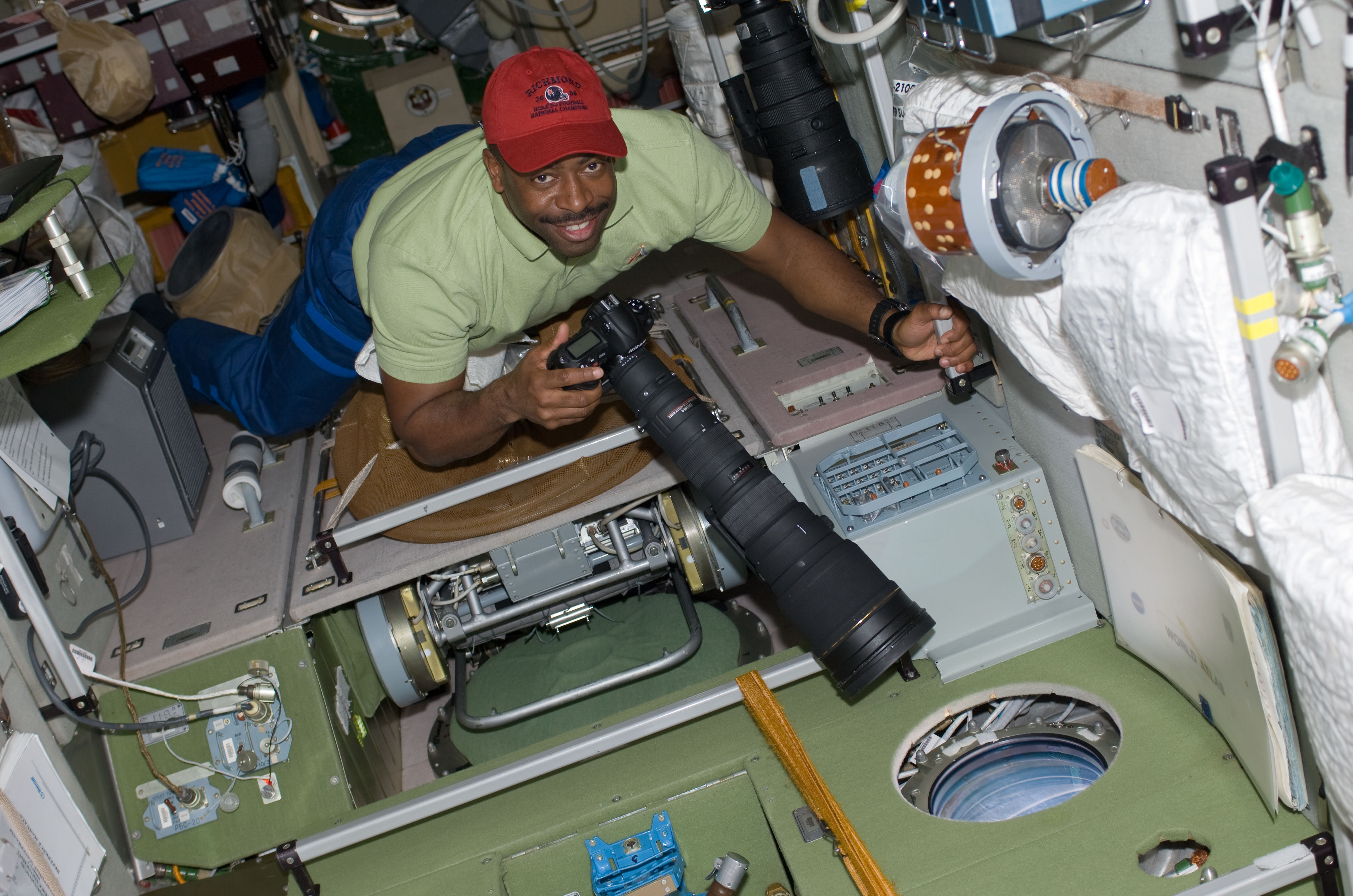
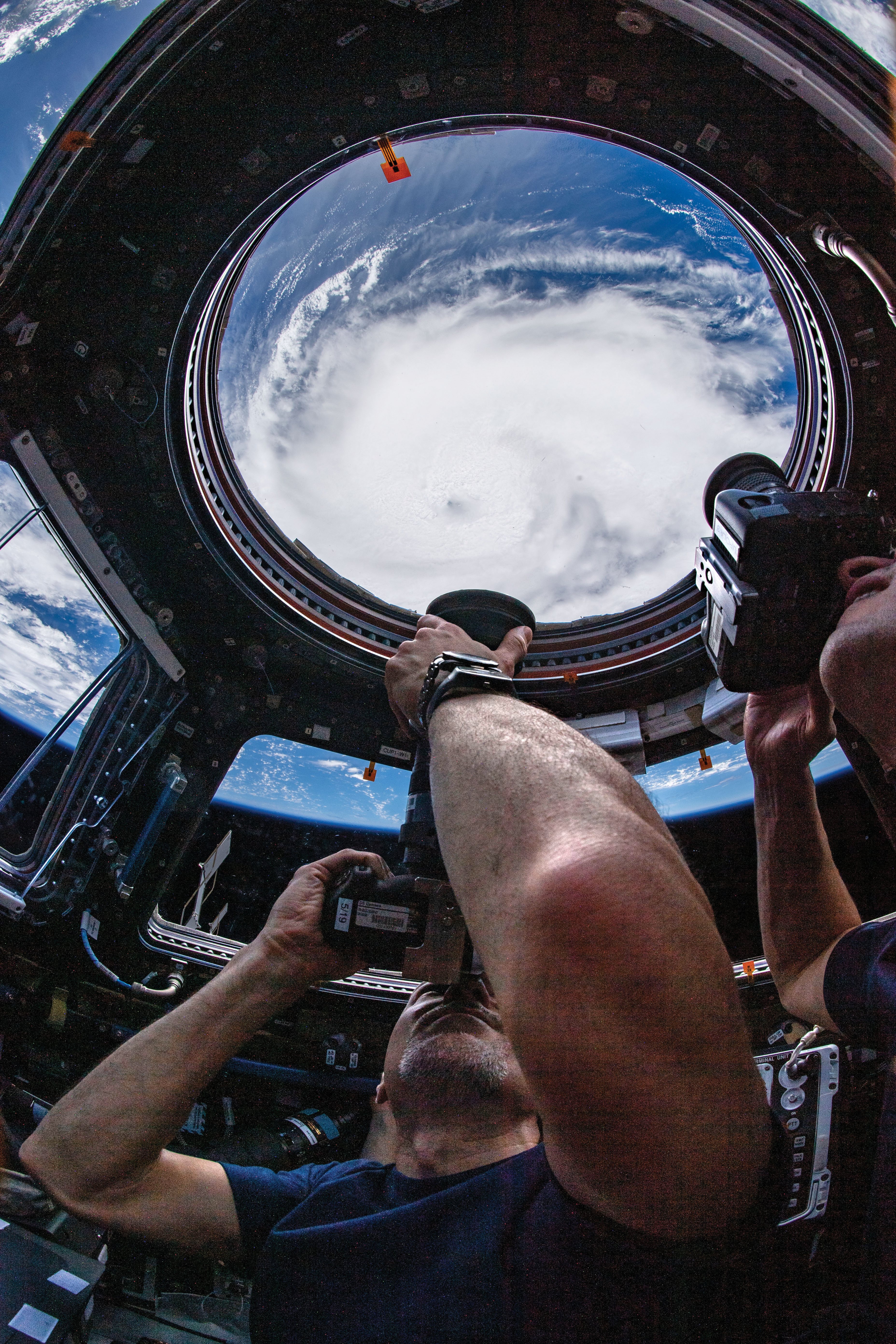
The windows of the space station provide an opportunity for astronaut photography and manual collection of climate data. Astronauts have taken more than 4 million images of Earth from space (over 3.5 million from the space station), contributing to one of the longest-running records of how Earth has changed over time. Crew Earth Observations currently support urban night lighting studies, glacier and volcano monitoring, and studies of atmospheric processes affected by volcanic eruptions. The ROSCOSMOS Hurricane-Visual study also contributes imagery that assists with Earth monitoring, providing an additional source of data. These images also support relief efforts for disasters such as hurricanes and wildfires.
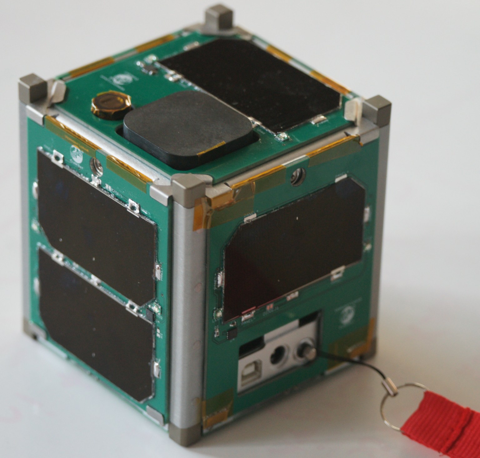
Station even extends its climate science impact by deploying CubeSats into low-Earth orbit. These shoebox-sized devices contain technology demonstrations or test new types of climate science. Astronauts unload and prep them on station and then deploy the devices out of the space station airlock.
“That has been a great resource for small programs, especially universities or NASA centers trying to get some small projects going. CubeSats might be their first stepping-stone to larger things,” says TSIS and NanoRacks-MinXSS principal investigator Tom Woods. “Space station offers a lot of opportunities to get these smaller things into space.”
Climate CubeSats deployed from station include the following:
- The student-designed NanoRacks-MinXSS CubeSat targeted a better understanding of solar X-ray energy and how it affects the layers of Earth’s upper atmosphere.
- JAXA’s DIWATA-1 satellite provides remote sensing information to the Philippines by observing meteorological disasters such as typhoons and localized heavy rains.
- NASA’s HARP CubeSat helps us better understand how clouds and aerosols impact weather, climate, and air quality.
As Earth’s climate changes, the International Space Station will be watching from above, helping provide unique insights needed to keep our planet safe.