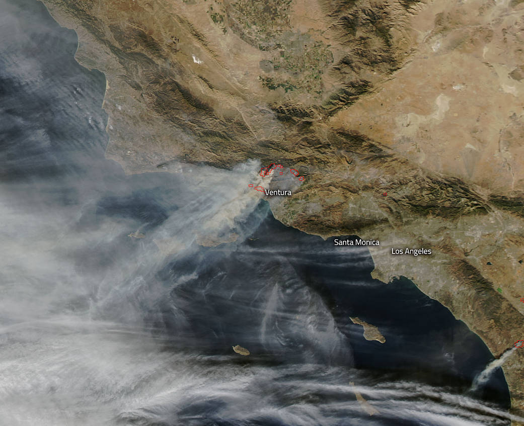
Copious columns of gray-brown smoke pour off the edge of California’s coast in this image of the Thomas Fire taken by NASA’s Aqua satellite on Dec. 7, 2017. This raging inferno that has been described by firefighters as a “war zone” started just four days ago on December 4. Burning more than 96,000 acres and 150 structures to date according to Inciweb this fire has been urged on by one particular meteorological phenomenon in California, the Santa Ana (also known as the Diablo or Devil) winds. These winds which although typical at this time of year have been uncharacteristically ferocious of late. In fact, for the first time in the history of wind warnings, a purple wind advisory, meaning “extreme”, has been issued. This advisory means winds could top 80 mph — hurricane strength. Winds at this strength would effectively shut down fire fighting efforts, and these winds have been the catalyst that have moved this fire so far so fast. On December 7, firefighters noted that fire was moving at a rate of one football field length every second. Even if the winds weaken there is another frightening risk that could arise–unpredictability. The winds slowing down could prompt a near instant change of wind direction putting firefighters in harm’s way. With only 5% of the fire contained at present the undertaking to quell this fire could be an arduous one.
NASA’s Aqua satellite collected this natural-color image with the Moderate Resolution Imaging Spectroradiometer, MODIS instrument. Actively burning areas, detected by MODIS’s thermal bands, are outlined in red. Each red spot is an area where the thermal detectors on the MODIS instrument recognized temperatures higher than background, indicative of fire. NASA image courtesy Jeff Schmaltz LANCE/EOSDIS MODIS Rapid Response Team, GSFC. Caption by Lynn Jenner with information from Inciweb.


