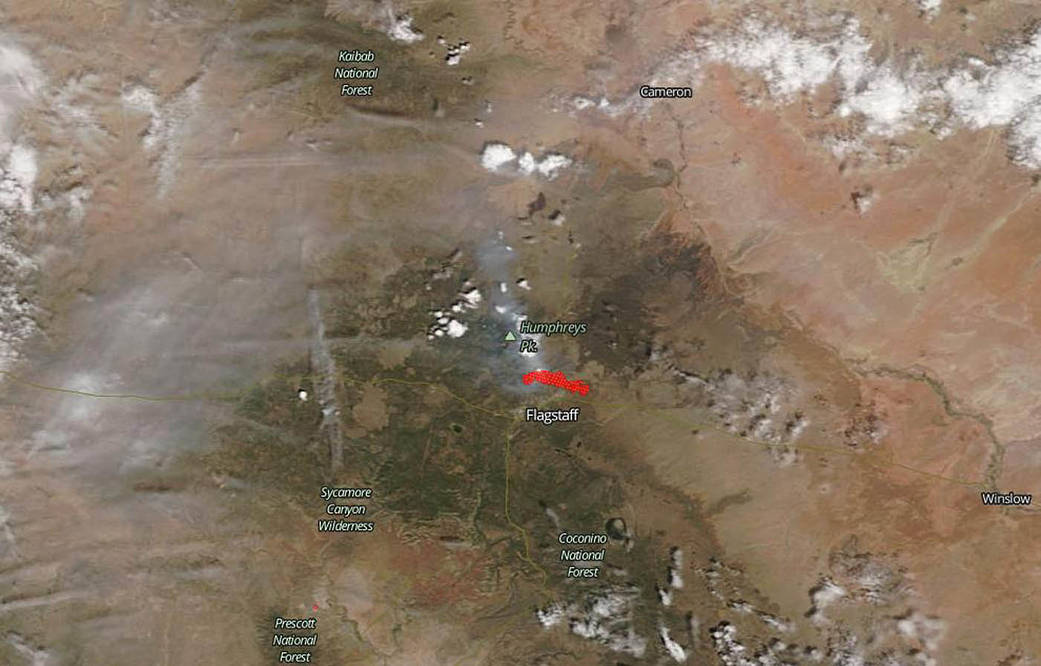
The wildfire dubbed the Museum Fire broke out Sunday, July 21, 2019 just one mile north of Flagstaff, Arizona. The cause of the fire is still under investigation. As of July 23, 2019, the blaze has grown to 1,800 acres mostly burning pines and mixed conifers. There are 200 personnel fighting the fire at present. Two dozen homes north of Flagstaff have been told to evacuate and thousands more are ordered to prepare for evacuation. Both Flagstaff and Coconino Counties have declared states of emergency. Firefighters have reported fire spotting which occurs when burning embers fly up and drift forward starting new fires in their wake. There is also a chance for flooding due to the burn scar that will be left behind from this fire since this fire is burning in the Spruce watershed that drains into Flagstaff.
NOAA/NASA’s Suomi NPP satellite collected this natural-color image using the VIIRS (Visible Infrared Imaging Radiometer Suite) instrument on July 22, 2019. Actively burning areas, detected by VIIRS’ thermal bands, are outlined in red.
NASA’s Earth Observing System Data and Information System (EOSDIS) Worldview application provides the capability to interactively browse over 700 global, full-resolution satellite imagery layers and then download the underlying data. Many of the available imagery layers are updated within three hours of observation, essentially showing the entire Earth as it looks “right now.” Image Courtesy: NASA Worldview, Earth Observing System Data and Information System (EOSDIS). Caption: Lynn Jenner with information from Inciweb.

