According to Tass Russian News Agency on March 04, 2019: “The number of wildfire zones in several Far Eastern regions saw a 30-fold surge in the past month, Acting Deputy Emergencies Minister Viktor Yatsutsenko said at a teleconference in the Emergencies Ministry on Monday. “A rise in the number of hotspots in the Khabarovsk, Primorsky and Trans-Baikal Regions was registered. The total area is more than 600 hectares [1,482 acres], with no threat to communities and economic facilities. The number of wildfire hotspots and their sizes reportedly saw a 30-fold surge,” he said.
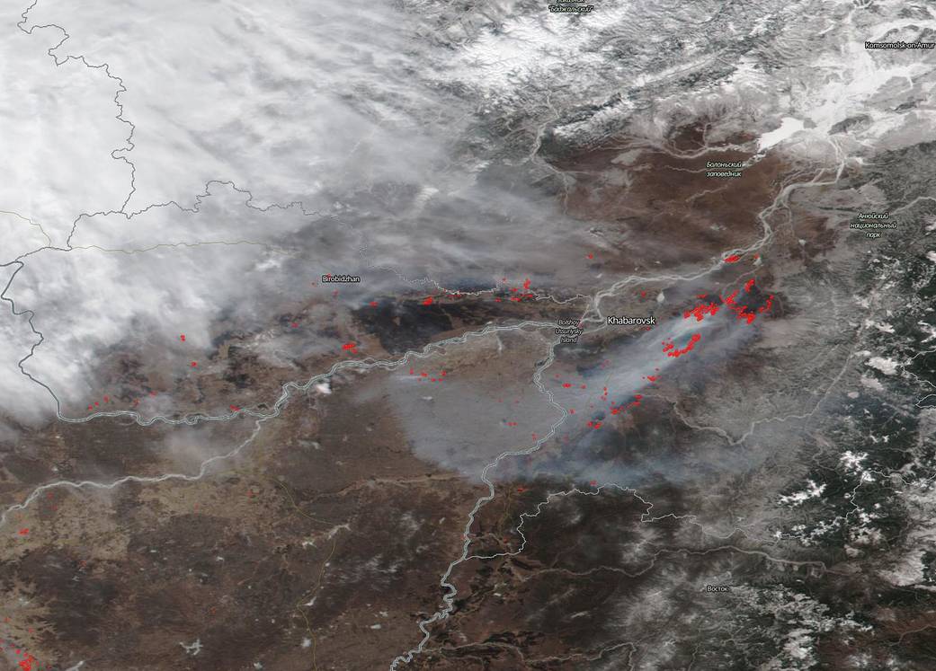
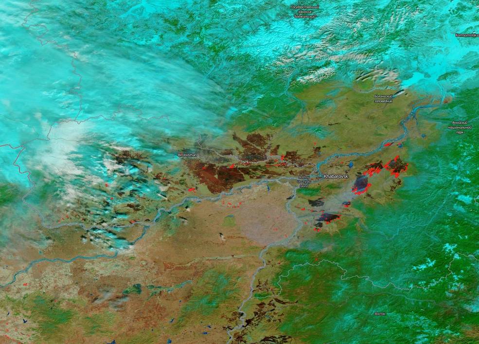
There are often fires in Eastern Russia after the snow recedes. Farmers anxious to start planting will set fire to grasses to prepare the land for the new crop season. Sometimes these agricultural fires can get out of control and then fire brigades must be called in the fight the flames. NASA’s Suomi NPP satellite collected this natural-color image (above) using the VIIRS (Visible Infrared Imaging Radiometer Suite) instrument on March 19, 2019. Actively burning areas, detected by MODIS’s thermal bands, are outlined in red. In the second image (below), the corrected reflectance bands are turned on to highlight the burned areas which appear very dark brown in the satellite image.
NASA’s Earth Observing System Data and Information System (EOSDIS) Worldview application provides the capability to interactively browse over 700 global, full-resolution satellite imagery layers and then download the underlying data. Many of the available imagery layers are updated within three hours of observation, essentially showing the entire Earth as it looks “right now.” Image Courtesy: NASA Worldview, Earth Observing System Data and Information System (EOSDIS). Caption: Lynn Jenner with information from the Tass Russian News Agency

