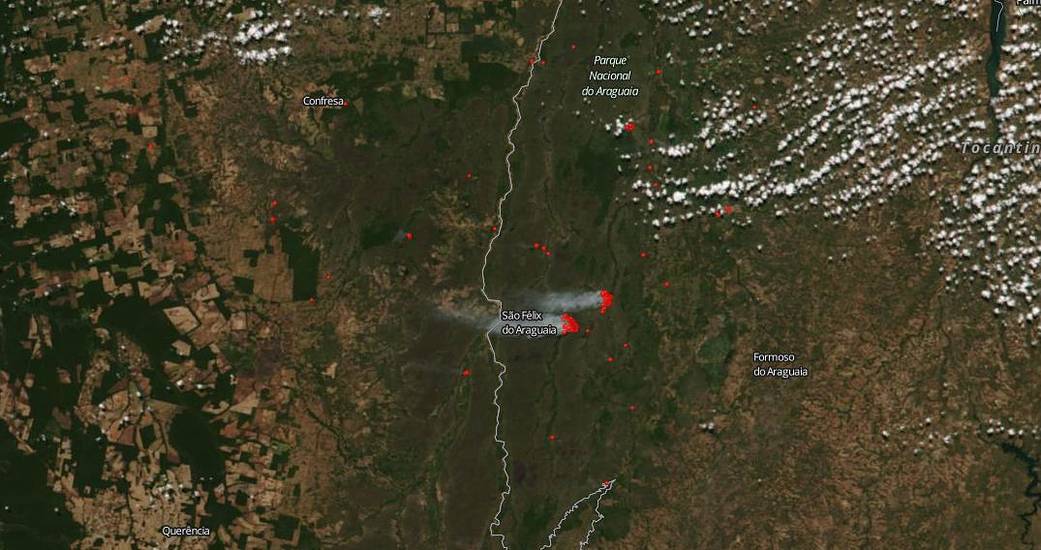
It is the dry season in Brazil and fires tend to break out easily in hot climates such as the country of Brazil. The Suomi NPP satellite captured this image on July 14, 2019 of fires in the state of Tocantins, Brazil. Tocantins is the newest state in Brazil and the “cerrado” landscape covers 87% of Tocantins. This type of landscape is characterized by extensive savanna formations crossed by gallery forests and stream valleys.
The cause of these fires is unknown, although several scenarios could be surmised. It could be a lightning strike from thunderstorms that crop up in hot, humid climates or it could be that the fires were set deliberately, either to clear land for planting or due to illegal deforestation.
NASA’s Earth Observing System Data and Information System (EOSDIS) Worldview application provides the capability to interactively browse over 700 global, full-resolution satellite imagery layers and then download the underlying data. Many of the available imagery layers are updated within three hours of observation, essentially showing the entire Earth as it looks “right now.” Actively burning fires, detected by thermal bands, are shown as red points. Image Courtesy: NASA Worldview, Earth Observing System Data and Information System (EOSDIS). Caption: Lynn Jenner

