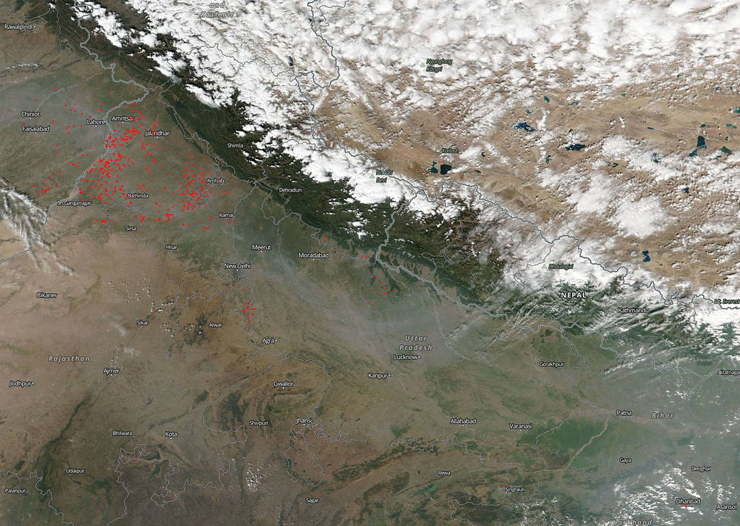
Although stubble burning is banned in India many farmers do not have the necessary farming equipment to rid their fields of leftover organic debris. So far there have been fewer agricultural fires this year than in year’s past but there are still quite a few fires burning with the smoke drifting southward toward the state of Uttar Pradesh. The lower number of fires may be due to the fact that there was a significant rainy season in September forcing a late harvest. The fires may increase in the next few weeks.
This natural-color image was captured by the Suomi NPP satellite on October 23, 2018. NASA’s Earth Observing System Data and Information System (EOSDIS) Worldview application provides the capability to interactively browse over 700 global, full-resolution satellite imagery layers and then download the underlying data. Many of the available imagery layers are updated within three hours of observation, essentially showing the entire Earth as it looks “right now.” Actively burning fires, detected by thermal bands, are shown as red points. Image Courtesy: NASA Worldview, Earth Observing System Data and Information System (EOSDIS). Caption: Lynn Jenner


