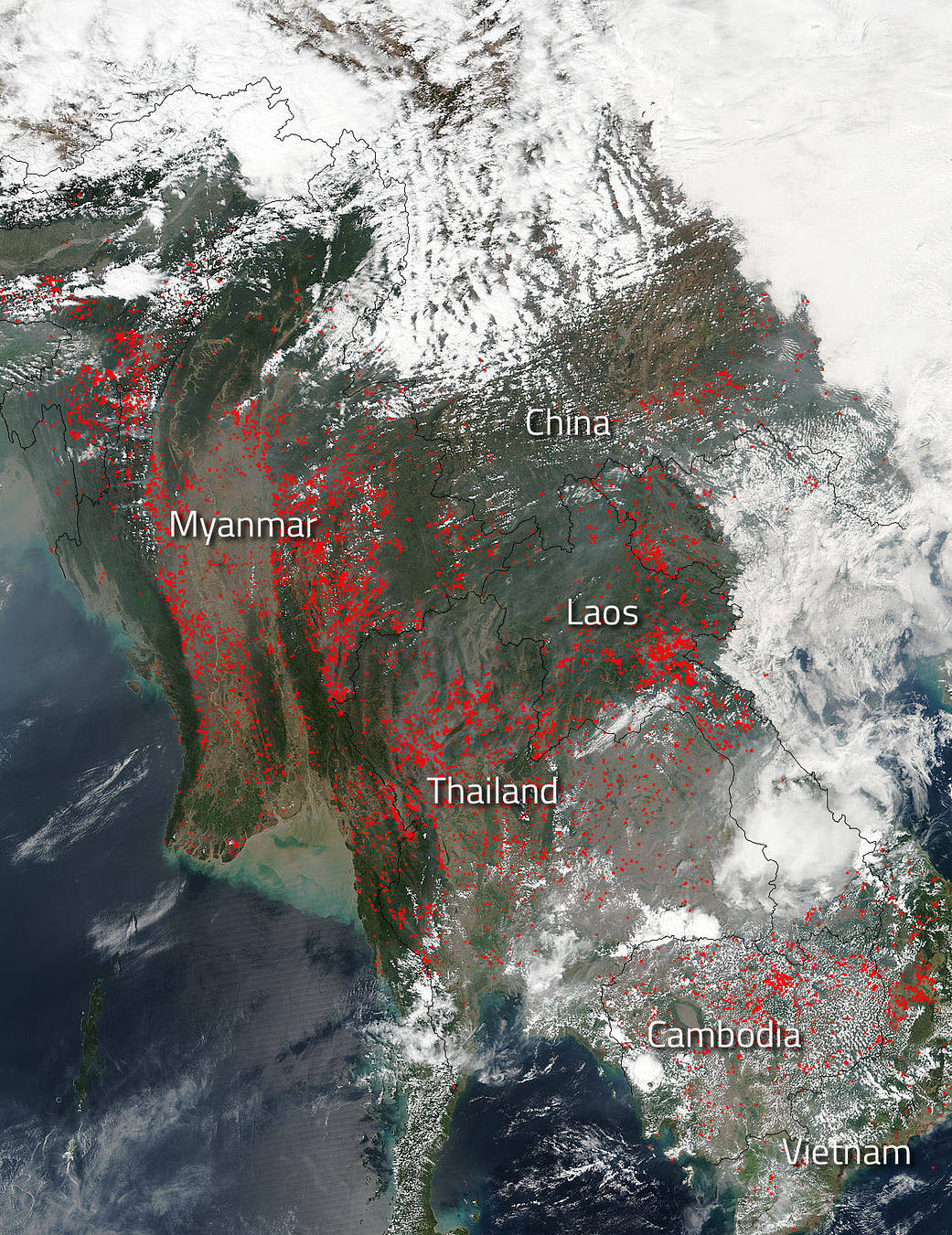
The start of planting season in Indochina first starts with cleaning out the old before the new is planted. That includes setting fires to clear fields as evidenced in this satellite image from March 06, 2018. This type of farming has been done in this area of the world for centuries.
Although most cost effective, the problem with “slash and burn” agriculture is what it leaves behind–smoke. The smoke released by any type of fire (forest, brush, crop, structure, tires, waste or wood burning) is a mixture of particles and chemicals produced by incomplete burning of carbon-containing materials. All smoke contains carbon monoxide, carbon dioxide and particulate matter or soot. This can be very hazardous to humans, especially the young and elderly or those with compromised respiratory systems. Smoke can also be carried on wind currents and taken hundreds and even thousands of miles to other areas that are then exposed to the effects of that smoke.
This image was taken by NOAA/NASA’s Suomi NPP satellite on March 06, 2018. The Visible Infrared Imaging Radiometer Suite (VIIRS) instrument onboard Suomi NPP was used to capture this image. Actively burning areas, detected by VIIRS are outlined in red. When they are accompanied by smoke, as in this image especially around southern Thailand and Cambodia, they are indicative of fire.
The Suomi NPP satellite is a joint mission between NASA and NOAA.
NASA image courtesy Jeff Schmaltz, MODIS Rapid Response Team. Caption: NASA/Goddard, Lynn Jenner


