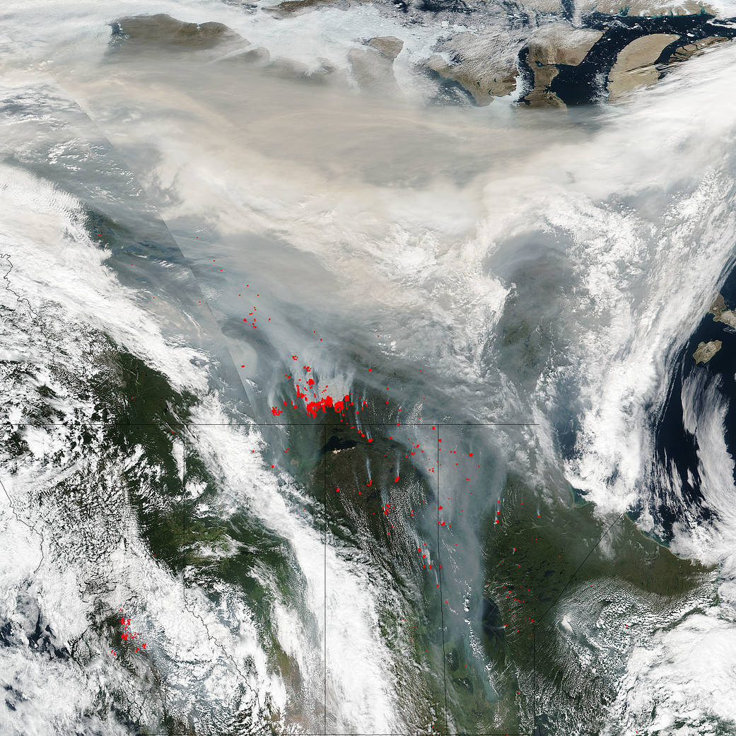
Smoke from the wildfires in Canada’s Northwest Territories, as well as British Columbia, Alberta, Saskatchewan and Manitoba are seen in this image from the Suomi NPP satellite. The smoke spewing from the fires has been swept up by the jet stream and is being carried across the continent. The largest fires seem to be in the Northern Territories. Fire is worrisome enough but the smoke that is produced from wildfires is extremely dangerous. Wind patterns have the ability to move smoke and dangerous particles across continents to affect people in far-flung parts of the world. The hotter the fire is the higher the smoke goes into the atmosphere and the farther it can travel. Winds in the upper atmosphere are stronger and allow the smoke to travel greater distances.
Smoke from extremely hot wildfires can even trigger massive thunderstorms, as they did in August of 2014 in Canada’s Northern Territories. Once in the stratosphere, above the part of the atmosphere where weather occurs, aerosol particles can travel long distances. In a case from 2010, the smoke from a massive thunderstorm triggered by Russian wildfires reached the eastern United States. The smoke stayed in the stratosphere for a long time because it was above the part of the atmosphere where weather occurs, so it was not able to rain or fall out easily.
There is some comfort, however, if you aren’t able to smell the smoke. Chances are the smoke most likely won’t negatively affect you, but always check the Air Quality Index in your area to be sure, especially if the skies seem hazy. If you do smell smoke, take precautions to avoid it.
The Suomi NPP satellite’s Visible Infrared Imaging Radiometer Suite (VIIRS) instrument captured a look at multiple fires, smoke from those fires, and cloud cover over northern Canada on August 14, 2017. The Suomi NPP satellite is a joint mission between NASA and NOAA.
NASA image courtesy Jeff Schmaltz, MODIS Rapid Response Team. Caption: NASA/Goddard, Lynn Jenner with information from NASA stories cited above.

