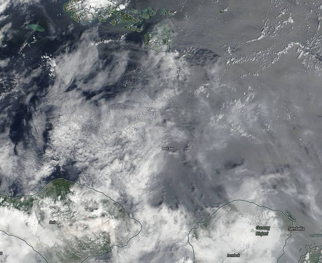
Ash from Mount Agung on the Indonesian island of Bali was visible in imagery from NASA’s Terra satellite.
The Moderate Resolution Imaging Spectroradiometer or MODIS instrument that flies aboard NASA’s Terra satellite captured a visible image of the ash cloud on Nov. 29, 2017 at 0245 UTC (Nov. 28 at 9:45 p.m. EST). The MODIS image showed a grey cloud of ash blanketing part of the Bali Sea. The Bali Sea is north of the island of Bali and south of Indonesia’s Kangean Island.
Indonesia’s National Disaster Management Authority (BNPB) noted that the first eruption of Mount Agung occurred on Nov. 21 at 5:05 p.m. WITA local time. At that time the status of Gunung Agung was at standby Alert level 3. On Nov. 27, BNPB raised the Alert to the highest level, level 4. BNPB warned that the eruptions are increasing. The volcano continues to spew ash as high as 2 miles into the sky.
On Nov. 27, BNPB also issued an evacuation proclamation, “people within a radius of 8 km and 10 km (5 and 6 miles) of expansion are urged to immediately evacuate.”
In 1963 Mount Agung’s eruption killed more than 1,600 people on the island. For local updates from the BNPB: https://www.bnpb.go.id/
By Rob Gutro
NASA’s Goddard Space Flight Center


