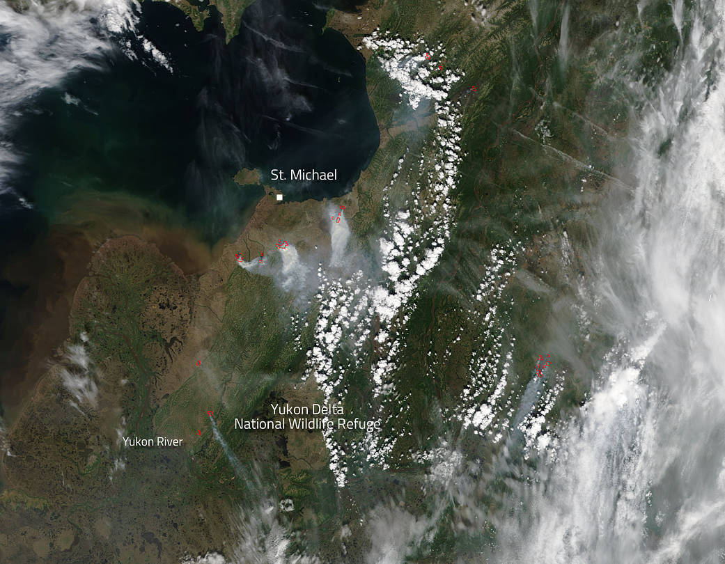
Inciweb is reporting that several lightning strikes have caused fires to start and begin burning in Southwest Alaska. Inciweb says: “As of the morning of June 11, there were 14 active fires burning in the area, which encompasses 88 million acres between McGrath and Dillingham. Five fires are burning in full/modified protection areas and nine are burning in limited protection areas. As of Sunday morning, five fires are being staffed and the remainder are being monitored by the Alaska Division of Forestry.”
Some of the fire activity was subdued over the past three days due to widespread rain although fires do continue to burn and grow in size. All fires have received at least some rain over the three day shower period which has helped to reduce fire threats to populated areas.
Of the 124,714 acres burned in Alaska as of June 11, more than half of those acres (67,239) have burned in the Southwest Area.The biggest fire currently burning in the Southwest Area is the 16,746-acre Pitka Fork Fire burning in a limited protection area. More than 160 firefighters have been working to quell the blazes.
NASA’s Terra satellite collected this natural-color image with the Moderate Resolution Imaging Spectroradiometer, MODIS, instrument on June 08, 2013. Actively burning areas, detected by MODIS’s thermal bands, are outlined in red. When accompanied by plumes of smoke, as in this image, such hot spots are diagnostic for fire. This image was taken before the rain moved in to the area.
NASA image courtesy Jeff Schmaltz LANCE/EOSDIS MODIS Rapid Response Team, GSFC. Caption by Lynn Jenner with information from Inciweb

