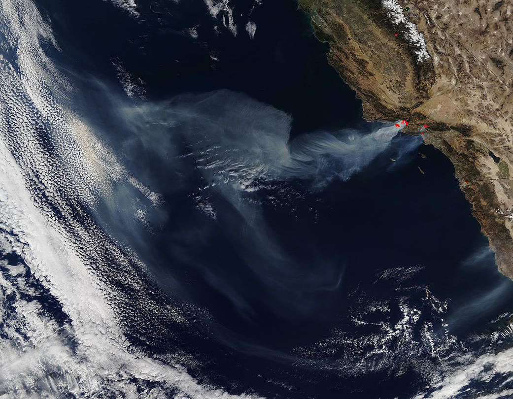
Nearly 200,000 people have been evacuated ahead of the firestorm that is sweeping across Southern California. The strong Santa Ana winds continue unabated and those winds coupled with steep terrain and crew fatigue are taking a toll on the entire area affected. The four largest fires together have swept across 116,000 acres in the Los Angeles area since the outbreak on Monday night. None of these fires is even 15 percent contained at present. Weather forecasters are hoping that winds will die down Friday into Saturday but until then the relentless march of this firewall continues.
NASA’s Terra satellite collected this natural-color image with the Moderate Resolution Imaging Spectroradiometer, MODIS, instrument on December 06, 2017. Actively burning areas (hot spots), detected by MODIS’s thermal bands, are outlined in red. Each hot spot is an area where the thermal detectors on the MODIS instrument recognized temperatures higher than background. When accompanied by plumes of smoke, as in this image, such hot spots are diagnostic for fire. NASA image courtesy Jeff Schmaltz LANCE/EOSDIS MODIS Rapid Response Team, GSFC. Caption by Lynn Jenner

