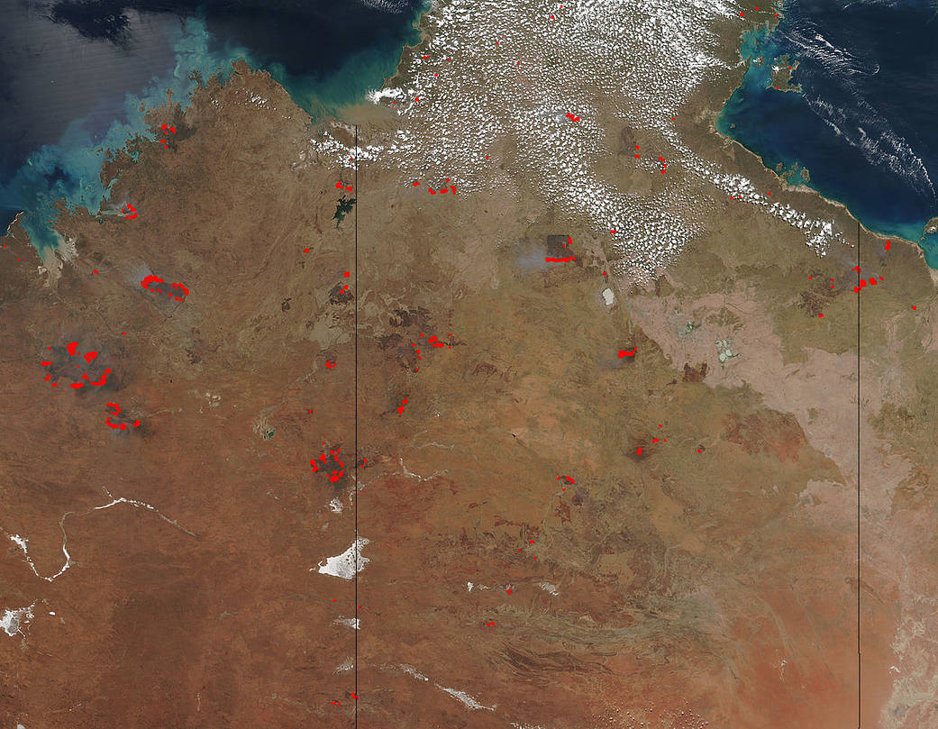
Fires that span across the Northern Territory and Western Australia appear to have broken out in areas that have already been burned in previous fires. Areas that sport “burn scars”, those areas that are a darker, almost red-brown color, are surrounded by fires that are anywhere from a few hours old to 7 days old. The areas that are seven days old can be attributed to fires that spread but areas that are just a few hours old may be fires that have presumably been put out only to have them break out again. The Northern Territory of Australia experienced a higher than normal amount of rain this past season allowing the plants and trees that fuel fires to become even more overgrown and subject to becoming fire fodder.
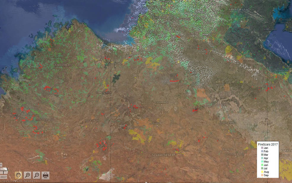
The fire map from the Northern Australia and Rangelands Fire Information site has been superimposed over the Suomi NPP fire image. The red marks are from the Suomi NPP image showing fires that are currently burning. The other colors come from the NAFI map that shows areas burned at other times. The legend on the lower right-hand side show which colors correspond to the months in 2017 where other fires made their marks on the landscape. NAFI map that shows areas burned at other times. The legend on the lower right-hand side show which colors correspond to the months in 2017 where other fires made their marks on the landscape.
The Suomi NPP satellite’s Visible Infrared Imaging Radiometer Suite (VIIRS) instrument captured this image on September 21, 2017. NOAA/NASA image courtesy Jeff Schmaltz, MODIS Rapid Response Team. Caption: NASA/Goddard, Lynn Jenner with information from the Northern Australia and Rangelands Fire Information site.

