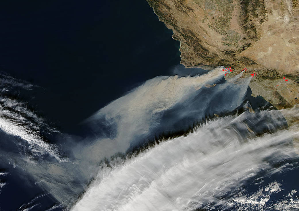
The fires in Southern California went from 0 to 30,000 (acres) in a matter of hours fueled by the Santa Ana winds. These winds, also dubbed the Diablo (Devil) Winds, are hot, dry, and ferocious. They can whip a small brush fire into a raging inferno in just hours. This is exactly what Southern California experienced on Monday night (Dec. 4). Thousands of residents found themselves evacuating when the Thomas Fire suddenly pushed into Ventura by the Santa Ana winds. These horrific winds are expected to continue through the end of the week making firefighting more difficult and much more dangerous. Winds in the area could reach 70 mph and this would have a devastating effect on the fire’s movement. The fire has consumed over 50,000 acres at present as it jumped over Highway 101 and moved towards the Pacific Ocean. Hundreds of homes and structures have been destroyed in this latest round of wildfires in California. Per the National Weather Center red flag conditions are expected to continue through the end of the week. This current round of Diablo Winds has been the longest and strongest wind event recorded this season.
NASA’s Aqua satellite captured this natural-color image with the Moderate Resolution Imaging Spectroradiometer, MODIS, instrument on Dec. 05, 2017. Actively burning areas (hot spots), detected by MODIS’s thermal bands, are outlined in red. Each hot spot is an area where the thermal detectors on the MODIS instrument recognized temperatures higher than background. When accompanied by plumes of smoke, as in this image, such hot spots are diagnostic for fire. NASA image courtesy Jeff Schmaltz LANCE/EOSDIS MODIS Rapid Response Team, GSFC. Caption by Lynn Jenner


