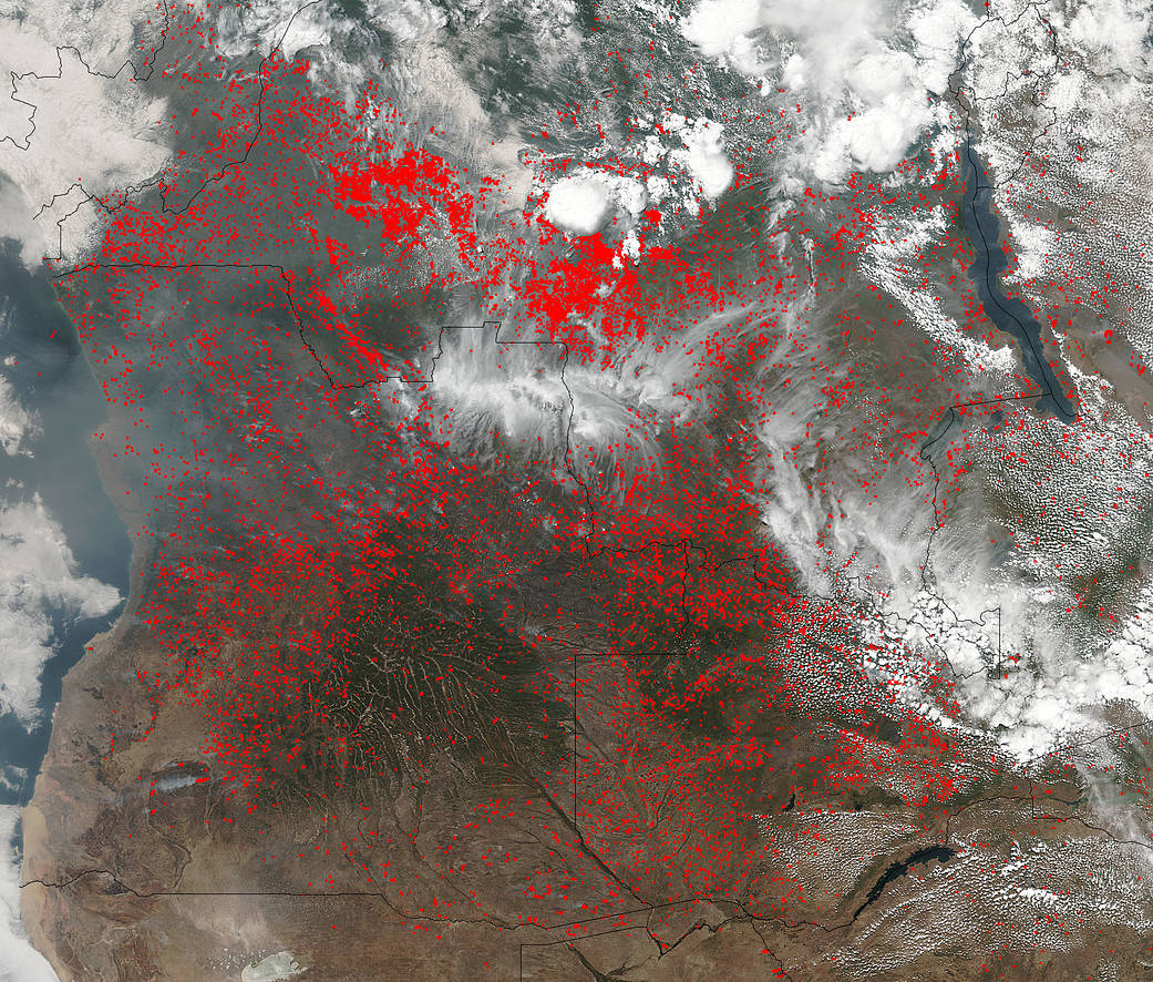
Hundreds of fires are covering large portions of Central Africa is this Suomi NPP satellite’s Visible Infrared Imaging Radiometer Suite (VIIRS) instrument image taken on August 14, 2017. This image looks very familiar to the image that was taken on June 27, 2017. Actively burning areas, detected by VIIRS are outlined in red.
These fires may be intentional agricultural fires set by people to rid the area of left over crops to ready the land for the next season. The agricultural burning season usually runs from May through August in this part of the world. Another cause of at least some of these fires may be from lightning strikes or they may be intentionally lit fires which may have gotten out of control.
The Suomi NPP satellite is a joint mission between NASA and NOAA.
NASA image courtesy Jeff Schmaltz, MODIS Rapid Response Team. Caption: NASA/Goddard, Lynn Jenner

