As of April 11, 2016, as many as 1.3 million hectares (over 3.7 million acres) of forest cover in Nepal has been destroyed by wild fires the last two weeks. Two persons have been killed and there have been huge losses to property across the country. Historically April and May are the when most forest fires are recorded in Nepal. On April 10th a record number of fires were reported in the country.
The Nepalese ministry of forests and soil conservation’s forests department, Director General Resham Dangi commented, “The fire situation is out of control. If prolonged dry conditions continue in the absence of rains, we are likely to experience a state of emergency in the coming days.”
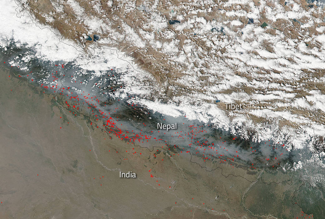
Forests in Sindhuli, Argakhanchi, Rupandehi, Mahottari, Dhanusha, Bardiya and Dang have been ravaged by fires in the past week, department officials stated. The satellite imagery showed that 457 forests across the country were affected by fires with the worst affected being Sindhuli, whose 40 percent forest cover has been reduced to ashes.
Nepal came up with a forest fire management strategy in 2011 was unable to implement it on the ground. Currently only 67 of the total 19,000 community forestry user groups across the country are equipped with fire-fighting tools and the training required to mitigate the risks.
NASA’s Suomi NPP satellite collected this natural-color image using the VIIRS (Visible Infrared Imaging Radiometer Suite) instrument on April 11, 2016. Actively burning areas, detected by MODIS’s thermal bands, are outlined in red. NASA image courtesy Jeff Schmaltz LANCE/EOSDIS MODIS Rapid Response Team, GSFC. Caption by Lynn Jenner with information from ZeeNews Indian news agency.

