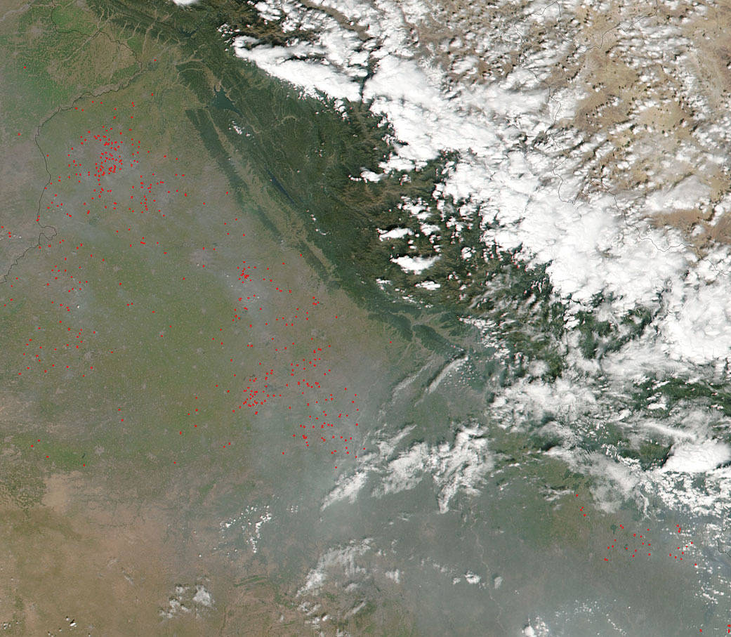
The Indian state of Punjab has two growing seasons—one from May to September and another from November to April. Prior to the planting season is time for farmers to clear their fields and they do that by burning the fields to clear them. This Suomi NPP image most probably shows this agricultural practice being carried out in this image from October 10, 2016. Red outlines show the approximate locations of active burning.
The Punjab state grows about one-fifth of India’s wheat and preparing for planting with fire has the benefit of clearing out some pests that eat crops and turning crop residues from the previous season into fertilizing ash. However, smoke in any form is harmful. Older adults, young children and those with respiratory issues can be most affected by this practice. All smoke includes a multitude of compounds, including carbon dioxide, carbon monoxide, nitrogen oxides, and particulate matter. These components have the potential to affect human health.
NASA’s Suomi NPP satellite collected this natural-color image using the VIIRS (Visible Infrared Imaging Radiometer Suite) instrument on October 10, 2016. Actively burning areas, detected by MODIS’s thermal bands, are outlined in red. NASA image courtesy Jeff Schmaltz LANCE/EOSDIS MODIS Rapid Response Team, GSFC. Caption by Lynn Jenner with information from the Earth Observatory.
Suomi NPP is managed by NASA and NOAA.

