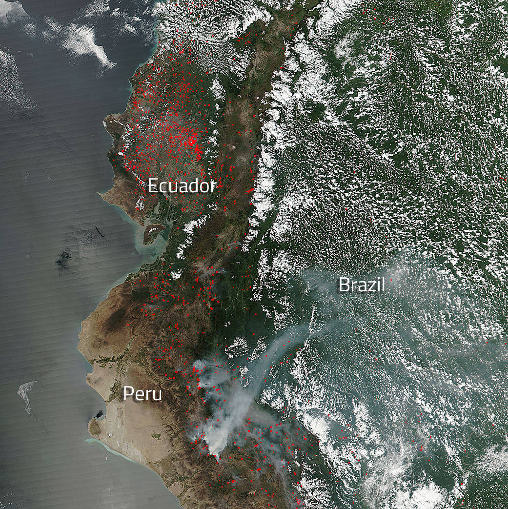
The Suomi NPP satellite’s Visible Infrared Imaging Radiometer Suite (VIIRS) instrument captured a look at multiple fires and smoke burning mostly in Ecuador and fewer fires in Peru on November 21, 2016. Actively burning areas, detected by VIIRS are outlined in red. Ecuador has been experiencing a large number of fires recently as evidenced by this image from November 02, 2016. This image feature provides several suggestions as to how the fires may have started, but none have been confirmed. It is known, though, that the coastal areas and lowlands tend to be drier July through November with fire hazard increasing through November.
The Suomi NPP satellite is a joint mission between NASA, NOAA and the U.S. Department of Defense. NASA image courtesy Jeff Schmaltz, MODIS Rapid Response Team. Caption: NASA/Goddard, Lynn Jenner

