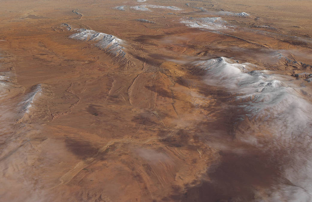
For the second time in three years, snow has accumulated in the desert near the northern Algerian town of Aïn Séfra. Sometimes called the “gateway to the desert,” the town of 35,000 people sits between the Sahara and the Atlas Mountains. On January 8, Landsat 8 captured data for these natural-color images of the snow in the Sahara. The Landsat 8 image was draped over a global digital elevation model, built from data acquired by NASA’s Shuttle Radar Topography Mission.
According to news and social media accounts, anywhere from 10 to 30 centimeters (4 to 12 inches) of snow accumulated on January 8, 2018, on some higher desert elevations (1000 meters or more above sea level). Social media photos showed citizens sliding down snow-covered sand dunes. Warming temperatures melted much of it within a day.
Snow in the Sahara and other parts of North Africa is infrequent, but not unprecedented. Measurable snow fell near Aïn Séfra in December 2016. Substantial snow also blanketed the Atlas Mountains in Morocco in February 2012 and January 2005.
Image Credits: NASA Earth Observatory image by Joshua Stevens, using Landsat data from the U.S. Geological Survey and topographic data from the Shuttle Radar Topography Mission

