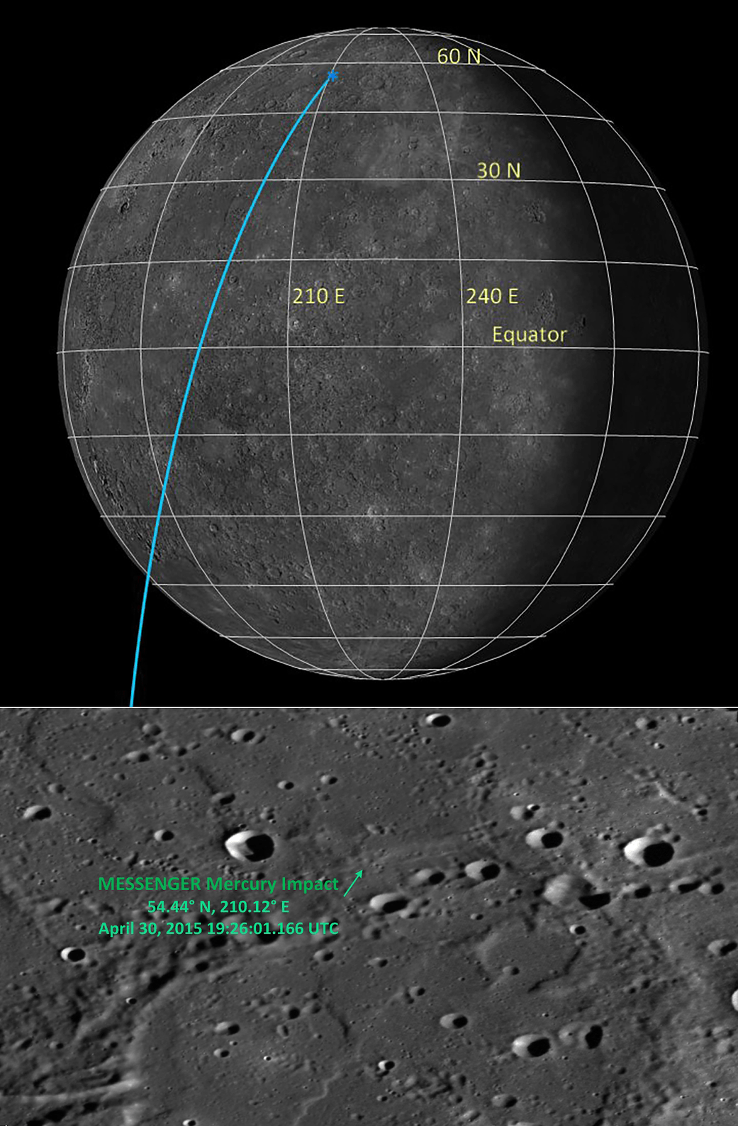
Bottom Image Scale: This image is roughly 130 km (81 miles) across.Of Interest: The day before the MESSENGER spacecraft impacted the surface of Mercury, the best prediction for the location and time of the impact was 54.4° N, 210.1° E, on 30 April 2015 at 19.26:02 UTC, as shown in the featured image of that day. In the last month since impact, MESSENGER engineers have completed the final and most accurate determination of where the MESSENGER spacecraft impacted Mercury’s surface. The determination indicates that the spacecraft impacted into a part of Mercury’s surface that has a gradual incline with an approximate slope of 8.5°. The final estimate of the impact location is at 54.4398° N, 210.1205° E, and 2438.790 km from the center of Mercury. The final determination of the impact time is 19:26:01.166 UTC on 30 April 2015. Traveling at 3.912 kilometers per second (8,750 miles per hour), the MESSENGER spacecraft is estimated to have created a crater 16 meters (52 feet) in diameter at this location. This new best determination of the impact location will help the next Mercury spacecraft to identify MESSENGER’s crater, such as the joint ESA-JAXA BepiColombo mission, scheduled for lauch in 2017 and arrival in Mercury orbit in 2024. The MESSENGER spacecraft was the first ever to orbit the planet Mercury. In the mission’s more than four years of orbital operations, MESSENGER acquired over 270,000 images and extensive other data sets. View highlights of the mission in this image highlights collection and details about its final month of orbital operations at this page. MESSENGER’s highly successful orbital mission came to an end, as the spacecraft ran out of propellant and the force of solar gravity caused it to impact the surface of Mercury on April 30, 2015.Credit: NASA/Johns Hopkins University Applied Physics Laboratory/Carnegie Institution of Washington
2 min read


