


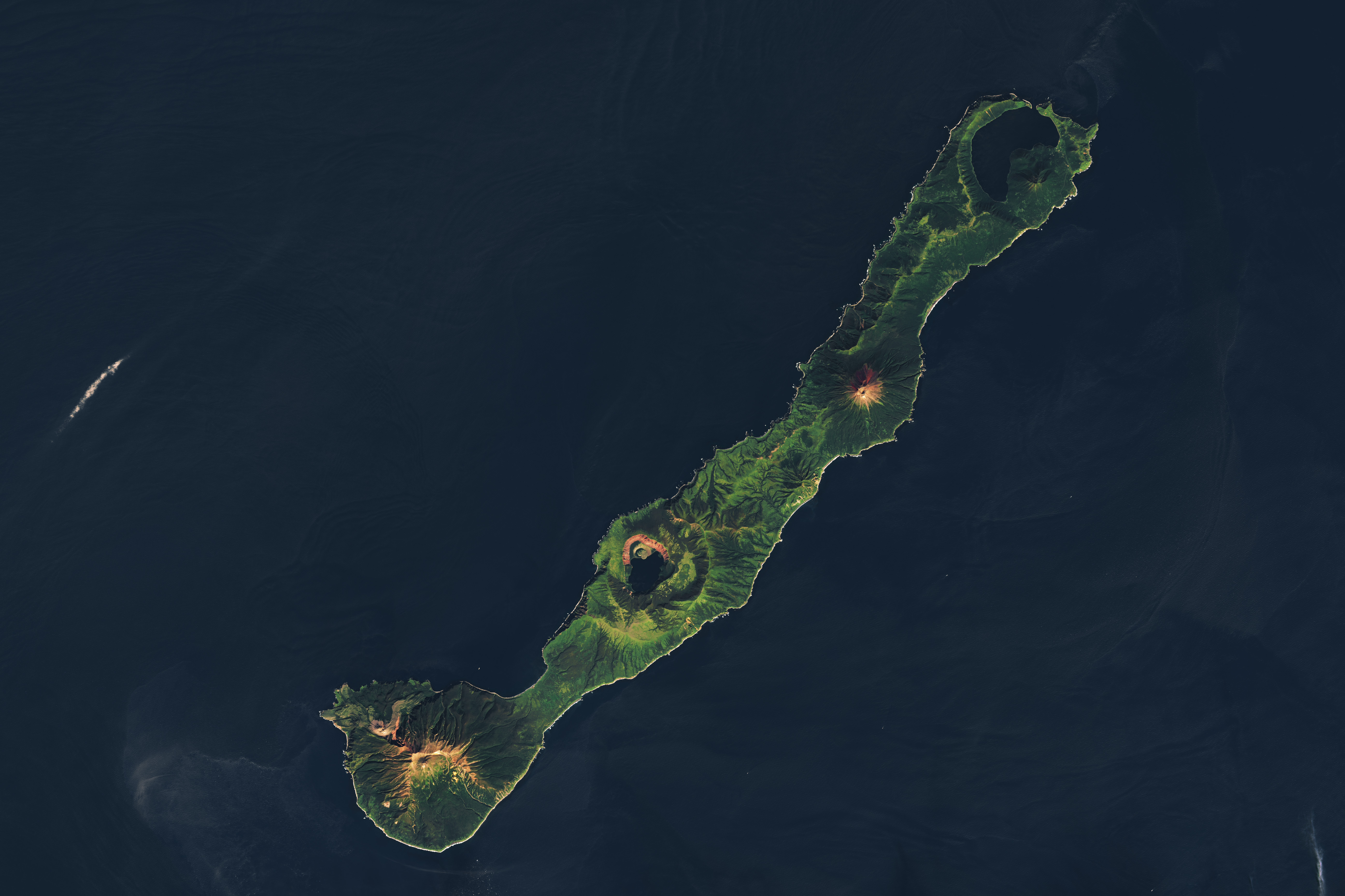
Nested Calderas of Zavaritskogo
In the remote northwest corner of the Pacific Ocean, a dotted line of islands stretches between northern Japan and Russia’s Kamchatka Peninsula. The Kuril Archipelago is sparsely populated by humans but riddled with volcanoes. The Zavaritskogo volcano (also called Zavaritskii) is a striking feature on Simushir Island, in the middle of the archipelago. It is made up of nested, steep-walled calderas surrounding a central lake. The OLI (Operational Land Imager) on Landsat 8 captured these images of Zavaritskogo and its complex edifice on September 12, 2024.
Image Credit: Landsat 8 — OLI
- X
https://www.nasa.gov/image-detail/zavaritskogo-oli-20240912-lrg/
Image CreditLandsat 8 — OLI
Size5191x3461px