


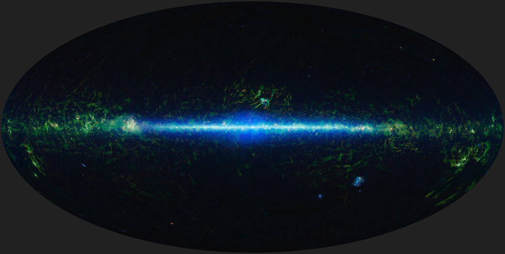
Mapping the Entire Night Sky
This mosaic is composed of images covering the entire sky, taken by the Wide-field Infrared Survey Explorer (WISE) as part of WISE’s 2012 All-Sky Data Release.
- X
https://www.nasa.gov/image-detail/mapping-entire-night-sky/
Size1041x524px