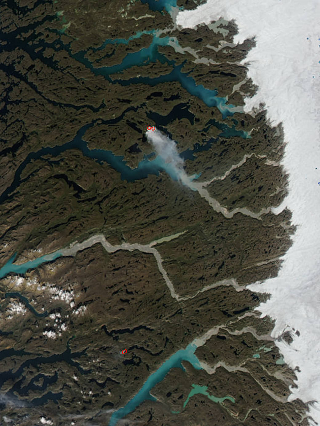
NASA’s Aqua satellite collected this natural-color image of a wildfire in the western part of Greenland with the Moderate Resolution Imaging Spectroradiometer, MODIS, instrument on August 04, 2017. Actively burning areas, detected by MODIS’s thermal bands, are outlined in red. Even though most of Greenland is covered with ice, the outer parts of the country are not. On the western side of Greenland a wildfire has apparently broken out.
From a feature story published by NASA on August 04, 2017: “In Greenland, everything got warmer at the same time: the air, the ocean surface, the depths of the ocean,” said Ian Joughin, a glaciologist at University of Washington. ‘We don’t really understand which part of that warming is having the biggest effect on the glaciers. What scientists do know is that warming Arctic temperatures – and a darkening surface of the Greenland ice sheet – are causing so much summer melting that it is now the dominant factor in Greenland’s contribution to sea level rise. Greenland’s summer melt season now lasts 70 days longer than it did in the early 1970s. Every summer, warmer air temperatures cause melt over about half of the surface of the ice sheet – although recently, 2012 saw an extreme event where 97 percent of the ice sheet experienced melt at its top layer.'”
Warmer temps combined with summer melting to reveal tundra that can burn equals the ability to have wildfires that most probably began with a lightning strike.
Each hot spot, which appears as a red mark on the image, is an area where the thermal detectors on the MODIS instrument recognized temperatures higher than background. When accompanied by plumes of smoke, as in this image, such hot spots are diagnostic for fire.
Read a feature from Earth Observatory about this fire in Greenland.
NASA image courtesy Jeff Schmaltz LANCE/EOSDIS MODIS Rapid Response Team, GSFC. Caption by Lynn Jenner with information from Aug. 04 NASA story

