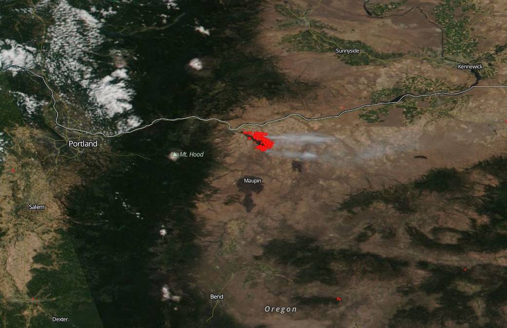
The Substation Fire in Oregon which began just last Tuesday is located southeast of The Dalles area in the north area of the state. The fire quickly began marching east driven by high winds. Firefighters saw heightened activity on the north and the south ends of the fire. More than 50,000 acres in Sherman and Wasco Counties are affected. As of Wednesday afternoon, July 17, 178 firefighters from 32 agencies across Oregon are focused on protecting structures in the line of the fire. It was noted by the Governor of Oregon in a released statement that the fire season this year has escalated much more quickly than in years past. She also added, “Given drought conditions and hotter than usual temperatures, Oregonians should be prepared for an intense wildfire season this year.” Farmers who are in the midst of harvest season in order to assist with the fire.
NASA’s EOSDIS provides the capability to interactively browse over 600 global, full-resolution satellite imagery layers and then download the underlying data. Many of the available imagery layers are updated within three hours of observation, essentially showing the entire Earth as it looks “right now”. This natural-color satellite image was collected on July 18, 2018. Actively burning areas, detected by thermal bands, are outlined in red. NASA image courtesy NASA/Goddard Space Flight Center Earth Science Data and Information System (ESDIS) project. Caption: Lynn Jenner with information from various news agencies.


