


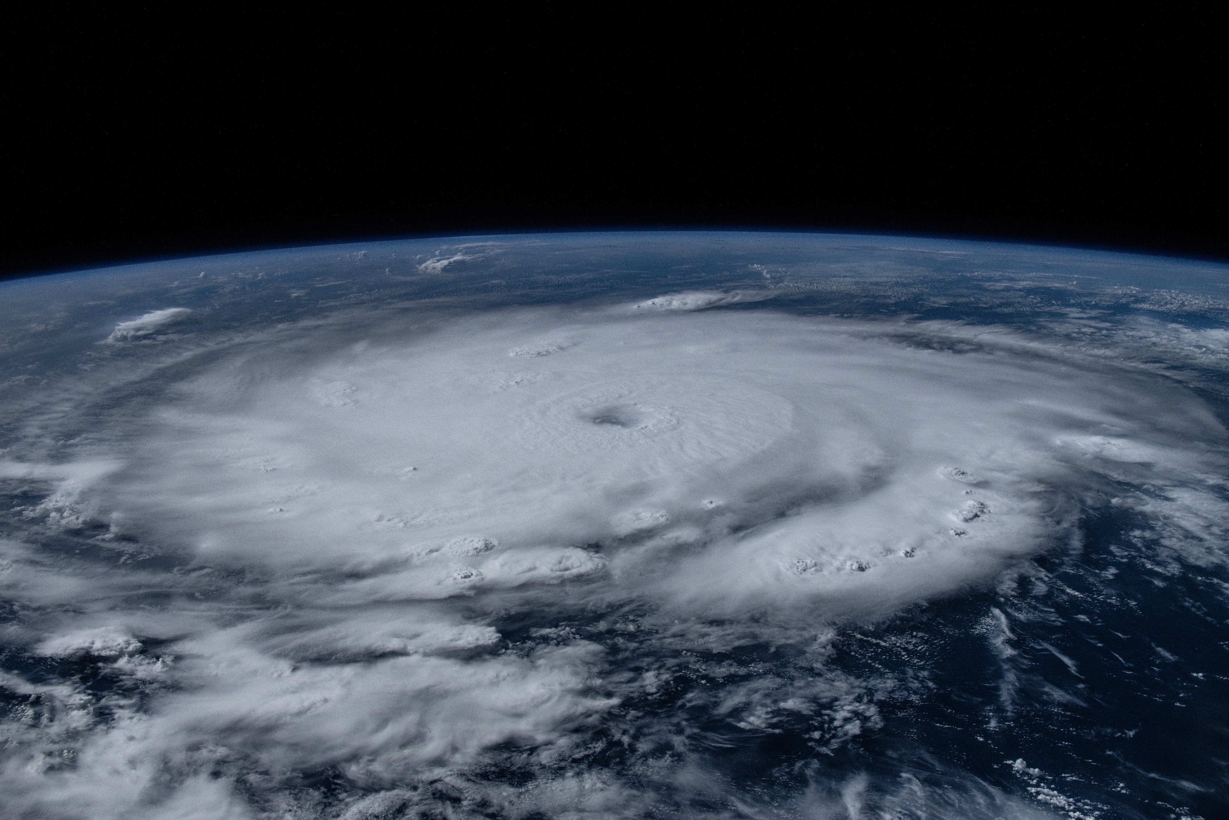
NASA astronaut Matthew Dominick captured this image of Hurricane Beryl in the Caribbean on July 1, 2024, while aboard the International Space Station, and posted it to X. The Category 4 hurricane had winds of about 130 mph (215 kph).
Hurricanes – tropical cyclones that form over the Atlantic Ocean or the eastern Pacific Ocean – use warm, moist air as fuel. The warm, moist air over the ocean rises upward from near the surface, causing an area of lower air pressure below. Air from surrounding areas with higher air pressure pushes into the low pressure area. Then that “new” air becomes warm and moist and rises, too. As the warm air continues to rise, the surrounding air swirls in to take its place. As the warmed, moist air rises and cools off, the water in the air forms clouds. The whole system of clouds and wind spins and grows, fed by the ocean’s heat and water evaporating from the surface.
NASA studies hurricanes from space through photos like this one, as well as observations from satellites. This vantage point helps scientists understand how climate change impacts hurricanes and learn how communities can better prepare for tropical cyclones in a warmer world. Learn more about how hurricane first responders use NASA resources and data.
Image Credit: NASA/Matthew Dominick