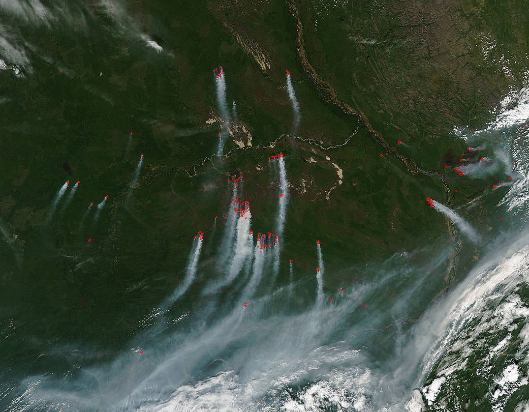
From July 28 through August 3, 2017 there were 58,419 fires detected in all of Russia by Global Forest Watch. Global Forest Watch even counts the number of fires in each region of a country. In this case, in all of Russia’s republics. The Aqua satellite happened to capture this image of the republic in Russia that has the second highest number of wildfires. The Sakha Republic in Russia is currently under siege from wildfires with a whopping 16,257 fires detected during the past week. The only republic that has seen higher totals is Yamal-Nenets with 26,368 fires. The third largest number of fires is far below these totals at 6,198 fires in Khanty-Mansiy Republic. Russia has seen a huge number of fires this calendar year – 141,968, but in 2012 there were a staggering 483,977 fires. So far the fire beleaguered country is not on track to meet that record, which is a very good thing.
Global Forest Watch uses NASA Fire Information for Resource Management System (FIRMS) near real-time (NRT) active fire data from the MODIS and VIIRS instruments on the Aqua, Terra, and Suomi NPP satellites to map fire locations. The sensors on these satellites detect the heat signatures of fires from the infrared spectral band. When a fire is detected, the system indicates the area where the fire occurred with an “alert.” Because each satellite orbits the earth twice per day, these alerts can be provided in near-real time. Actively burning areas are outlined in red. When they are accompanied by smoke, as in this image, they are indicative of fire.
NASA’s Aqua satellite collected this natural-color image with the Moderate Resolution Imaging Spectroradiometer (MODIS) instrument on Aug. 04, 2017. NASA image courtesy Jeff Schmaltz, MODIS Rapid Response Team. Caption: NASA/Goddard, Lynn Jenner with information from Global Forest Watch


