The Martin Fire near the small Northern Nevada town of Paradise Valley erupted on July 05, 2018. The cause of the fire is under investigation. Between Thursday and today, July 09, 2018, the fire has exploded in size and updated mapping on Monday, has the fire just shy of 400,000 acres which is roughly 624 square miles. Contained is low at 8 percent.
The fire’s extreme growth has made it the largest wildfire currently burning in the United States by a margin of hundreds of thousands of acres, according to the National Interagency Fire Center’s daily report.
Hot, dry and windy conditions combined with an extraordinarily high fuel load in the area have created very challenging conditions for the more than 500 firefighters assigned to the blaze. Firefighters are contending with a fire maelstrom with flames as high as 45 feet and fire that is spreading at the rate of eleven miles per house. The reason for the fast spread seems to be the amount of dry grass in the area which is 200 to 1,000 percent above the normal amount of growth, most probably due to heavy rains earlier in the year which promoted grass growth. Now the hot weather, low humidity and steady winds create the perfect storm for a huge conflagration which is the Martin Fire.
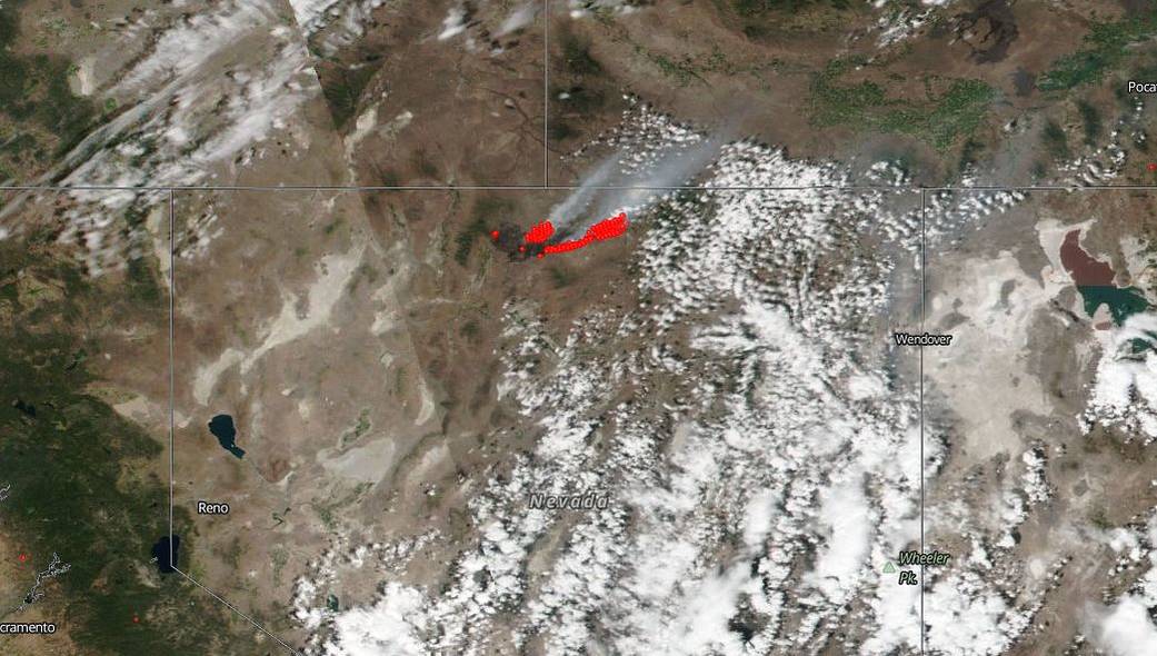
NASA’s Suomi NPP satellite captured this image of the fire and smoke blowing from it on July 08, 2018 with the Visible Infrared Imaging Radiometer Suite (VIIRS) instrument. Actively burning areas (hot spots), detected by thermal bands, are outlined in red. Each hot spot is an area where the thermal detectors recognized temperatures higher than background. When accompanied by plumes of smoke, as in this image, such hot spots are diagnostic for fire. NASA image courtesy of the NASA/Goddard Space Flight Center Earth Science Data and Information System (ESDIS) project. Caption by Lynn Jenner with information from Inciweb.

