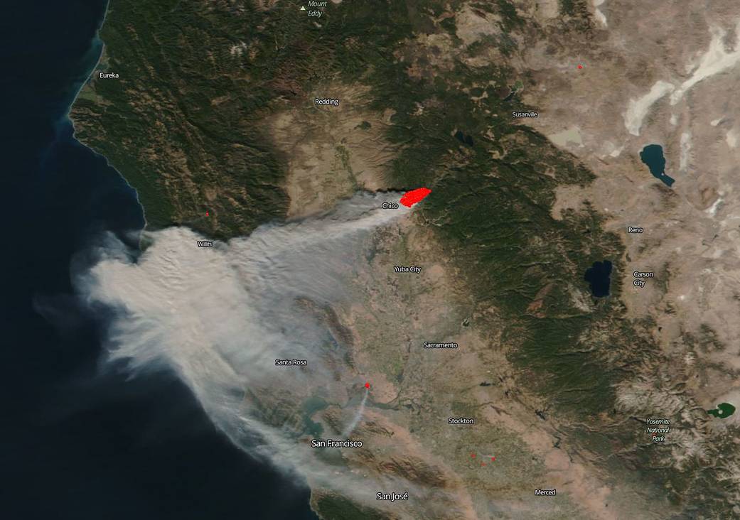
California has suffered from record-setting wildfires this past fire-season and now a late fire-season wildfire, the Camp Fire, has overtaken and nearly burned out the town of Paradise in Northern California. On November 8, 2018, a fire broke out in the early morning hours just outside Paradise, home to many retirees. The cause of it is still under investigation. The town of Paradise was engulfed in black smoke from the fire and 30,000 residents were quickly evacuated. There is still no reporting on the number of residents who may have perished in the blaze. In one day this fire consumed 20,000 acres with over 15,000 structures still threatened. The fire is traveling quickly and is now within 2 miles of Chico, California. The Camp Fire was so named because of its proximity to Camp Creek Road near Highway 70 in the Feather River Canyon. Firefighters continue to be challenged with extreme fire and weather conditions including strong winds and with long range spotting.
NASA’s Earth Observing System Data and Information System (EOSDIS) Worldview application provides the capability to interactively browse over 700 global, full-resolution satellite imagery layers and then download the underlying data. Many of the available imagery layers are updated within three hours of observation, essentially showing the entire Earth as it looks “right now.” This satellite image was collected on November 08, 2018. NASA’s Suomi NPP satellite collected this natural-color image using the VIIRS (Visible Infrared Imaging Radiometer Suite) instrument. Actively burning fires, detected by thermal bands, are shown as red points. Image Courtesy: NASA Worldview, Earth Observing System Data and Information System (EOSDIS). Caption: Lynn Jenner with information from CA Fire.


