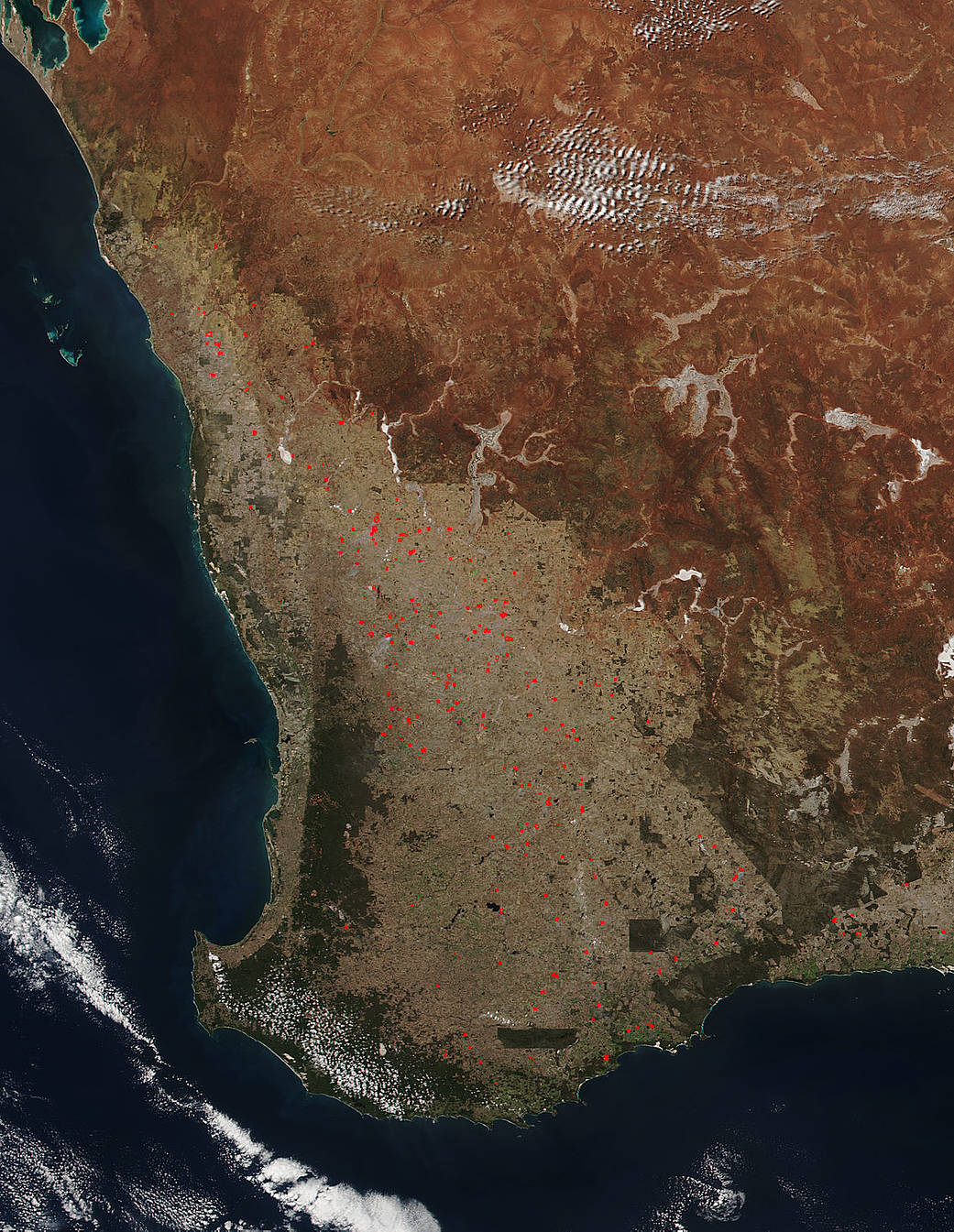
The Government of Western Australia has reported several bushfires in the Perth area and surrounding parts of the state. This image, which was captured in natural-color by the Suomi NPP satellite on March 16, 2017 using the VIIRS (Visible Infrared Imaging Radiometer Suite) instrument shows quite a few bushfires in the Western Australia state. On the Government of Western Australia bushfire warning website these include: Jandabup, King River, Newman, Boscabel, Meckering, Cowalla, Karlgarin, and Mundaring. Also on the website two burnoffs were noted. These are known as prescribed fires here in the States and the main reason to set these fires is to reduce hazardous fuels, protecting human communities from extreme fires.
Actively burning areas, detected by MODIS’s thermal bands, are outlined in red. NASA image courtesy Jeff Schmaltz LANCE/EOSDIS MODIS Rapid Response Team, GSFC. Caption by Lynn Jenner
Suomi NPP is managed by NASA and NOAA.


