Before humans could safely land on the Moon, scientists needed to understand the lunar surface’s properties. NASA’s Jet Propulsion Laboratory in Pasadena, California, managed the Surveyor series of robotic landers that served as precursors to the Apollo crewed Moon landings. The Surveyors provided ground-level information at potential Apollo landing sites that, combined with orbital imagery from Lunar Orbiters, increased our knowledge of the Moon in preparation for human missions. Surveyor 1 lifted off on May 30, 1966, and performed a successful soft landing on the Moon’s Ocean of Storms on June 2, the first American spacecraft to do so. Surveyor 1 returned thousands of images of its landing site, operating well past its design life, and confirming that spacecraft could safely land on the Moon and return useful scientific information.
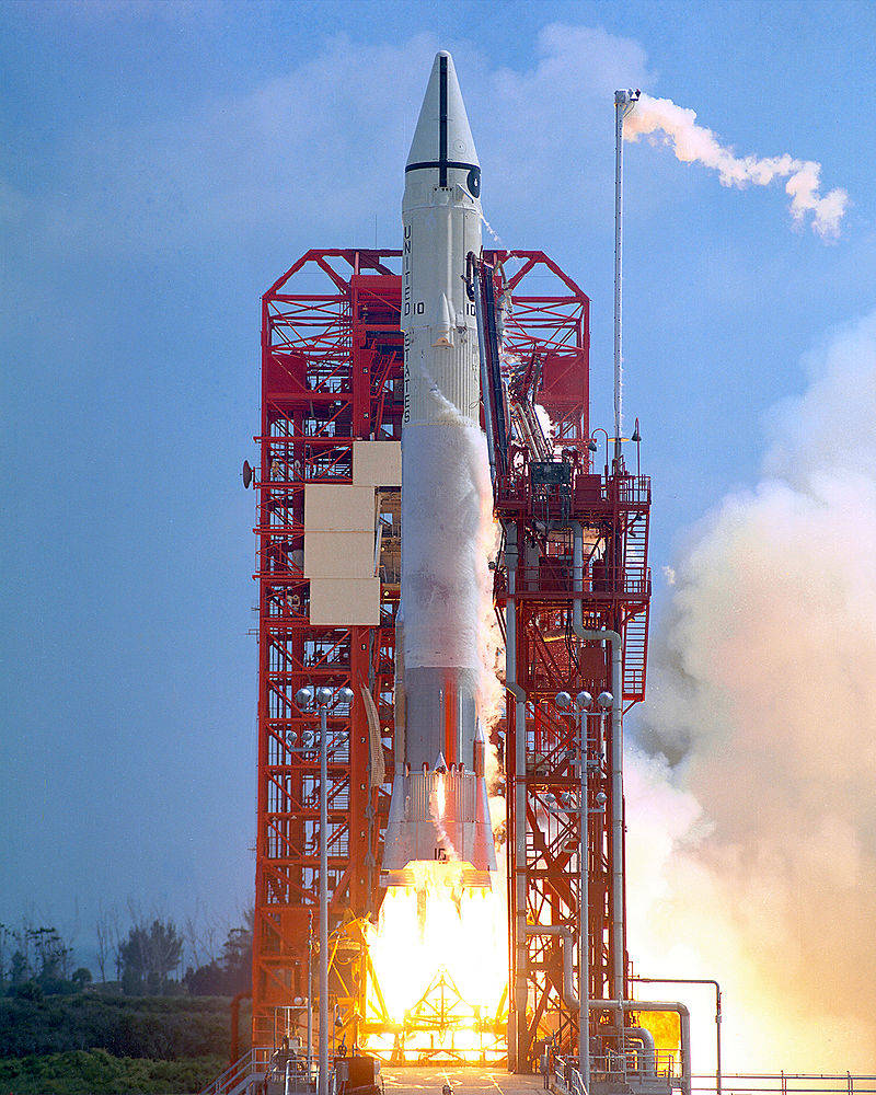
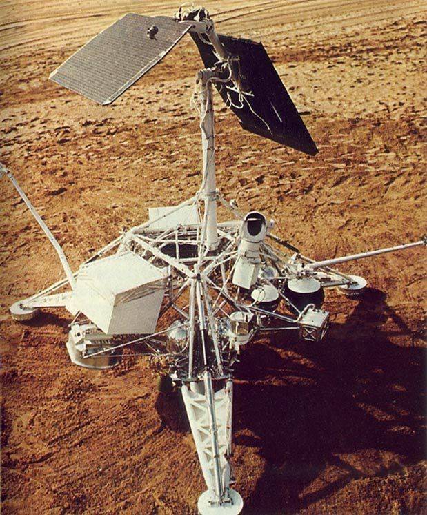
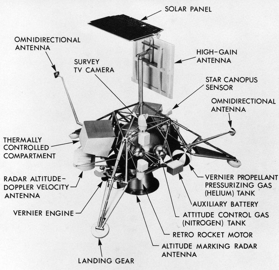
Left: Launch of Surveyor 1. Middle: Model of Surveyor 1. Right: Schematic of Surveyor 1 showing its major components.
The 2,200-pound Surveyor 1 spacecraft launched atop an Atlas-Centaur rocket on May 30, 1966, from the Cape Kennedy Air Force Station, now the Cape Canaveral Space Force Station in Florida. After a 63.6-hour coast from Earth, the spacecraft made a soft-landing on the Moon on June 2 inside the 60-mile wide Flamsteed P crater in the Ocean of Storms, bouncing once before settling on the surface. Tracking indicated that it had landed only nine miles from its target point. At landing, after using fuel for the descent and jettisoning its retrorocket, Surveyor 1 weighed only 648 pounds. Surveyor 1 carried a television camera used to return images from the surface with resolution down to one millimeter at a distance of four meters. The camera also included a filter wheel containing red, green, and blue filters, allowing engineers on Earth to reconstruct color images of the Moon’s surface. Thirty-six minutes after landing and sending engineering data back to Earth to confirm it survived the landing, Surveyor 1 returned its first image from the surface, showing parts of the spacecraft, one of its landing pads, and the dark lunar soil. Relive the excitement of Surveyor 1’s landing in this video.
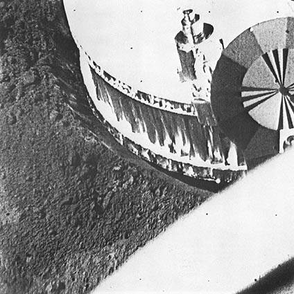
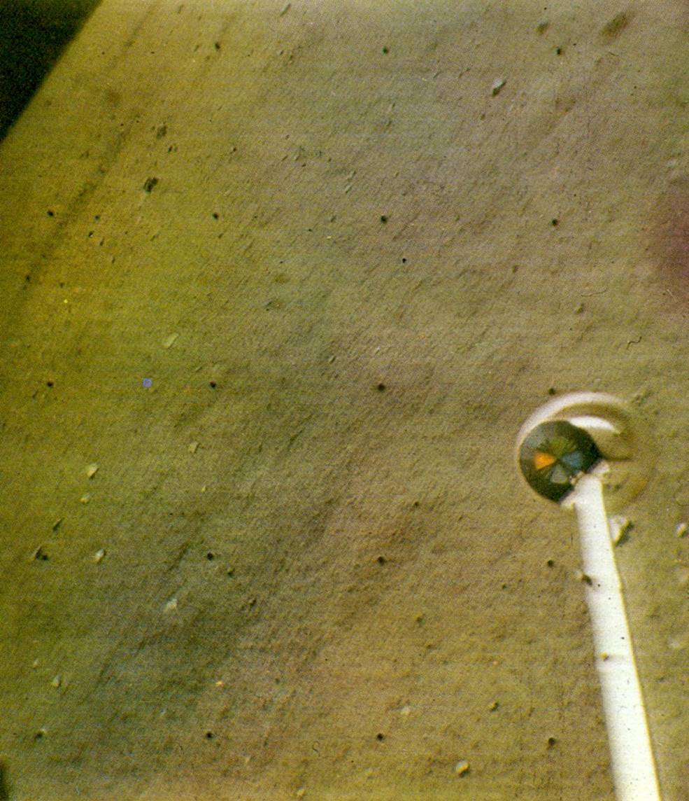
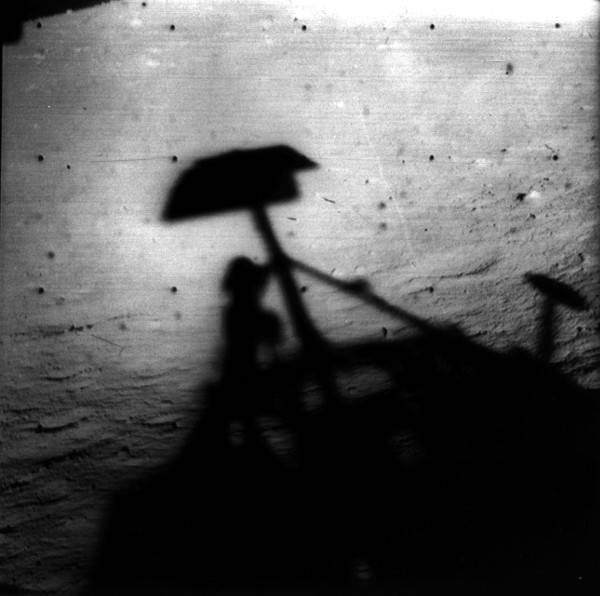
Left: Surveyor 1 image of its own footpad to show the properties of the lunar soil. Middle: Composite of three images taken through red, blue, and green filters to create a color view of the lunar surface. Right: Surveyor 1 image of its own shadow as the first lunar night approaches.
Surveyor 1 returned 10,622 images of the lunar surface, including the first color photo, until the first lunar nightfall on June 14. Since it carried only a solar panel and batteries, engineers didn’t know whether the spacecraft would survive the frigid 14-Earth-day lunar night, and indeed initial attempts at contact on June 28 proved unsuccessful. But the hardy spacecraft responded to commands on July 6 and returned another 618 images during its second lunar day of operations. After its second sunset on July 13, the spacecraft’s battery voltage dropped dramatically, and although controllers maintained intermittent contact with Surveyor 1 until Jan. 7, 1967, its mission was effectively over. The 11,240 images Surveyor 1 beamed back to Earth added a wealth of information about lunar surface conditions. Over the next two years, NASA launched six more Surveyors to the Moon, four of which completed soft landings, providing valuable information from different landing sites. Three years after Surveyor 1’s mission ended, Apollo 11 landed the first humans on the Moon’s Sea of Tranquility. During Apollo 12’s landing in the Ocean of Storms, astronauts visited Surveyor 3 and returned parts of the spacecraft to Earth for analysis of the effects of three years in the harsh lunar environment.
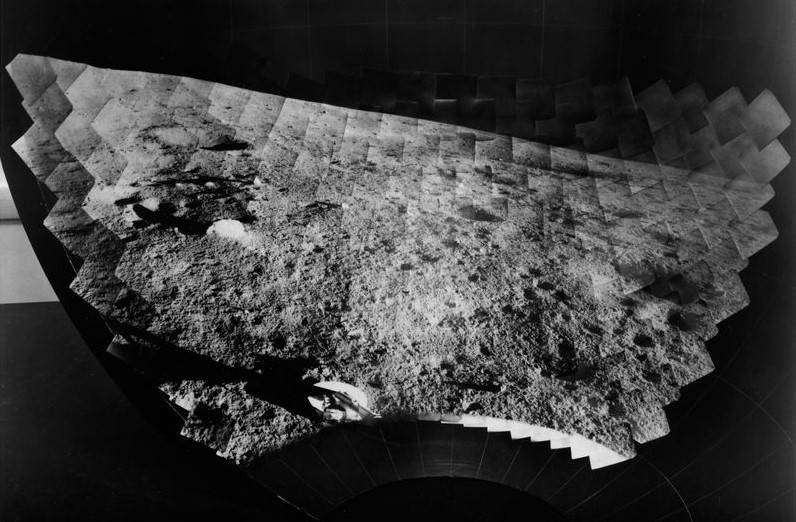
Composite of images taken by Surveyor 1 of its landing site in the Flamsteed P crater in the Moon’s Ocean of Storms.
In 2009, the Lunar Reconnaissance Orbiter spacecraft imaged the Surveyor 1 landing site at low Sun angles, the spacecraft’s shadow revealing its precise location.
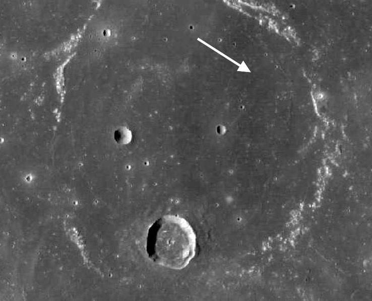
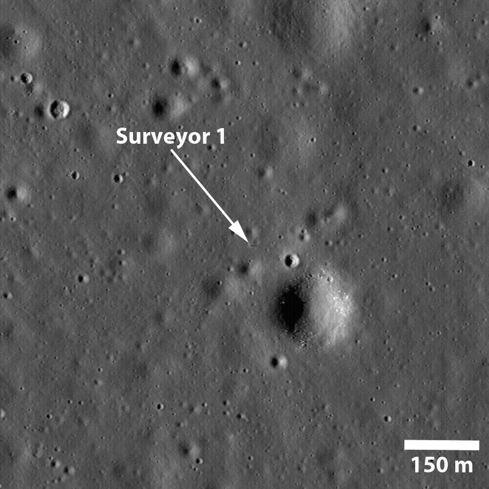
Left: Image taken by the Lunar Reconnaissance Orbiter (LRO) in 2009 of the Flamsteed P crater in the Ocean of Storms showing the location of the Surveyor 1 landing site. Right: Image taken in 2009 by LRO of Surveyor 1 and its shadow.

