Suggested Searches

Improving Firefighter Safety with STRATO - A hand holding a small rectangular screen showing a map with an area circled.
A fire burns in Fishlake National Forest, as part of the Fall 2023 FASMEE prescribed burn. Grace Weikert / Goddard
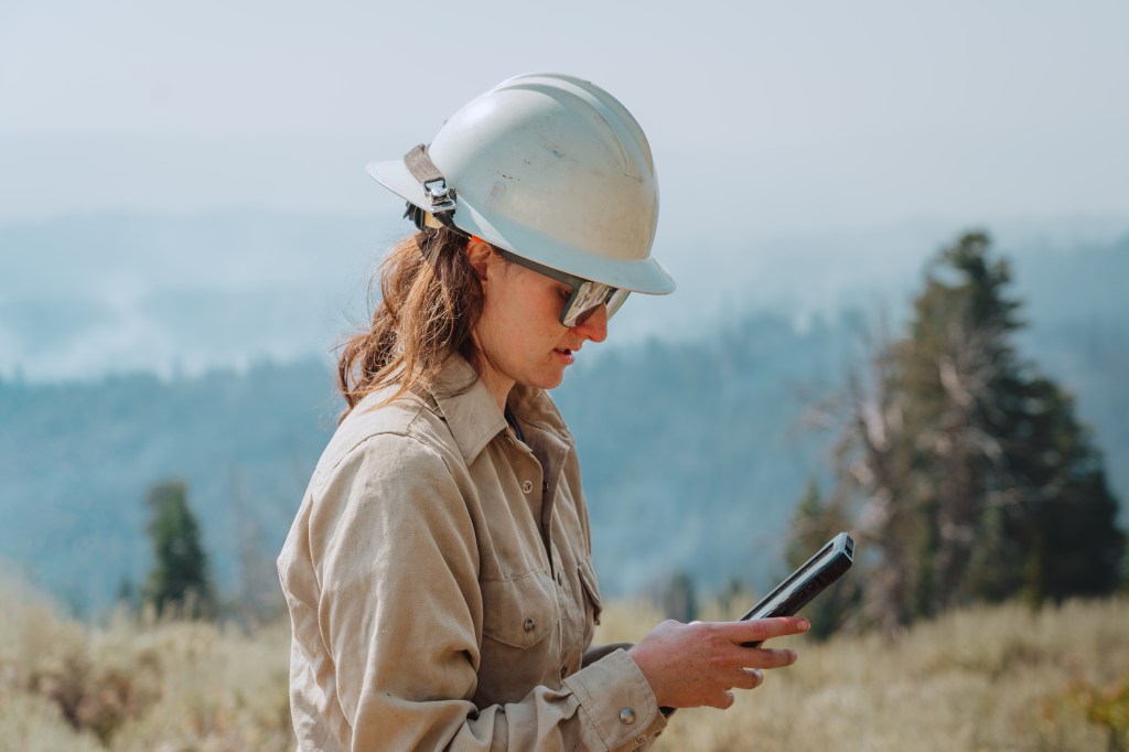
Closeup of firefighter looking at handheld device while walking in a grassy field. Smoke can be seen in the background. Improving Firefighter Safety with STRATO

Fire Science Missions & Projects at Ames

active projects

9

subject matter experts

6

NASA Ames poc

Jacquelyn Shuman

FireSense

The FireSense project is focused on delivering NASA’s unique Earth science and technological capabilities to operational agencies, striving to address challenges in US wildland fire management. The project concentrates on four use-cases to support decisions before, during, and after wildland fires. These include the measurement of pre-fire fuels conditions, active fire dynamics, post fire impacts and threats, as well as air quality forecasting, each co-developed with identified wildland fire management agency stakeholders.

Click here to learn more about FireSense about FireSense
Picture of dry landscape with a green tree on the left side, and down the middle an intersection showing the left side has yet to be burned and the right side is burning black

Strategic Tac Radio and Tac Overwatch (STRATO)

The Strategic Tac Radio and Tac Overwatch (STRATO) system is designed to provide real-time fire observations and last-mile communications with firefighters from stratospheric platforms. By providing persistent communications to a wildfire response team for a week or longer, STRATO is expected to offer capabilities beyond the currently used tethered balloons, which have a limited range and coverage area. By achieving station-keeping at altitudes up to 70,000 feet above ground level—to be demonstrated in flight testing—the STRATO will be able to provide communications to incident response teams in areas with no cellphone coverage.

Click here to learn more about STRATO about Strategic Tac Radio and Tac Overwatch (STRATO)
A group of roughly 20 firefighters walk in a line away from the camera, in yellow longsleeve shirts and white hard hats. There is brown shrubbery in the foreground, and the group is walking toward a copse of trees in the distance which is partially obscured by tan smoke, which also fills the sky.
Firefighters perform a firing operation on the Boulder fire in August 2024 while using STRATO-enabled TAK (Team Awareness Kit) devices to enhance situational awareness.
Colorado DFPC Center of Excellence for Advanced Technology Aerial Firefighting/Austin Buttlar
The focus areas of the surface biology and geology including: ecosystems, agriculture, coastal zones, and snow & ice
The Surface Biology and Geology (SBG) Directed Observables mission will map Earth with hyperspectral imager sensors at visible and short-wave infrared (VSWIR) wavelengths and at thermal infrared (TIR) wavelengths. The rich image datasets provided by SBG will allow us to study a diverse array of focus areas in unprecedented detail and monitor changes over time. Topics of interest include agriculture, coastal zones, snow and ice, and minerology.
NASA

Arctic Boreal Vulnerability Experiment (ABoVE)

Climate change in the Arctic and Boreal region is unfolding faster than anywhere else on Earth, resulting in reduced Arctic sea ice, thawing of permafrost soils, decomposition of long- frozen organic matter, widespread changes to lakes, rivers, coastlines, and alterations of ecosystem structure and function. NASA’s Terrestrial Ecology Program is conducting a major field campaign, the Arctic-Boreal Vulnerability Experiment (ABoVE), in Alaska and western Canada, from 2015 – 2025. ABoVE seeks a better understanding of the vulnerability and resilience of ecosystems and society to this changing environment.

Click here to learn more about ABoVE about Arctic Boreal Vulnerability Experiment (ABoVE)
ABoVE Vulnerability and Resilience Framework
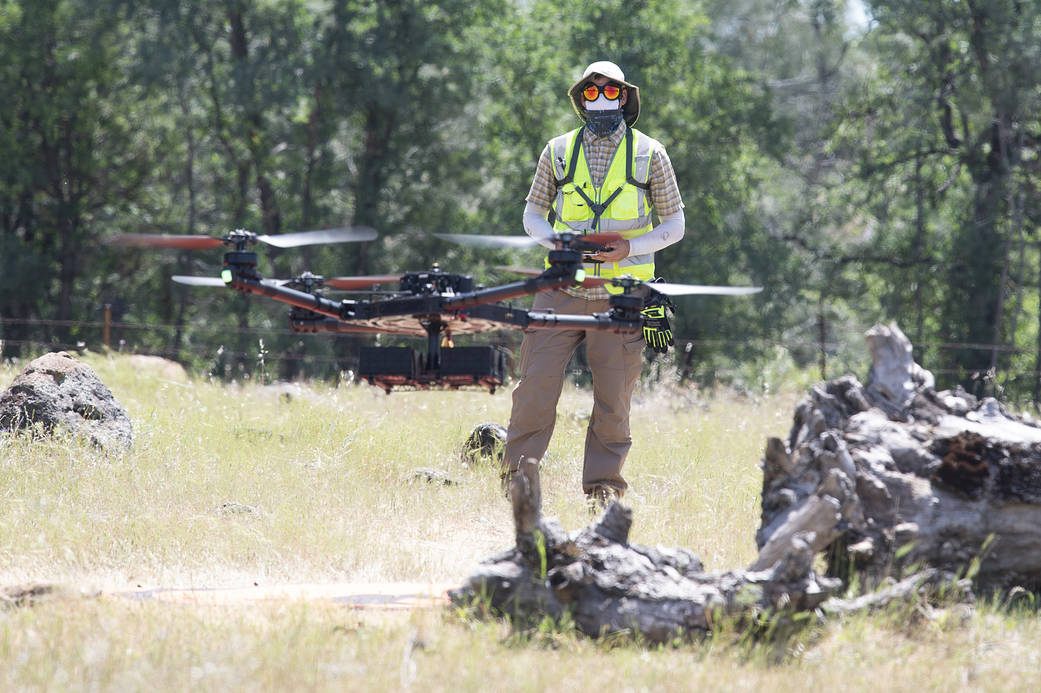
A drone flies in the foreground while a person wearing a hat, sunglasses, and yellow safety vest pilots the drone in the background, with a forest behind.
Helping make the battle against wildfires faster, safer, and more targeted, a NASA project recently tested its tools in a realistic wildland firefighting exercise. The Scalable Traffic Management for Emergency Response Operations project, or STEReO, aims to create a system that can be deployed during emergencies to coordinate multiple elements of disaster response. These may include aircraft, teams on the ground, and data collected from the air. Pictured here is NASA drone pilot Jonas Jonsson, flying an uncrewed aircraft during a flight demonstration in Redding, California, on May 5, 2021. STEReO’s partners at the California Department of Forestry and Fire Protection, or CAL FIRE, and the U.S. Forest Service flew wildfire-fighting aircraft in coordination with NASA drones like this one, using STEReO’s system to keep all parties informed of the ongoing operations.
NASA / Joel Kowsky

Embracing CSDA-Supported Spaceborne SAR Data in NASA FireSense Airborne Campaigns

This project aims to determine the capability of Umbra X-band Synthetic Aperture Radar (SAR) data to characterize rapidly changing fire landscapes during NASA’s FireSense airborne campaigns.

To learn more about FireSense, click here about Embracing CSDA-Supported Spaceborne SAR Data in NASA FireSense Airborne Campaigns
Image of psychedelic SAR
SAR (Synthetic aperture radar) Frequency

Opti-SAR

This artist’s concept depicts the NISAR satellite in orbit over central and Northern California.
This artist’s concept depicts the NISAR satellite in orbit over central and Northern California. Short for NASA-ISRO Synthetic Aperture Radar, NISAR is a joint mission of NASA and ISRO (Indian Space Research Organisation). Credit: NASA/JPL-Caltech

Opti-SAR is focused on accurate and timely mapping of forest structure and aboveground biomass (AGB) with integrated space-based optical and radar observations. This project will make a fundamental contribution to an integrated Earth System Observatory by using the mathematical foundation of RADAR-VSPI and VSPI to integrate SAR and optical data to achieve breakthroughs in forest monitoring and assessment.

Tropospheric Regional Atmospheric Composition and Emissions Reanalysis – 1 (TRACER-1)

TRACER-1 is a 20-year atmospheric composition re-analysis product that will enable researchers to answer questions about changes in wildfire emissions and the impact of extreme wildfire events on regional air quality. Active dates: 2005 – 2024

Click here to learn more about TRACER-1 about Tropospheric Regional Atmospheric Composition and Emissions Reanalysis – 1 (TRACER-1)
satellites over Earth
Illustration of the TRACERS satellites in space. TRACERS will fly through the Earth’s magnetic cusp to study magnetic interactions between Earth and the solar wind.
NASA

Cultural Burning

The Indigenous People’s Initiative partners with indigenous groups in the US and across the world, many of whom practice a long history of cultural burning.

Click here to learn more about Cultural Burning about Cultural Burning