NASA is partnering with the European Space Agency, the National Oceanic and Atmospheric Administration (NOAA) and the European Organisation for the Exploitation of Meteorological Satellites (EUMETSAT) to continue 28 years of ocean height measurements with the launch of a new Earth science satellite, Sentinel-6 Michael Freilich.
We have pulled together a variety of resources to enable educators to share information about this mission, the STEM-related careers of several of the scientists and engineers involved with this effort, as well as the science behind the mission. These resources have been aligned to Next Generation Science Standards (NGSS) to assist with curriculum planning.
Continuous observations from satellites and other sources show with increasing certainty that global sea level rise is accelerating. Ice sheet loss in Greenland and Antarctica is a major contributor to accelerating global sea level rise. NASA is studying this ice sheet loss, along with mountain glacier melt and ocean warming, to inform sea level rise projections and climate models.
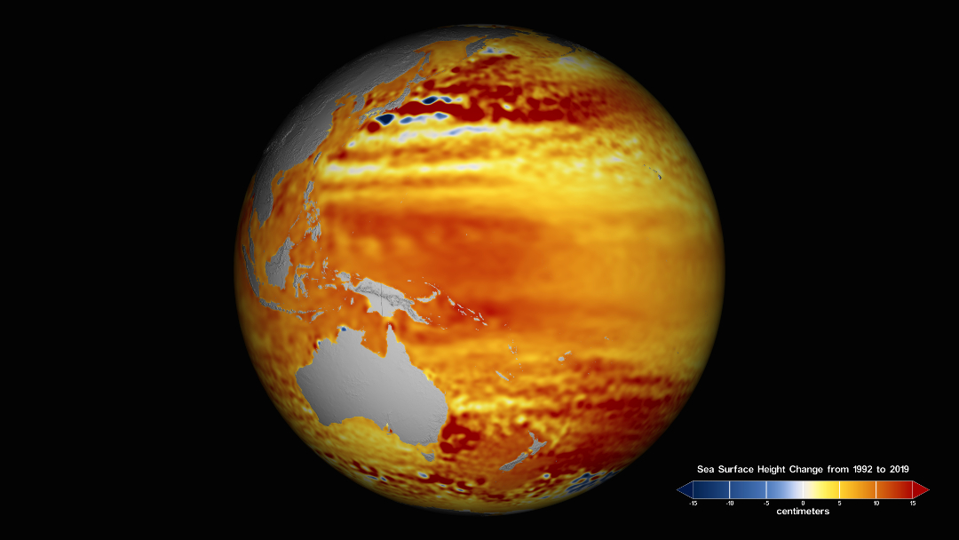
Sea level rise is beginning to creep up on the U.S. West Coast, while rising waters continue to transform life in regions including the southern and eastern coasts of the United States. Sea level rise looks different in different geographic regions, due to factors including the sinking and uplift of Earth, changes in land water storage, ocean currents and ocean-atmosphere climate variability. Rising sea levels cause nuisance flooding, worsen the impact of coastal flooding from storms, damage coastal habitat, and disrupt economies in the United States and around the world.
Kindergarten to 2nd Grade
3rd Grade to 5th Grade
6th Grade to 8th Grade
9th Grade to 12th Grade
By Dorian Janney
NASA’s Goddard Space Flight Center, Greenbelt, Md.

