


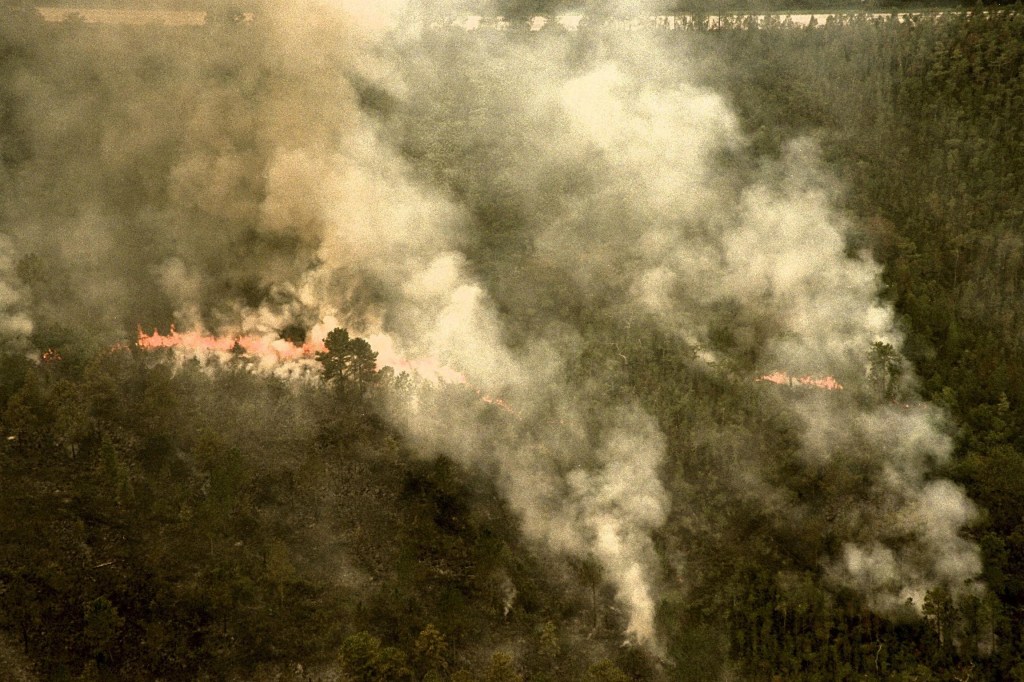


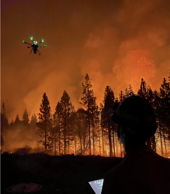
Armed with fire-retardant clothing, a helmet, headlamp, and flashlight, NASA’s Joey Mercer spent a night in August scrambling over rocks. He was in the woods of Northern California shadowing a team fighting the Dixie fire – the second-largest wildfire in the state’s history to date. In September, he and teammates made their way to three more California wildfire events, watching and learning as firefighters used small uncrewed aircraft to help battle blazes from above.
Mercer is the principal investigator for the Scalable Traffic Management for Emergency Response Operations, or STEReO, project at NASA’s Ames Research Center in California’s Silicon Valley. His team is designing software and communication tools to help disaster responders work more safely and efficiently. Part of their approach is to scale up the use of unmanned aircraft systems, or UAS, also called drones.
Drones are good for capturing thermal images of the landscape below, for example. The heat signatures obtained can help determine where firefighters should establish fire-containment lines, dug either by bulldozer or by hand. Mercer was in the forest that night to observe firefighting UAS operators in action.
“The smarter we are about their operations, the smarter capabilities we can create,” said Mercer. “They’re running operations at night. They don’t know what terrain they’ll encounter, or where they can launch their aircraft from. There are so many details about their working environment that are hard to capture in conversation or get lost in translation.”
On the Ground at California Wildfires
To help make their tools as useful as possible, Mercer and members of his team joined wildland firefighters in the very real-world setting of active wildfires.
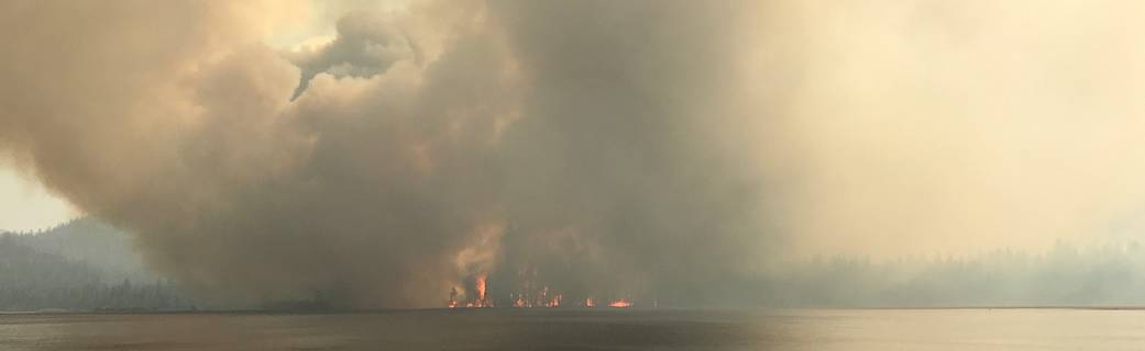
Between the Dixie, Caldor, McCash, and Windy fires, scattered across the state, but concentrated in Northern California, they shadowed drone pilots and incident personnel from three different agencies. They gleaned important, behind-the-scenes information from members of the California Department of Forestry and Fire Protection, or CAL FIRE, the U.S. Forest Service, and the National Park Service.
On the frontlines of the Dixie fire, a drone was sent to look for any traces of fire down a steep gully. The thermal data it collected helped decide whether crews could safely attempt to hold the fire there, or if they should work from the next ridgeline, even if it meant losing more acres to the flames.
Decisions like these were occurring all over the wildfire zone, under rapidly changing conditions.
“It really speaks to how critical information is in their decision making,” said Mercer, “and the timing of when that information becomes available to the various decision makers has a huge impact on the overall operation.”
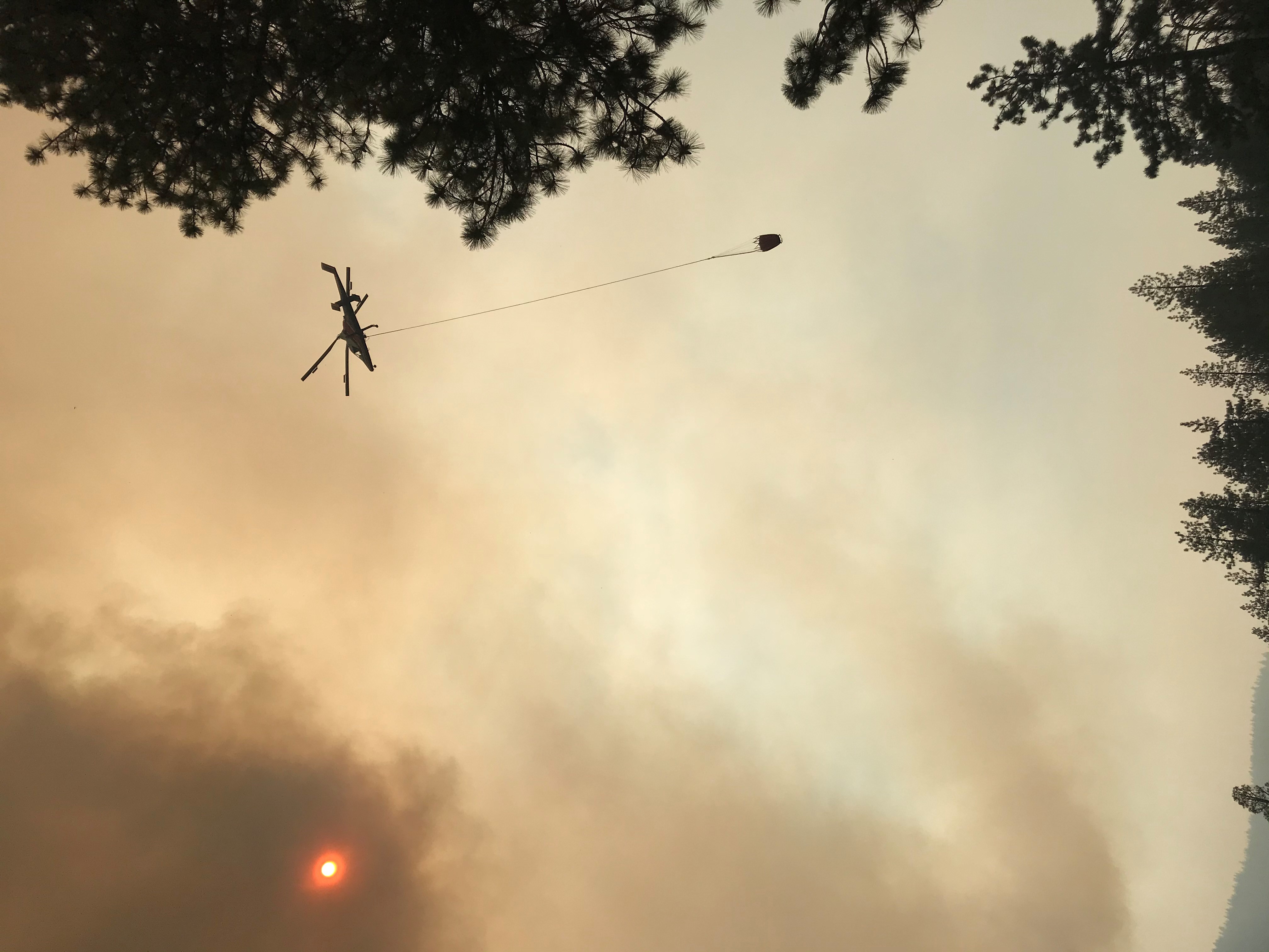
The location of nearby piloted aircraft is one example of essential information the STEReO team is working to provide to drone pilots. The challenge of tracking those aircraft is the focus of STEReO’s prototype tool kit for drone pilots.
At the McCash fire, the team deployed the pilot kit for the first time during an active incident. This was an important opportunity, both for the team to test their technology in a true operational setting, and for the firefighters to see it at work. That context easily and efficiently revealed how the tools could be improved in the next round with certain tweaks.
Mercer also experienced firsthand why their tools must be entirely portable, as he and his group pushed past stubborn tree branches to approach the edge of a canyon, searching for a spot to launch their drone. The STEReO team has been testing its portable internet that can provide local connectivity, even in remote settings. His experience at the fires showed how it needs to be packaged so even a firefighter hiking into the middle of nowhere can carry it.
Witnessing how much the drone pilots were juggling was informative for the NASA team. They observed pilots having to make fast decisions by following fire-tactics updates via radio, while also tracking their drones in flight. This told the designers of STEReO’s software capabilities – like those for tracking piloted aircraft above and teams on the ground – that audio notifications could be an important feature to add. UAS operators may not have the luxury of monitoring their airspace on a screen.
Drone pilots remain fairly rare at wildfire response operations, while the fire community works with partners like STEReO to find the safest, most efficient ways to take advantage of their unique contributions. As California’s fire season burns on, the NASA team will continue its observations in the field, learning from the firefighting experts how STEReO’s tools could help them most.
STEReO is led by Ames in collaboration with two other NASA centers: Langley Research Center in Hampton, Virginia, and Glenn Research Center in Cleveland, Ohio. STEReO’s partners range from federal agencies to city and state fire departments, utilities, and private companies. The work is a concept study under NASA’s Convergent Aeronautics Solutions initiative. The results of the CAS study, designed to determine STEReO’s feasibility, will be used to determine whether and how NASA will pursue further development.
For news media
Members of the news media interested in covering this topic should reach out to the NASA Ames newsroom.