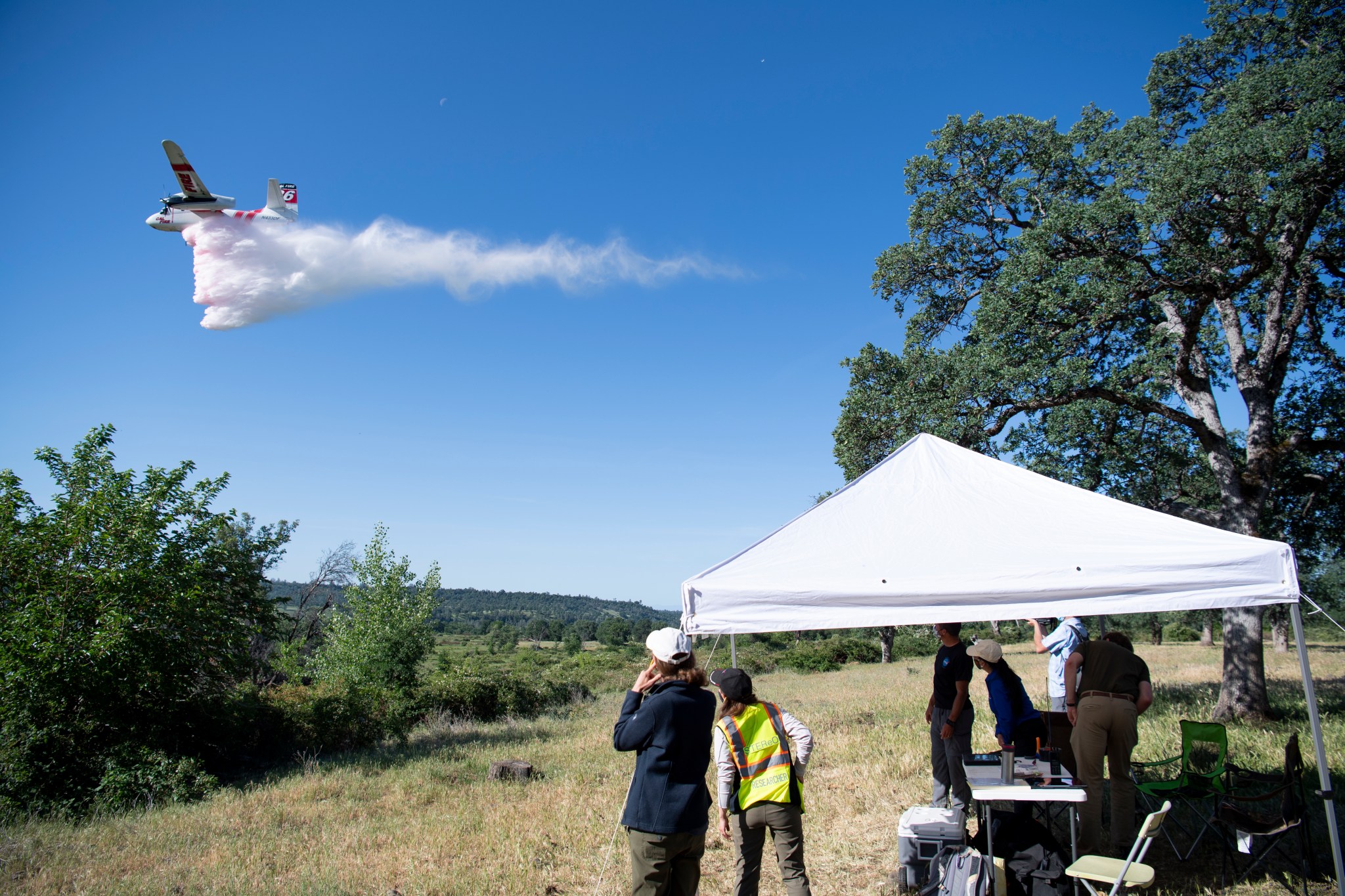
The fire wasn’t real that day in the rolling hills of Northern California, already turning crisp and brown at the beginning of May. But it offered the perfect opportunity for a group of NASA researchers to test the technology they’ve been building.
Their demonstration at a wildfire simulation outside Redding, California, showed how emergency responders of all kinds could work more safely and effectively using the prototype tools of NASA’s STEReO project – Scalable Traffic Management for Emergency Response Operations.
The faux fire, marked out with orange flags and smoke flares, was being used for aerial firefighting training by STEReO’s partners at the California Department of Forestry and Fire Protection, or CAL FIRE, and the U.S. Forest Service. The exercises focused on the role in wildfire response of an air traffic controller in the sky.
Circling above the scene, this person watches from the window of a plane. They visually track numerous aircraft and juggle their requests – over multiple radio frequencies – to fly near the fire or drop fire retardant, all while steering everyone clear of the firefighters on foot.
While the partners’ trainees were learning this demanding job, NASA’s STEReO team got to work testing tools that could one day assist them.
New Solutions Require New Coordination
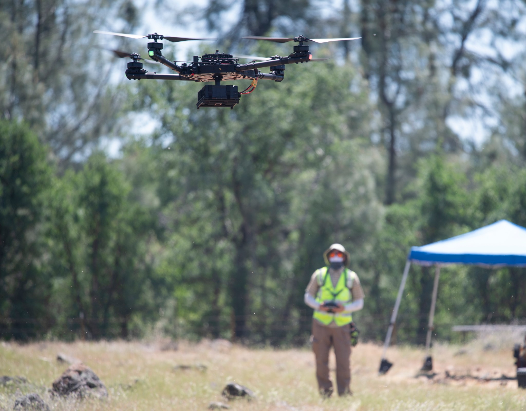
Wildland firefighting is no joke, and, today, critical decisions about dangerous situations rely in part on reports that come in from teams in the field. New technologies could help here: imagine, instead, drones sending real-time data from the perimeter of a forest fire to determine where crews will be most effective.
But that means even more moving parts to coordinate and, without the tools to do it, drones have largely had to stay on the sidelines of wildfire incidents when piloted aircraft are around.
“Planes and helicopters fighting fires have had limited awareness of the drones’ whereabouts,” said Joey Mercer, STEReO’s principal investigator at NASA’s Ames Research Center in California’s Silicon Valley, “but STEReO provides a way to see all operations responding to a disaster, in the air and on the ground.”
It also sends out alerts to signal potential issues, like a plane getting close to a drone. STEReO is building on the agency’s expertise in drone traffic management to develop these tools that let all elements of an emergency response stay in close contact and out of each other’s way.
The result is a system that can be deployed during and after emergencies, from fires to hurricanes, wherever they may be.
“STEReO is a portable system,” said Mercer, “and we’re developing a sort of ‘bring your own internet’ capability. That means the system works without high-speed internet access from the usual providers, which is likely to be lacking in a remote area struck by wildfire or a city following an earthquake or major storm.”
Firefighting in the Air, on the Ground, and on Screen
The project also created software tools that show in real time which operations are happening and where. Teams responding to a disaster can follow the action on their own screens, with a data display like a cell phone map in satellite mode. Moving icons show aircraft and humans at work, and the areas where drones will fly are marked.
From April 26 to May 7, 2021, the STEReO team got to see their tools in action in the most realistic setting yet: working alongside CAL FIRE and Forest Service firefighting teams in training.
In this part of Northern California’s countryside cell phones have only sketchy coverage, so STEReO’s portable internet would definitely be needed. The team arranged their communications equipment strategically and proved that the area of a fire, even in hilly terrain, could be blanketed with STEReO’s wifi coverage.
Above them, firefighting planes and helicopters flew in coordination with NASA drones. STEReO tracked them all, along with ground crews and some simulated aircraft for added complexity.
By the end of the demonstration, STEReO’s partners had seen how the technology could work for them in a real-world setting, and which tools would help them most when fires strike.
New Technology for a Growing Need
This work, which is led by Ames in collaboration with two other NASA centers – Langley Research Center in Hampton, Virginia, and Glenn Research Center in Cleveland – is a concept study under NASA’s Convergent Aeronautics Solutions project. The CAS activity is designed to determine STEReO’s feasibility, and the results will help determine whether to pursue further development.
Support from CAS is something like a start-up investment for technology exploration government research is well suited for.
“For STEReO, we built basically four or five individual ‘products’,” said Mercer. “We designed them based on input from our partners, and, after seeing how it all came together during the flight demonstration, they identified the products they needed most. This was a low-cost way of connecting technology still in development with their immediate needs – something NASA is particularly good at.”
As climate change impacts extreme weather events, there may be a growing need for tools like those STEReO is creating. The team will continue developing the system, aiming to let its partners test some of the tools independently next year.
By applying NASA technologies to responders’ most critical needs, STEReO’s creators hope to let them work together seamlessly, helping save property, homes, and lives.
For News Media
Members of the news media interested in covering this topic should reach out to the NASA Ames newsroom.


