By Jim Cawley
NASA’s Kennedy Space Center
Teams spanning multiple NASA centers and the Cape Canaveral Space Force Station (CCSFS) executed a flawless Artemis I weather simulation ahead of the first launch of the agency’s Space Launch System (SLS) rocket and the Orion spacecraft on a flight beyond the Moon targeted for early next year.
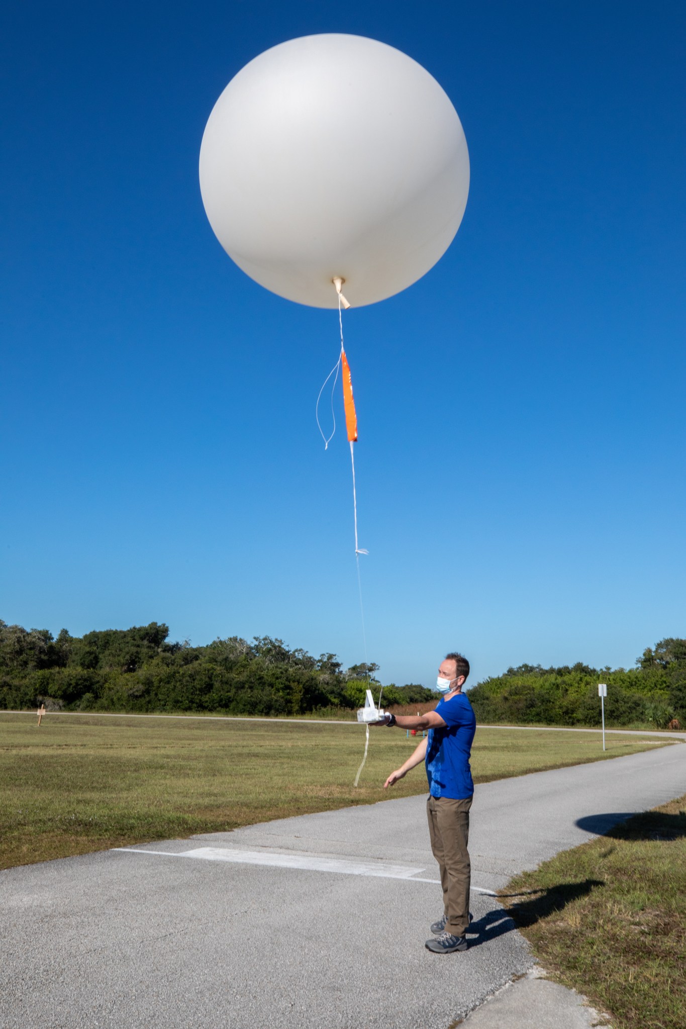
Civil servants and contractors from NASA’s Kennedy Space Center in Florida, Johnson Space Center in Texas, Marshall Space Flight Center in Alabama, and CCSFS effectively collaborated during a nine-hour simulation, analyzing and processing weather data just as they would during the Artemis I launch. They processed data through the use of two key instruments: the Tropospheric Doppler Radar Wind Profiler, located at Kennedy, and 14 weather balloons released at the CCSFS Weather Station.
DOLILU, a fun-sounding acronym for a critically important team, stands for “Day of Launch Initialization Load Update.” Based at Johnson, but also staffed at Marshall, the DOLILU team receives real-time weather data from the radar wind profiler at Kennedy and weather balloons released at CCSFS. The team uses the data to design vehicle steering commands, uploads the commands onto vehicle flight computers, and verifies that vehicle constraints remain within acceptable limits during the launch countdown. Data also is sent to Exploration Ground Systems personnel inside the Launch Control Center firing rooms at Kennedy.
“The team handled everything extremely well; they worked so well that it was flawless,” said Kennedy meteorologist Kristin Smith. “They have proven they have their checklist in place for when we get to the actual launch.”
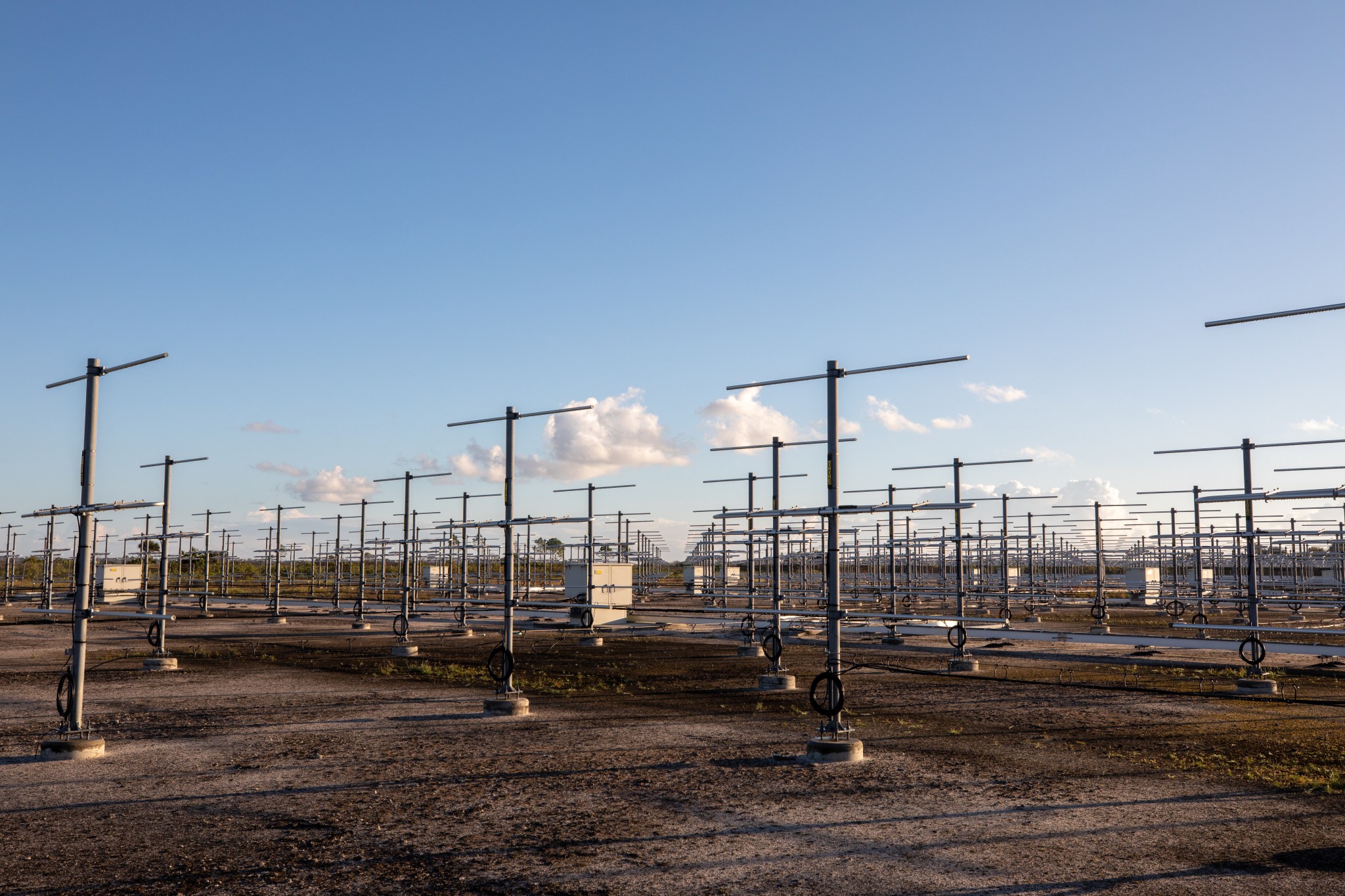
Located on five acres near the Launch and Landing Facility, the wind profiler will serve as the primary upper level wind instrument for NASA’s Artemis missions. Its 640 antennae deliver data – from 6,000 to 62,000 feet high – every five minutes. The instrument works by shooting radar beams into the sky, where it detects particles of dust, clouds, and moisture within turbulent eddies. It is in a fixed location near the launch pad, and the instrument’s radar aligns with the rocket’s flight path, providing more rapid and reliable wind measurements than traditional weather balloons.
Weather balloons deliver hourly data, which is used by meteorologists below 6,000 feet and above 62,000 feet – outside of the range of the wind profiler’s radar. Weather balloon data also can be used at all altitudes in the event of wind profiler data loss, though according to Kennedy Weather Officer Kathy Rice, that scenario is unlikely.
“The wind profiler is a big part of the team; it’s a very reliable system,” she said.
Teams faced a pre-scripted failure scenario during DOLILU processing where data from the primary wind source – radar wind profiler – was not available for use. The team utilized back-up readings from weather balloons and made successful adjustments within the launch timeline.
Andrew Spier, section manager, Eastern Range Weather Systems, oversaw the planning, coordination, and execution of the simulation at the CCSFS Weather Station, including weather balloon releases and quality control of the weather data. During the countdown, Spier’s team worked closely with the NASA team to ensure all data for launch requirements was received. He said the open communication among the teams was critical to the success of the event.
“Weather plays a critical role in any launch, and delivering that weather data accurately and on time is vital to mission success,” Spier said.
Artemis I will be the first test of the SLS and the Orion spacecraft as an integrated system prior to crewed flights to the Moon. NASA’s Artemis missions will land the first woman and first person of color on the lunar surface, establish a long-term presence at the Moon, and prepare for human missions to Mars.

