


Satellites continuously peer down from orbit to take measurements of Earth, and this week a group of scientists set sail to verify some of those data points.
On June 2, the SCOAPE (Satellite Coastal and Oceanic Atmospheric Pollution Experiment) research team, in partnership with the U.S. Interior Department’s Bureau of Ocean Energy Management, took to the seas in the Gulf of Mexico for its second campaign to make surface-based measurements of air pollutants.

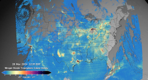
The primary pollutant scientists are measuring is nitrogen dioxide (NO2), the compound that reacts with sunlight to make ground-level ozone, said Anne Thompson, senior scientist emeritus for atmospheric chemistry at NASA’s Goddard Space Flight Center in Greenbelt, Maryland, and senior researcher at the University of Maryland, Baltimore County.
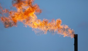
The Gulf of Mexico is highly concentrated with oil and natural gas drilling platforms, which are sources of NO2. By taking measurements of these emissions from the sea surface nearby, scientists can help validate measurements taken from a much different vantage point. The research vessel the scientists are using, Point Sur, is owned by the University of Southern Mississippi and operated by the Louisiana Universities Marine Consortium.

“We’re the eyes on the surface to understand how well the eyes in the sky are working,” said Ryan Stauffer, research scientist for the atmospheric chemistry and dynamics laboratory at Goddard. Stauffer is also the principal investigator for the SCOAPE II project.
For the first iteration of the project in 2019, ship-based measurements were compared to data gathered by the Ozone Monitoring Instrument aboard NASA’s Aura satellite and the Tropospheric Monitoring Instrument aboard ESA’s (European Space Agency) Sentinel-5 Precursor satellite. Both instruments fly on polar orbiting satellites, which pass over every part of the globe once per day. They capture snapshots at the same time each day, but cannot capture the short-lived NO2 emissions that come and go at different times.
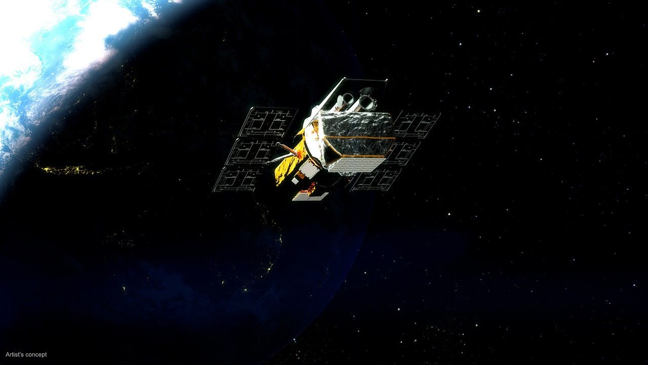
In 2024, the research team is working to validate the measurements taken by TEMPO (the Tropospheric Emissions: Monitoring of Pollution instrument), which was launched on a commercial satellite in April 2023. The TEMPO instrument provides a different perspective to the NO2 measurements due to its geostationary orbit — it focuses solely on North America and has a constant view of the Gulf of Mexico region. This allows scientists to better quantify emissions and make comparisons across all daylight hours.
From space, satellites collect measurements of the “total column” of air, which means they measure the concentrations of NO2 from the land or ocean surface all the way up to the top of the atmosphere. With SCOAPE, scientists are taking measurements from the ship, about 33 feet above sea level, to focus measurements on the air that people breathe.

Learning more about how those surface measurements compare to what satellites see in the total column can help scientists figure out how to use satellite data most effectively. Measuring NO2 from space over the past two decades has helped scientists understand how the compound affects air quality, and has helped to inform policies to reduce emissions of the pollutant.
During SCOAPE’s 2019 campaign, researchers detected concentrations of methane – a significant greenhouse gas – near the Gulf Coast. This time around, the scientists are looking to accurately measure these concentrations from the surface as well. They will mount the NASA Airborne Visible and InfraRed Imaging Spectrometer–3 imaging spectrometer instrument on a Dynamic Aviation B-200 plane to collect methane measurements above the Gulf, which will add an extra layer to understanding emissions of this potent greenhouse gas from Gulf of Mexico oil and gas operations.
It has historically been difficult to measure methane from space, but scientists are working to build those capabilities. As with NO2, taking surface measurements helps scientists better understand the measurements taken from space.
NASA’s Goddard Space Flight Center, Greenbelt, Md.