


Marshall Space Flight Center
Science Achievements 2024
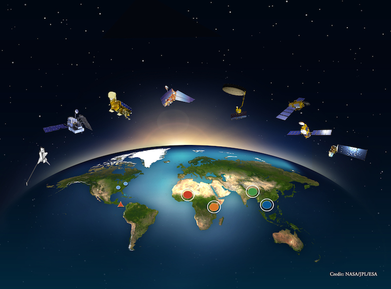
Earth Science
NASA Short-term Prediction and Transition (SPoRT) and Disasters Teams Deliver Critical Insights with Satellite and Ground-Based Data to Support Communities
NASA’s Short-term Prediction Research and Transition (SPoRT) and Disasters teams provided essential insights using both satellite and ground-based data to assist communities during this intense 2024 hurricane season. These contributions helped improve disaster response and decision-making in the face of major weather events. Read more on the SPoRT blog.

NOAA/NASA Geostationary Operational Environmental Satellites-R Series (GOES-R) Fuel Weather and Disaster Response Research
The National Oceanic and Atmospheric Administration (NOAA)/NASA Geostationary Operational Environmental Satellites-R Series (GOES-R) Receiving Station at NASA’s Marshall Space Flight Center plays a critical role in advancing weather forecasting, disaster response, and space weather research. This state-of-the-art facility supports the development of tools like DustTracker, which enhances air quality monitoring capabilities, and Lightning-AI, which provides improved insights for lightning safety. For more information, read the full blog post.

Short-term Prediction Research and Transition (SPoRT) Center Lightning Safety Products Now Available on NASA SAFE App
Chris Schultz and Kelley Murphy with the NASA Short-term Prediction Research and Transition (SPoRT) Center, Kris White of the National Weather Service (NWS) Huntsville, Christina Dortier of Marshall Space Flight Center’s Emergency Operations Center, and Linda Spurlock of Johnson Space Center’s Emergency Management Team have recently incorporated a prototype link and content within the NASA SAFE App. This will allow all NASA employees at Johnson and Marshall to have direct access to lightning data and lightning safety products through the NASA SAFE App. During this prototype phase, the team will work on adding lightning safety content, product training for the public, and design the app to make it as user-friendly as possible for the workforce. After the evaluation period ends in March, the plan is to roll the content out to the remaining centers by late Spring, so all the NASA workforce has access to this valuable lightning data and safety information for their personal use and daily availability.

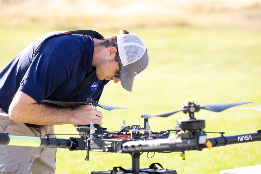
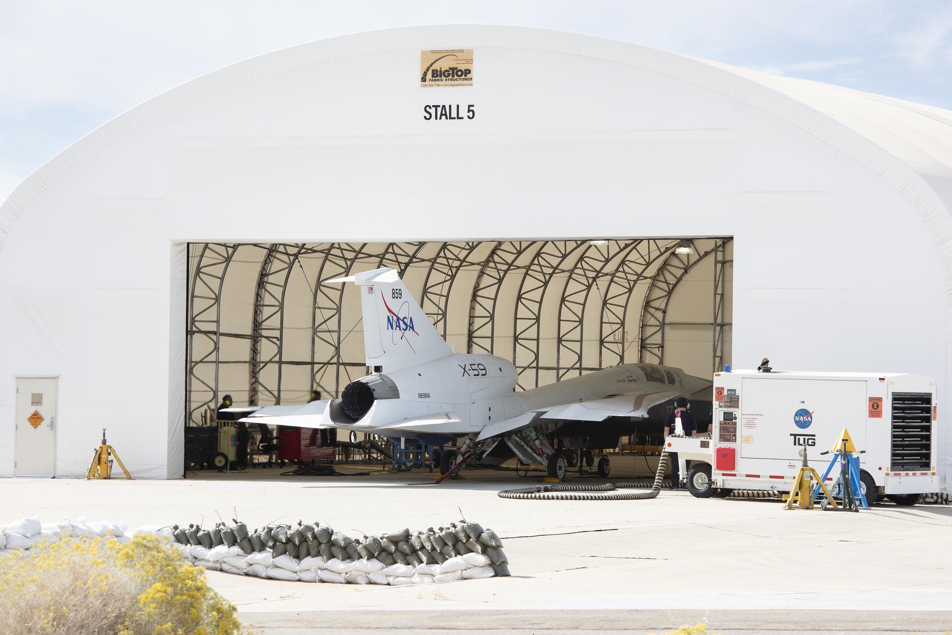
WH2yMSIE Field Campaign Completes Operations
After four weeks of operations, the Westcoast and Heartland Hyperspectral Microwave Sensor Intensive Experiment (WH2yMSIE) has concluded. Marshall Space Flight Center provided the Advanced Microwave Precipitation Radiometer (AMPR) to the suborbital campaign, which was based out of Armstrong Flight Research Center (AFRC) and assisted with mission science. Timothy Lang, AMPR principal investigator, and Corey Amiot, NASA postdoctoral fellow, from Marshall’s Earth Science Branch were deployed with additional support in the field from University of Alabama in Huntsville (UAH) employees Scott Podgorny, David Corredor, and Jonathan Hicks. Doug Huie from H&H Engineering also deployed to support AMPR, and Matt Wingo fom UAH managed AMPR logistics.
AMPR successfully gathered more than 60 hours of data over 10 flights on the NASA ER-2 high-altitude remote-sensing aircraft. WH2yMSIE will advance the NASA Decadal Survey Incubator priority of understanding how best to make remotely sensed thermodynamic measurements of the planetary boundary layer (PBL). With its low microwave frequencies, AMPR contributes to this goal by characterizing surface emissivity and being sensitive to the presence of clouds and precipitation, all of which can help improve PBL retrievals when using a multi-sensor data fusion approach.

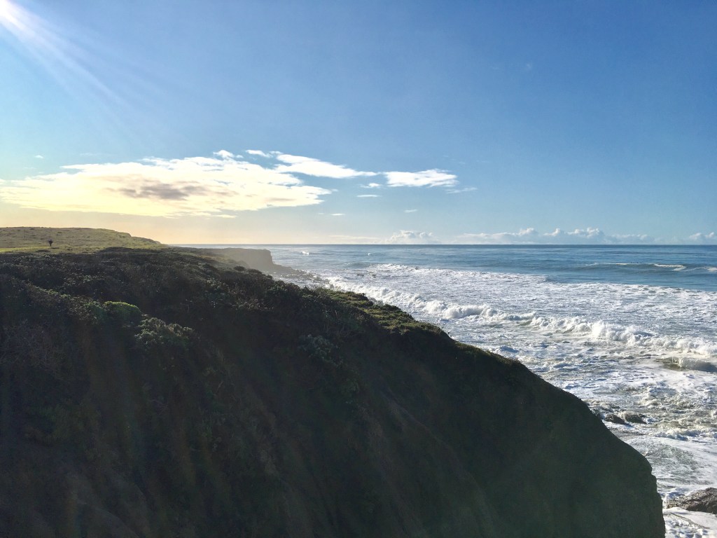
The Visualization, Exploration, and Data analysis (VEDA) Project Supports the Release of the Global Sea-level Change Portal
The Global Sea Level Change Portal was publicly released and announced at the United Nations Climate Change Conference of Parties (COP29). The site, hosted by NASA’s Interagency Implementation and Advanced Concepts Team (IMPACT), allows users to explore the effects of sea level change on their specific counties and how coastlines will be altered in the future. The team at NASA IMPACT collaborated with the Jet Propulsion Lab (JPL) to develop and deploy the Visualization, Exploration, and Data Analysis (VEDA) cloud infrastructure required to make the site available on earth.gov.
Advanced Information Systems Technology (AIST) Water Cycle Digital Twin Proposal Selected for Funding
A proposal to build a digital twin of the land surface water cycle has been selected for funding with a start in March 2025. This is a large, multi-institution effort led from NASA Goddard Space Flight Center (GSFC) and includes water cycle subject matter expertise from Marshall Space Flight Center (MSFC), including Brent Roberts and Chris Hain from the Earth Science Branch. NASA provides observations of precipitation, evapotranspiration, terrestrial water storage change, and now, with the advent of the NASA Surface Water and Ocean Topography (SWOT) mission, discharge. The water budget research community is now able to take advantage of a complete suite of observations to investigate land surface water budget closure. The work selected for funding will bring observation-based projections of these water budget components together in a digital twin for the purpose of visualizing the community’s progress toward balancing the terrestrial water budget. This web-based terrestrial water budget digital twin will facilitate water budget analyses, broaden the research community, and extend its relevance to water basin managers and the public.
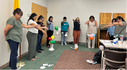
SERVIR Supports Air Quality Management Training in Guatemala
From Nov. 19-22, 2024, representatives of the SERVIR Science Coordination Office and the new SERVIR Central America hub at the Tropical Agricultural Research and Higher Education Center (CATIE, in Spanish) supported an air quality management training in Guatemala. The training was held at the Universidad del Valle de Guatemala and had roughly 20 participants from the government of Guatemala, as well as academia. It focused on using satellite and in situ measurements for monitoring and forecasting air quality. The training was organized at the request of Guatemala’s Ministry of the Environment and Natural Resources (MARN, in Spanish), which recently acquired air quality monitoring instruments. The SERVIR Science Coordination Office’s Air Quality & Health Thematic Lead Alqamah Sayeed was the principal trainer; he was supported by Betzy Hernandez Sandoval, the outgoing regional science coordination lead for Central America, and Diego Gil Agudelo, the Americas continental coordinator. Also in attendance were Alejandro Solis, the SERVIR Central America hub’s Chief of Party, User Engagement Lead Jorge Cabrera, and Capacity Building Lead Andrea Zamora, all from CATIE. In addition to the air quality training, the SERVIR representatives also organized a consultation and needs assessment meeting focused on forest monitoring, in conjunction with representatives of the US SilvaCarbon program.
Commercial SmallSat Data Acquisition Program Publishes GeoOptics and Capella Space Data to the SmallSat Data Explorer
Science data from GeoOptics’s Global Navigation Satellite System (GNSS) and Capella Space’s Synthetic Aperture Radar are now available for download by authorized users through the Commercial SmallSat Data Acquisition Program’a (CSDA) SmallSat Data Explorer (SDX).
The CSDA program data management team led by Marshall Space Flight Center’s Dr. Aaron Kaulfus and Helen Parache released this data on Oct. 22, 2024. GeoOptics and Capella Space participated in the third onramp of commercial data vendors into the CSDA program. The data available have been acquired during the yearlong CSDA evaluation. Full evaluation reports will be posted to the CSDA website.
Flood Preparedness in Texas with SPoRT’s Streamflow-AI Tool
The Streamflow-AI tool, designed to forecast river flooding beyond 48 hours, has advanced flood prediction capabilities. Developed in collaboration with the National Weather Service (NWS), Streamflow-AI aids in disaster preparedness by providing accurate three to seven-day stream height predictions. During a heavy rainfall event in May 2024, Streamflow-AI enabled effective emergency responses in south Texas, such as timely road closures and evacuation advisories, thus minimizing damage and disruption. Read more on the SPoRT blog.
NASA SPoRT Geostationary Lightning Mapper Stoplight Product Considered “Go-To” Product by National Weather Service Office
The work of the Short-term Prediction Research and Transition Center’s (SPoRT’s) Dr. Christopher Schultz, Michael Antia, Roger Allen, Kristopher White, and Kelley Murphy to develop and display the Geostationary Lightning Mapper (GLM) Stoplight Product has helped the National Weather Service (NWS) support safety at various events. Most recently, forecasters at the NWS office in Milwaukee, Wisconsin referred to the Stoplight Product as one of their “go-tos” for increasing awareness and providing event decision makers with the likelihood that lightning will impact their event. One forecaster spoke on how the stoplight product aided him during his weather briefings while he was on-site providing weather support for the U.S. Secret Service at the Republican National Convention in Milwaukee.
NASA’s SERVIR Science Coordination Office Launches Farm Action Toolkit Service in Bhutan
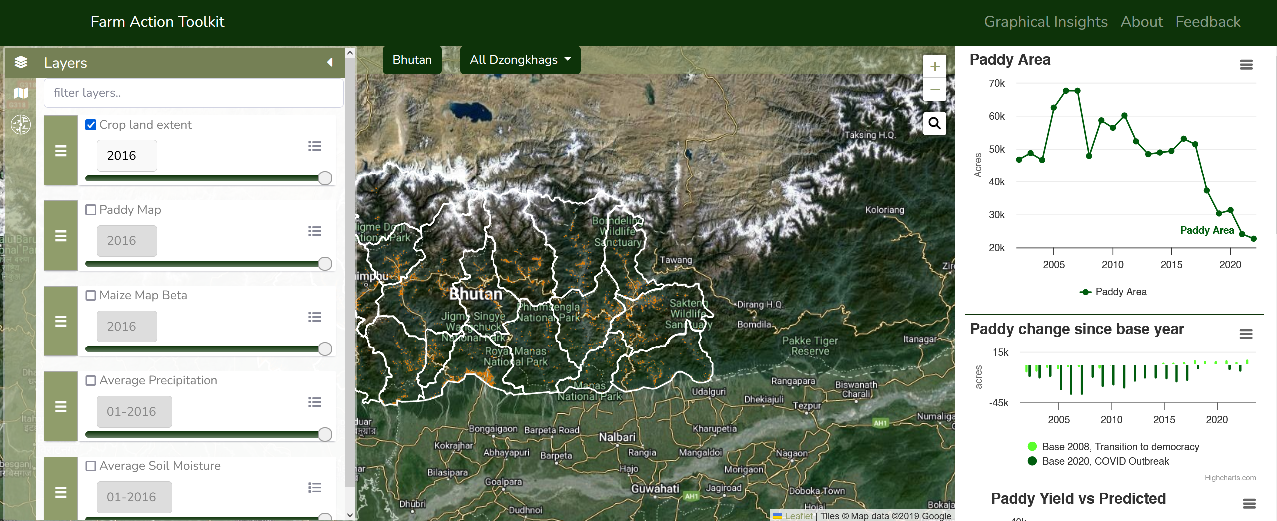
Dr. Aparna Phalke, Sarah Cox, and Tony Kim traveled to Thimphu, Bhutan, to represent the SERVIR Science Coordination Office (SCO) at the official launch of the Farm Action Toolkit service on May 17, 2024. The Farm Action Toolkit was co-developed by SERVIR and Bhutan’s implementing partners to support their mission to obtain food self-sufficiency and save operational costs. This service provides 30-meter scale cropland, paddy, and maize area maps and paddy yield estimations covering mountainous and marginal farmlands across Bhutan from 2002 to 2023.
Kim, Phalke, and Cox conducted in-person outreach events at the Royal Thimphu College and Royal University of Bhutan’s (RUB) College of Natural Resources on May 14 and May 24, respectively. Over 100 students from each academic institution participated in the outreach events, which focused on how to leverage Earth observations to address immediate environmental issues in Bhutan.
Following the launch, a SERVIR SCO service team led by Phalke and Bhutan’s partner team from Druk Holding and Investments Limited (DHI) performed surveys of agricultural fields across the Thimphu, Punakha, and Paro areas of Bhutan using GPS, helmet data collection with GoPro cameras and drones. The team interviewed individual farmers from rice cultivation areas with pest, disease, and water related issues. They also collected market analysis data from over 50 vendors and interviewed farmers on agricultural commodities and the supply chain. These field surveys will play a significant role in the operation and adoption of the Farm Action Toolkit service.
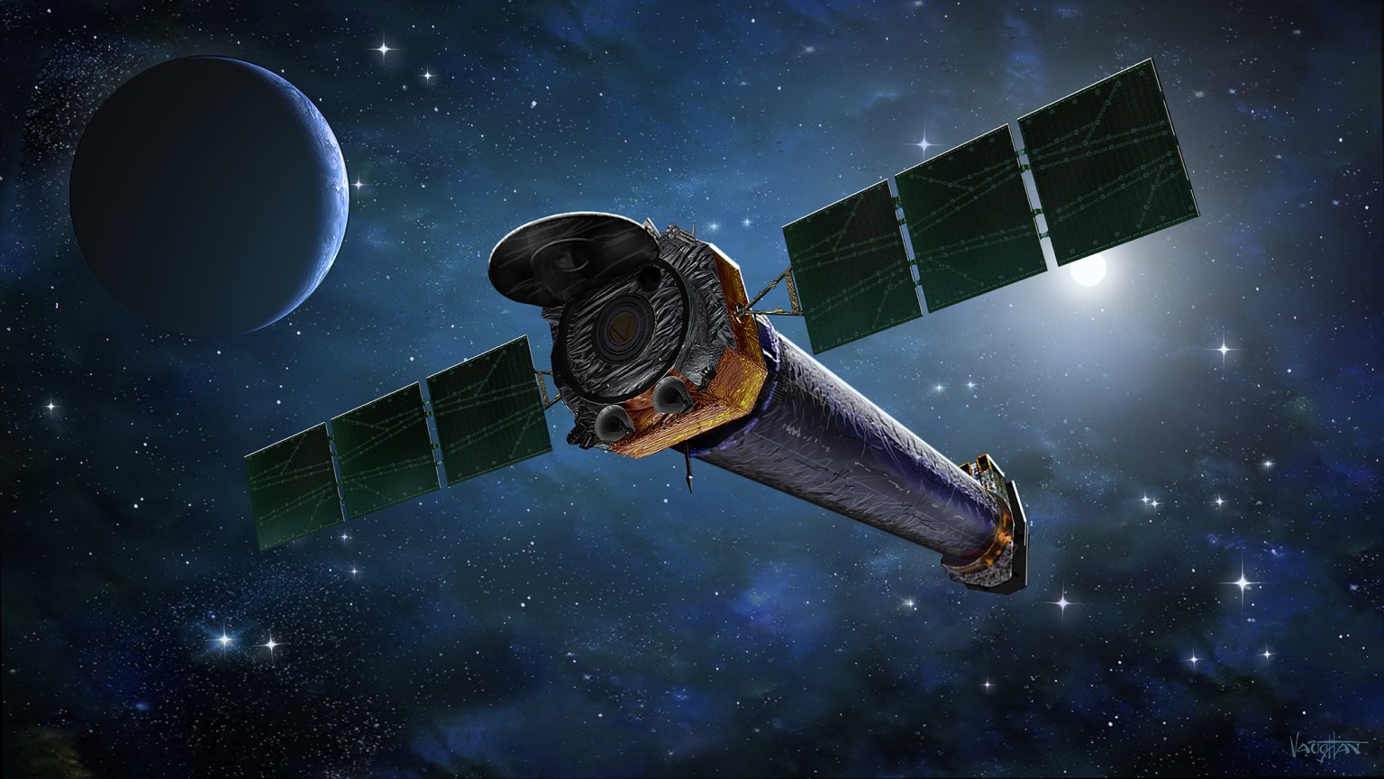
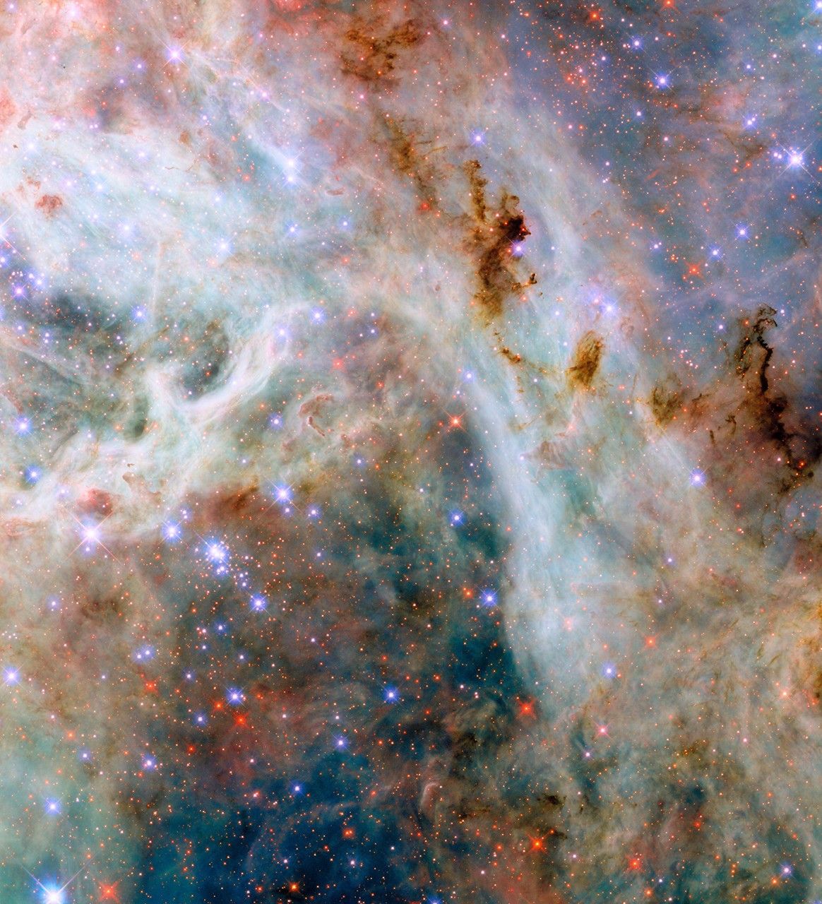
Astrophysics
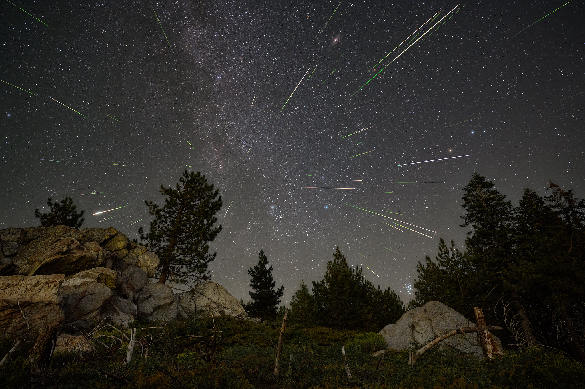
Imaging X-ray Polarimetry Explorer (IXPE): Ph.D Thesis Award
Jakub Podgorny, a member of the Imaging X-ray Polarimetry Explorer (IXPE) Science Team, recently received the National Prize for Ph.D. Theses in Natural Sciences in the Czech Republic. Podgorny’s Ph.D. research focused on X-ray polarization simulations and IXPE observations for stellar and supermassive black holes.