Fifty years ago, on April 22, 1970, people around the globe marked the first Earth Day. On this Earth Day, as we physically separate ourselves by necessity, we can still collectively appreciate the wondrous beauty of our planet and the extraordinary science that helps us understand how it all works – and we can do it from our homes.
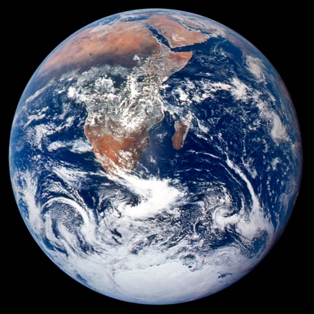
This classic photograph of the Earth was taken on Dec. 7, 1972, by the crew of Apollo 17. The original caption is reprinted below:
View of the Earth as seen by the Apollo 17 crew traveling toward the moon. This translunar coast photograph extends from the Mediterranean Sea area to the Antarctica south polar ice cap. This is the first time the Apollo trajectory made it possible to photograph the south polar ice cap. Note the heavy cloud cover in the Southern Hemisphere. Almost the entire coastline of Africa is clearly visible. The Arabian Peninsula can be seen at the northeastern edge of Africa. The large island off the coast of Africa is the Malagasy Republic. The Asian mainland is on the horizon toward the northeast.
Astronaut photograph AS17-148-22727 from NASA Johnson Space Center Gateway to Astronaut Photography of Earth
Our astronauts still make observations of Earth from space. Learn more: The Combined Power of Remote Earth Observations aboard the International Space Station.
Follow along this week as we celebrate #EarthDayAtHome with NASA.
Image Credit: NASA


