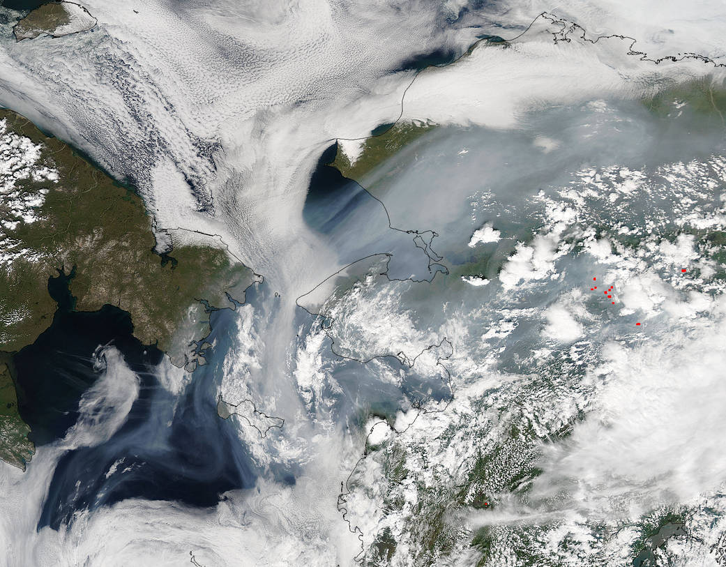
Fires have raged throughout Alaska in 2015. The Moderate Resolution Imaging Spectroradiometer (MODIS) on NASA’s Aqua satellite acquired this image on July 14, 2015. Actively burning areas, detected by the thermal bands on MODIS, are outlined in red.
According to the most recent update (July 16, 2015) from the Alaska Interagency Coordination Center, about 304 fires were actively burning when MODIS imaged the area. To date, fires have charred a total of 4,854,924 acres in Alaska. The worst fire season in Alaska’s history was in 2004. At this point in time, 2015 is a month ahead of the totals in 2004 putting it on track surpass the fire totals in 2004. The amount of acreage burned in Alaska during June 2015 shattered the previous acreage record set in June 2004 by more than 700,000 acres delivering a sobering piece of news for Alaskan residents.
NASA images by Jeff Schmaltz, LANCE/EOSDIS Rapid Response. Caption by Lynn Jenner

