Transcript
(sound FX: wind, snowmobiles)
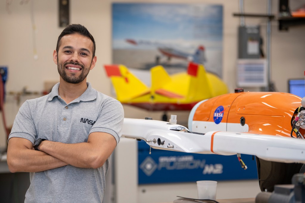
[0:04] Narrator:For the past several years, a team of NASA scientists has been trekking to the farthest reaches north and south on a unique mission. A video, made in 2015 about one such trip, features JPL technologist Dan Berisford.
Dan Berisford:Here we’re just taking an expedition out to a northern Arctic lake, up near the northernmost point in Alaska. So we’re driving on snow machines, out to take our robot underneath the ice.
Narrator: “A robot under ice” may sound like a futuristic cocktail, but it’s actually part of a goal to explore icy worlds like Jupiter’s moon Europa and Saturn’s moon Enceladus. Those moons are frozen at the surface, but underneath a top layer of thick ice they may have vast oceans. NASA wants to explore them with robotic rovers, and Earth’s ice-covered ocean regions provide an ideal testbed.
Instead of driving along the top of an ice sheet, the rover drives below it, upside-down.
[1:03] Dan Berisford: We thought, ‘Oh, we’ll just invert the surface. Instead of a rover that drives on the ground, we’ll have a rover the drives on the ceiling.’ And, ‘What are we gonna do to do that? We just make it buoyant.’ So, it floats and essentially drives on the ceiling, which is the ice surface.
(sound FX: rover digging into ice)
Narrator: The Buoyant Rover for Under-Ice Exploration, or BRUIE, is three feet, or one meter long, and has two wheels with spiky teeth that help it grip the underside of the ice. BRUIE is designed to operate independently for months.
That’s important, because the icy moons are so far away, communication with the rover would take a long time. A signal sent to the moon Europa would take 45 minutes to get there, and it would take more than an hour for a signal to reach the moon Enceladus. You’d need to hear back from the rover before you tried anything new, so you’d have to wait another hour or so to receive the rover’s status report. To speed things up, you’d want to send the rover a bunch of commands all at once, rather than direct the rover on every step of its journey.
(music)
[2:11] Narrator: The quest to explore the icy moons of our solar system is reminiscent of the race to the North and South Poles in the early 1900s.
We still thrill to the tales of Ernest Shackelton, Roald Amundsen, Robert Scott, and other polar explorers who competed to be the first to plant their flags at the very top and bottom of our planet. At the time, those areas of the globe were largely unmapped, big white blanks that promised suffering and endless danger to any who dared venture there. Communication with the outside world took months, relying on letters sent on infrequent ships.
(sound FX: wind)
The once mysterious poles don’t seem as remote now as they were a hundred years ago, thanks to satellites that relay messages and take images of the entire planet. But despite advances in technology, traveling there is still far from easy. Many of the hardships endured by those original explorers are just as forbidding today – unforgiving weather can strand you for days at a time; you have to chip away at ice and melt it over a stove to have drinkable water; faces and fingers become frost-bitten, muscles grow painfully stiff in the frigid temperatures.
[3:25]Yet still, many feel drawn to the polar regions. There’s a romance in their pristine beauty, their stillness and silence, their isolation from our connected, bustling world. For some, there’s no better place on Earth – especially if you get to play with robots.
Dan Berisford:Sub-zero temperatures, Arctic ice, biting winds, polar bears and robots. God, I love this job.
(intro music montage)
[4:28] Narrator: Welcome to “On a Mission,” a podcast of NASA’s Jet Propulsion Laboratory. I’m Leslie Mullen, and in this third season we’re traveling to the ends of the Earth with scientists who explore our planet. This is episode five: Frozen in Time.
Ice Age movie:
Dab: Prepare for the Ice Age!Sid: Ice Age?Dab: Sub-Arctic temperatures will force us underground for a million billion years!
Narrator: The “Ice Age” movies depict a time dominated by ice and snow, when large ice sheets covered entire continents and woolly mammoths roamed the frozen landscape. But did you know that we’re still in that Ice Age today?
(music)
[5:06] We live in the Quaternary Period, which geologists refer to as an Ice Age because it’s cold enough to support thick ice sheets that cover at least 20,000 square miles of land, or 52,000 square kilometers. There have been at least five Ice Ages in the history of our planet, some much colder and longer-lasting than others.
At other times in the past, our planet has been a hothouse, with average temperatures too warm to foster continental ice sheets. The dinosaurs, for instance, lived in this more tropical kind of world 100 million years ago.
We humans evolved during this most recent Ice Age — it’s all we’ve ever known. But even within our Ice Age, the temperatures have varied greatly. The coldest spells, known as glacial intervals, are what most of us think an Ice Age is like. The last glacial interval reached its coldest point twenty thousand years ago, when much of North America, Northern Europe, and Southern South America were covered by an ice sheet – about a quarter of the planet.
[6:16] In milder times, so-called “interglacials,” ice sheets are not as widespread. We’ve been enjoying an interglacial interval for over ten thousand years, and the only ice sheets left are in Antarctica and Greenland.
Our Ice Age began about 2.6 million years ago, during which we’ve bounced back and forth about 25 times between colder glacial and warmer interglacial intervals.
One reason Earth blows hot and cold is because the surface keeps shifting. The tectonic plates that float on our planet’s hot mantle cause the continents to drift over millions of years, and this slow creeping of the land can eventually end up blocking water routes. Our ocean has a big effect on the climate, so arresting ocean circulation patterns can lead to drastic worldwide changes.
[7:11] Tectonic plates also affect the atmosphere when they trigger volcanic eruptions, which send carbon dioxide and other heat-trapping gases and particles skyward. And, less obviously, after collisions between tectonic plates raise up mountains, the newly exposed rocks interact with the air and alter its composition.
It’s not just Earth’s surface that shifts. Our planet doesn’t circle the Sun so much as dance around it, slightly wobbling and swaying over many thousands of years as it’s tugged by the gravity of the Sun, Moon, and giant planets like Jupiter and Saturn. Those shimmies of Earth’s place in space alter how the Sun’s light illuminates and warms us.
There are a lot of other factors that have led us into or out of an Ice Age, and cause climate variations within an Ice Age. Figuring out exactly why our world freezes and then thaws, over and over again, is an area of active research. The warming and cooling of our planet does seem to happen in somewhat predictable cycles, reminiscent of the change of seasons, a kind of universal summer and winter, except instead of happening every year, these transitions usually take place over millennia.
[8:34] Game of Thrones TV show:
Catelyn Stark: Ten is too young to see such things.Eddard Stark: He won’t be young forever. And winter is coming.
Narrator: That line in the TV show “Game of Thrones” was a warning of fearsome times ahead. Climate scientists also have been warning us, not of a coming winter, but that by burning carbon-rich fossil fuels, we’re quickly propelling ourselves out of our Ice Age and into a warmer world than we’ve ever known.
JPL scientist Josh Willis has been tracking the loss of one of our planet’s biggest reservoirs of ice.
[9:10] Josh Willis:Greenland has enough ice in it to raise sea levels by 25 feet, if it all melted today. It’s the second largest chunk of ice on the planet, the largest being Antarctica. And we know it’s melting; it’s the largest single ice contributor to sea level rise today. By itself, it’s about a sixth of modern sea level rise.
You know, we think about Greenland as this big block of ice that’s just melting because the air is hot. But in fact, the ice is flowing off of Greenland into the water, and when it reaches the water, it’s interacting with the ocean. That interaction is what’s going to be the difference between us getting slammed with six or even 10 feet of sea level rise in 100 years, and maybe two or three feet of sea level rise in 100 years. If we’re going to have six feet of sea level rise in the next 100 years, it won’t just be because of the ice, it’ll be because of how the ocean interacts with the ice. So that’s where our mission, Oceans Melting Greenland, or OMG for short, comes in.
[10:15] (music)
The idea is that we’re collecting data around the oceans around Greenland, and we’re also collecting data on the ice. So we’re watching the ice retreat, and we’re measuring the temperature of the oceans at the same time, and we’re asking, how are these two things related? How much are the oceans driving ice loss in Greenland?
Narrator:To answer that question, and therefore be able to tell how quickly sea levels will rise, the OMG mission canvassed Greenland’s ice and ocean in different ways.
Josh Willis:In the first couple of years, we had a ship, and we took the ship all around Greenland and measured the sea floor with a sonar.
(sound FX: sonar ping)
In addition, we also fly a radar called the GLISTIN radar. This is a radar that gets strapped to the bottom of a plane, and it measures how tall the glacier is. And we fly it all the way around the edges of Greenland, measuring the last five or 10 kilometers, or last few miles, of the glaciers’ edge, where they meet the water.
[11:23] And actually, we finished up our ice measurements. The reason we stopped is because of the launch of ICESat-2, which is giving us all kinds of great data from space.
For the ocean measurements, it’s really cool. We drop these cylinders out of a plane, these metal gray tubes. They’re about three feet tall, about six inches in diameter, and they go out of a tube in the plane, and they fall through the air on a little parachute.
(sound FX: water splash)
And when they hit the water, they separate into two parts. And one part stays at the surface and it radios the data back to the plane, and then the other part is like this little torpedo that falls down through the water and collects data about the temperature and the saltiness of the water as it goes. Eventually, it goes all the way to the bottom, and it’s connected, but the two are connected by a tiny thin wire that’s unspooled as the weight falls. So in that way, we’re actually able to figure out the temperature not just at the surface but all the way down to the sea floor.
[12:25] And that’s really important around Greenland, because the warm water around Greenland is down deep, which is weird. There’s a layer of cold water on top, and a layer of warm water on the bottom.
Narrator:This weirdness is due to differences in saltiness. The fresh water of the melting glaciers dilutes the cold ocean around Greenland, making it less salty. Meanwhile, a layer of warm and saltier Atlantic Ocean water flowing up from the south stays beneath the colder water, because salty water is heavier than fresh water. This heavier, warmer, saltier water threads its way underneath Greenland, slipping through networks of underwater canyons that honeycomb the bedrock.
Josh and his team expected to see glaciers melting wherever they’re touched by this warm salty water.
[13:15] Josh Willis:What was really exciting scientifically was the very first year, we took data over Jakobshavn, which is Greenland’s biggest glacier, fastest moving glacier, and discharges the most ice, and it grew between the first and second years of our survey. Which was startling. (laughs) Why is it growing? It’s been shrinking for 20 years. And what we found out was that there was this cold ocean water that had drifted into the continental shelf, made it all the way up to the glacier, and when it felt the cold water, it actually grew for the first time in 20 years.
So we’ve documented that the ocean temperature change is so important that the biggest, probably the fastest retreating glacier at the time, could reverse its retreat if the ocean temperature changed drastically. So at first, it sounds like great news, because the glacier’s growing. But it’s actually bad news, because it’s reacting to the oceans, and in the long run, we know the oceans are going to warm, and we know that when that happens, the glacier is going to go back to retreating even faster. So almost in the first year or two of OMG, we confirmed our hypothesis, our question: how much are the oceans driving ice loss in Greenland? The answer is a lot.
[14:45] Narrator:Josh had never been to Greenland before working on the OMG mission.
Josh Willis:I was struck immediately by how huge it is. Your standard flat map has it like a bulging forehead, when really, it’s almond-shaped almost.
(music)
It’s considered an island, but it’s also kind of like a continent; it has a continental shelf. And it’s covered with almost two miles of ice, almost everywhere. When you fly over it, you have to be above 10,000 feet or you’ll hit the ice. A couple times, we flew across the ice sheet in a jet, and it still took two or three hours, where all you see is this giant white plain that’s the top of the ice block.
I mean, when you fly over it, it’s actually boring because it’s just flat and white. It’s like a layer of clouds that you’re flying over. But when you get to the edges of it, it’s incredible, because the ice is so alive there. It reaches the ocean in these rivers of ice that have carved out canyons in this incredibly dramatic steep landscape, and when the ice hits the water, often the glacier is kind of broken up and cracked at the edges. Occasionally, you see chunks fall off, what’s called calving, which is incredibly dramatic because oftentimes it creates a huge wave.
[16:17] (sound FX: glacier calving)
The chunk of ice that’s falling off could be thousands of tons and displace a huge amount of water, and essentially cause a little tidal wave. At the edges, it’s also often huge chunks of ice that have been breaking off all summer. Some of these fjords are just jam packed with ice. It’s really a spectacular landscape.
(music)
When we do the ocean survey, we fly very low, like a few hundred feet off the water. And some icebergs are bigger than that. So this year we were flying along and we flew next to an iceberg, and it literally blotted out the Sun. It cast a shadow over the plane. Like, “Why is… where did this… oh. There’s a gigantic block of ice right out the left-hand window!” So, it’s incredibly dramatic and exciting.
[17:27] And they have interesting stories, actually, icebergs. You look at the edge of the glacier, the top is very white and kind of snowy, but when it breaks off of the glacier, an iceberg often flips over. When it does, then the part of the ice that was underwater is this deep blue. And as they drift along, chunks melt off and they rotate a little bit, and so you see these water lines on the edge of the iceberg where one side sunk and the other popped up, and now you can see where the water used to be. And sometimes they have waterfalls off the side, if it’s a big flat-topped iceberg. But they tell the story of where they came from.
I mean, if you drill down through the ice on the ice sheet, you can reconstruct the history of that ice sheet for hundreds of thousands of years. A lot of our knowledge about things like the Ice Ages coming and going, and the cycles of those, we know from the ice cores. They’re fantastic because the snow falls and it traps a little bit of the atmosphere, and so you can literally see how much CO2 was in that atmosphere. Not only that, you can figure out what the temperature of that air was when it got trapped. So you have a temperature history of the ice sheet too. There’s an incredibly rich history, if you do the detective work of looking at ice cores.
[18:51] Narrator: In Greenland, Antarctica, and mountains like the Himalayas and Andes, scientists have drilled down into the ice, sometimes as far as 2 miles, or over 3 kilometers, to extract samples called ice cores. The layers that make up these cylinder-shaped cores represent different periods of snowfall. In addition to revealing air temperatures and gases like carbon dioxide – CO2 – each layer also can indicate how much snow fell in a given year, what the wind patterns were like, and if volcanoes were erupting particles of dust and ash. These ice core layers are like pages in a history book, a record of ancient times that will be lost forever as the ice sheets melt away.
There’s naturally some seasonal waxing and waning of the ice, but overall Greenland has been losing ice faster than it gains it. NASA’s IceSat and GRACE satellites have been keeping tabs on Greenland’s ice balance. On the whole, Greenland has seen a net loss of about 300 billion tons of ice every year since 2002. But in 2019, Greenland had an extreme summer heat wave and wildfires, and saw double its average yearly ice loss.
[20:08] This is affecting the lives of the Inuit people who have survived on Greenland’s shores since the Middle Ages. The Arctic is warming more than twice as fast as the rest of the world, and many have noticed that storms there have become more frequent and powerful. The increasing rate of melting ice affects the migrations of the animals they rely on, as well as their ability to use traditional boats and sleds.
Josh Willis:They’re very hardy and resourceful people. And their climate changes in an incredibly dramatic way every season. You know, everything freezes over, it’s night for like weeks on end, and they’re kind of used to extremes.
And so watching it change for them, it’s a problem of course, because ice is disappearing and they’re hunters and they use the ice for travel and for hunting, and the climate is definitely changing and they definitely notice it, but I think they feel like they’re ready to adapt to it, too. Unlike us, in a way. We’re very fixed in our cities and towns, and you tell people, “Hey, sea level rise is coming and this town has to move.” No way. They freak out, right? I think the Greenlandic people, are like, “Well, that’s how it is.”
[21:23] A lot of the subsistence hunters are quasi-nomadic. They spend months a year out on the ice somewhere in a little fishing hut over here, and then they go over there. And there’s hundreds of tiny little towns all around Greenland, but they’re way more used to having to pick up and move, I think, than we are.
Narrator:Josh and his team have traveled all around Greenland.
Josh Willis:We actually in the last couple years have stayed in small towns in the southeast, in the west – the big airbase in the northwest is called Thule – and a couple other little remote places, but it’s allowed us to stay close to the areas we want to survey, and get the survey done in an efficient way. The first year, we were in a jet and we actually had to park the jet in Iceland for about half the time, and then fly across the Atlantic, do some work and then go home. It’s varied a little bit, but we do stay in Greenland, and it’s not camping, but it’s not The Ritz either. (laughs)
[22:22] The town we operated from last year was called Kulusuk, and it’s a small town in the southeast and it has like 200 people in it. There’s one hotel and one store, and a boat to go to another nearby town, which has a couple thousand people in it. It’s very remote, and the internet is also very slow.
All the habitable land is just right around the edge of Greenland, but it tends to be there in these fjords. So you have this deep canyon, and maybe you’ll have a little flat spot somewhere; that’s where your town is. So you tend to have this really complicated edge of the continent that’s all canyons, and people have found ways to settle in the canyons. But you’re always pretty close to some glacier. Roads tend to be short if they go anywhere. If you spent a half an hour or an hour in a car in Greenland, you’ve really gone somewhere. That’s a long trip in a car. Otherwise, you get in a boat or a plane.
[23:20] We stayed in this one little town, it’s not even actually a town, it’s really just an airport, called Constable Point, on the east coast. There’s a mountain on one side and water on the other. You stay in a little room that’s part of the airport, and you eat in the airport and then you get in the plane and take off. It’s just a way stop.
And those places, there’s a feeling of being disconnected from the rest of the world. It’s neat to be kind of removed like that. Makes you a little introspective. As soon as you’re away from a little town or whatever, it’s incredibly pristine. The air is very clear. It’s interesting too, because the air is so cold and has very little humidity, you can see really long distances. And so sometimes mountains that are 10 or 20 miles away look like you could walk to them. And it’s this kind of black and white landscape. The dirt there is very dark, and the ice and snow are very bright, and so you have this really huge contrast everywhere you look.
But of course, we’re also really busy when we’re there, so we’re working really hard and often so distracted that you don’t have time to go, “Oh wow, that’s really pretty.”
[24:34] Narrator:A lot of their time was spent flying around in a small DC-3 plane.
Josh Willis:It looks like an old Indiana Jones plane or something. It’s called a tail dragger, and the tail sits low on the ground and so when it’s parked, you have to walk up this slope to get to the cockpit, and then when it takes off, it levels out first and then takes off.
(sound FX: DC-3 plane)
They were originally all built for World War II, and they’ve been rebuilding these and repurposing them, and they outfit them to do science. They’re great for us especially, because they can fly low and slow, and they can land in tiny airports. There’s actually a fair amount of airports in Greenland, the thing is most of them are small.
[25:22] The little DC-3 is actually really fun to fly in. It can be a little bumpy, but it’s smooth bumpy. Because it’s going slow, whenever you go over a bump, it’s like being in an Oldsmobile or something. You know, whooo.
(sound FX: wind)
It can blow quite hard through the canyons, and so it can be a little wild. It’s not as scary, to me, at least, as bad turbulence on a commercial flight. On a commercial flight, you’re going like 500 miles an hour, and we’re going 1/4th of that or less. You kind of ride with the bumps a little more. It’s more like being in a boat, I think.
[26:02] Our pilots are also really excellent. What was kind of amazing was watching the pilots meet the challenge of trying to drop a probe. For example, sometimes we’ll fly into a fjord and there’ll be one hole in the ice. There’re just no opportunities to drop a probe because of the ice cover. I’ll point at some hole in the ice that’s the size of a Volkswagen and say, “Can you guys put a probe in there?” And they’ll be like, “Yeah,” and fly around. Safely, obviously. They’re very careful, the pilots, but they enjoy the challenge of flying that way.
And they’re pilots, so there’s always a competition. There’s always an informal pool. Last year, we had one about polar bears — who could see the polar bear? I think that’s fun though, because it keeps them engaged. And overall, I think we get better science in the end that way, because they’re like, “Hey, we can hit that Volkswagen-sized hole.”
Star Wars Episode IV: A New Hope:
Obi-Wan Kenobi:Use the Force Luke. Let go, Luke.Darth Vader:The Force is strong in this one.
Obi-Wan Kenobi:Luke, trust me.
[27:10] Josh Willis:“Stay on target.” The chief pilot’s name was Andy. “Andy, you’ve switched off your targeting computer. Is everything okay?”
Star Wars Episode IV: A New Hope:
Luke Skywalker: I’m all right.
Josh Willis:We’ve collected some fantastic data in places I never thought we’d be able to get it. There’re some fjords that are just so ice-choked all the time, we thought it wasn’t even worth it to fly into them, but what we’ve found is that the pilots are so good, and this plane is also very well adapted to this kind of work, we’re really able to get data in way more places than we thought. That’s been really exciting.
Narrator: Beyond flight maneuvers that put pilots to the test, the biggest challenge for the OMG mission is navigating Greenland’s temperamental weather.
Josh Willis:We try and know if there’s a storm headed for our location; we try and be out of there days ahead as opposed to hours trying to get there. Weather forecasts in Greenland, they’re pretty good. The Icelandic meteorological service has good forecasts, and the Europeans do good forecasts across the Atlantic. I’ve been amazed where it’s like, “I think we can get into this area. Looks like there’s going to be no clouds, but any further, that’s where the clouds start,” and you get there, and it’s just like it was predicted. But it’s always a challenge.
[28:21] And of course, every once in a while, you get stuck somewhere and you have to ride out a storm. If you’re really worried that a storm is going to blow in while you’re in the air, you don’t take off. That’s more or less the rule. In the wintertime, and even sometimes when there’d be a big storm in early spring, it could be like negative 20 in Thule, and then you have to bundle up and more or less just stay inside.
Narrator: Long before Josh was facing powerful Greenland storms that can redirect a NASA mission, he was a student at the University of California, San Diego, trying to find his way.
Josh Willis:I failed out of graduate school one time. I was going to be a physicist before I was an oceanographer, and I was at UCSD in the physics program, just not having a good time. You know, classes weren’t as interesting anymore as they used to be, and when it came time to find a physics problem to study, I never really landed on one that excited me. And I took their departmental test one too many times, and they said, “Thank you for playing. Please move along.” (laughs)
[29:25] It was sort of a tough time, and I was lucky enough to be at UC San Diego, which is home to one of the world’s foremost oceanographic institutions, Scripps Institution of Oceanography. I started talking to a professor there who eventually became my advisor, a guy named Dean Roemmich. He said, “It’s not that you don’t like physics, you just need an interesting physics problem to work on. And the ocean’s the best one.” And I was like, “Yeah, you’re right!”
Narrator: After Josh got a PhD in oceanography, he came to JPL to work on missions that study the ocean. And it was on the ocean, during a cruise vacation, that another passion came to light. A troupe of Second City improv comedians were performing on the ship, and it reawakened a love of the stage that he’d had since acting in school theater productions.
[30:18] Josh Willis:Their director, after one of the shows, he went to a little bar and he sat down with a guitar and he said, “Okay, I’m going to sing a blues song. Somebody in the audience tell me what this blues song is about,” and somebody yelled, “Blueberries,” and he sang the Blueberry Blues, and my mind was blown. I couldn’t believe that you could write a song and play the guitar and sing the Blueberry Blues on the spot without any rehearsal or practice.
I walked up to him and I said, “I’m a climate scientist, and I’m in desperate need of comedic assistance. I need to make global warming funny.” He said, “Wow. You have a terrible problem. Take a class at Second City when you get home.” I did, and I’m a graduate of Second City Hollywood Conservatory program. I took classes at Groundlings, and I still do improv, I perform. It’s very much become a part of my life.
[31:13] And it was funny because I had been a working scientist for about a decade when I started writing this proposal for OMG, and it was a big deal. It’s a $30 million mission, and I was going to be writing it and in charge, and at the same time, I had started taking these improv classes. And I was sort of having a reawakening of my creative self. And I thought, this mission needs to be fun. It needs to be cool and have a really good name.
And then, it was actually my wife’s idea. She was like, “You know, we should do something like OMG. There’s Greenland and stuff.” So the simplest answer was the best: “Oceans Melting Greenland,” because that’s what the mission is actually about. And of course, it’s, “OMG, Greenland’s melting!”
Narrator: It’s no easy task to make climate change fun. The ever-warming climate and the melting of our ice sheets feels like a tragedy, not a comedy. But Josh does what he can, sometimes even cloaking himself in the cape of a King.
[32:10] Josh Willis/Climate Elvis: The Climate Rock
Sunny on Sunday, high of 73.
Monday rain was pouring down on me.
Tuesday was cold, I almost froze my toes.
What’s it going be next week, who knows?
That’s weather. Oh, that’s the weather you got.
But you take a bunch of weather and you average it together,
And you’re doing the Climate Rock…
Josh Willis:I created a character, Climate Elvis, to sing about the climate. You know, I’m kind of a doughy middle-aged white guy with sideburns, so it seemed obvious.
Josh Willis/Climate Elvis: The Climate Rock
The globe it has been warming
But the weather still blows through
So just because it’s cold sometimes doesn’t mean it isn’t true
Global warming… oh that’s global warming…
[32:57] Josh Willis:Thank you. Thank you very much. I worked really hard on that. Spent all of 30 minutes writing those lyrics. Two years trying to learn how to play the guitar.
I always liked Elvis. We took a trip to the National Portrait Gallery in Washington DC, and we happened to be there when they had an Elvis exhibition. There was a photograph of Elvis from over the shoulder, and he was in front of a sea of people, and he’s on stage and he’s singing, and everybody’s going crazy, and he’s just kind of standing there with his hip leaning over to the side a little bit, and he seemed like the coolest guy in the world.
And the title of the photograph was 21, which is how old he was when they took the picture. I thought, if that guy was that cool at 21, you know, he’s connecting with a sea of thousands of people. Can I channel that to talk about climate change?
The answer was no. But I tried, I tried. (laughs)
[33:55] Elvis Presley – For the Good Times
Don’t look so sad, I know it’s over
But life goes on, and this old world will keep on turning
Let’s just be glad we had some time to spend together…
Narrator: From a sea of Elvis fans to rising sea levels, the tides of change are always upon us. Earth is a planet of constant transformation, although the pace is often so gradual that it can escape our notice. For instance, right now, parts of Europe, Asia, South America, and North America are still reacting to the end of the last glacial interval over ten thousand years ago. The great ice sheets that once lay upon the continents may be long gone, but the land is still slowly rising up after being relieved of that immense weight, and they may continue to rise for another ten thousand years.
Antarctica and Greenland also experience this uplift, and as they lose their ice sheets, that will only continue. As some parts of Earth’s crust rise, other areas will sink — and become more flood-prone just as sea levels are going up. All these changes in the planet’s crust generate earthquakes, and even affect Earth’s gravity and rotation.
[35:17] And of course, melting ice sheets alter the ocean as well — all that added fresh water changing the salinity, chemistry, temperature, and circulation, which then affects life in the sea, as well as the weather and climate. Ice sheets are like the thread that unravels the fabric, and scientists are still learning about all of the ripple effects.
(music)
In addition to OMG, Josh is the project scientist for the Sentinel-6 Michael Freilich mission That satellite is the latest in a series of Earth-orbiting spacecraft that have been tracking sea level for nearly three decades, and more sea-level monitoring satellites are planned for the future.
[36:03] Josh Willis:What we know is that Greenland and Antarctica are continuing to melt, and that the rate at which they’re melting is increasing. So sea level rise is going to continue to increase, and in 20 or 30 years it’ll probably be rising at an even faster rate.
Some people think it might take 2,000 years for Greenland to melt. Scientists are going, “Ah! They’re melting!” Right? But they are really huge. If it turns out it’s 500 years instead of 2,000 years, it’s a major disaster. 25 feet in 500 years would be… like we need to be evacuating cities already.
Even with five or six feet, Florida starts to lose a lot of land. The map of the coastline looks totally different with a few feet of sea level rise. You’re looking at hundreds of millions of people being displaced by a few feet of sea level rise, and when you get up to six feet or so, it gets closer to a billion.
[37:02] So the missions are helping us understand that, and hopefully helping us say a little better what the ice sheets are going to look like in 100 years, when we might be looking at many feet of sea level rise around the world.
Earth may seem like a big place, but humans are the biggest driver of climate change today. For 10,000 years we’ve been in this warm period, nice stable climate. We started farming and building cities and roads and iPhones, and then we’ve been warming even further out of this warm period. We’re changing the climate in a way that’s different than anything we’ve seen for millions of years. And it will reshape our civilization. Literally reshape the coasts of the planet, change where we have to farm, where we can live, how we can live. We really are reshaping our planet. And with that profound impact comes a profound responsibility, too.
(music)
Narrator: Check out NASA’s other podcasts on NASA dot gov, forward slash podcasts. We’re “On a Mission,” a podcast of NASA’s Jet Propulsion Laboratory.
(music to finish)
[run time = 38:30]

