During this season of El Nino influenced Pacific storms, NASA has been analyzing the storms that brought rain and snow to the U.S. West Coast.
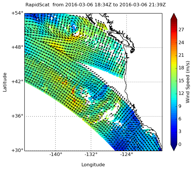
NASA’s RapidScat instrument spied tropical-storm-force winds in a weather system affecting the Pacific Northwestern U.S. and southwestern Canada on Sunday, March 6 and Monday, March 7. NOAA’s GOES-West satellite provided an infrared look at the clouds associated with the system that blanketed the U.S. West Coast.
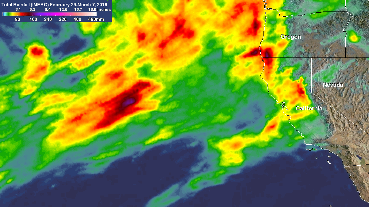
In addition, NASA’s Integrated Multi-satellitE Retrievals for GPM (IMERG) precipitation product added up the large rainfall totals that the west coast received from Feb. 29 to early March 7 as the latest system was bringing more rain and snow.
RapidScat is a scatterometer instrument that flies aboard the International Space Station. It measures surface wind speeds and direction over open waters of oceans. Images from RapidScat data are made into images at NASA’s Jet Propulsion Laboratory in Pasadena, California, where the mission is managed.
On Sunday, March 6, 2016 from 2 to 4 p.m. EST (1900 to 2100 UTC), NASA’s RapidScat instrument measured the surface winds over the Eastern Pacific Ocean that are associated with the low pressure area that neared U.S. Pacific Northwest and southwestern Canada. RapidScat measured sustained surface winds near 46.9 mph (21 meters per second/75.6 kph) along the eastern and southern quadrants of the low pressure center. Those winds were affecting coastal areas of British Columbia, including Vancouver Island. Winds of that strength also extended along the coast of Washington State.
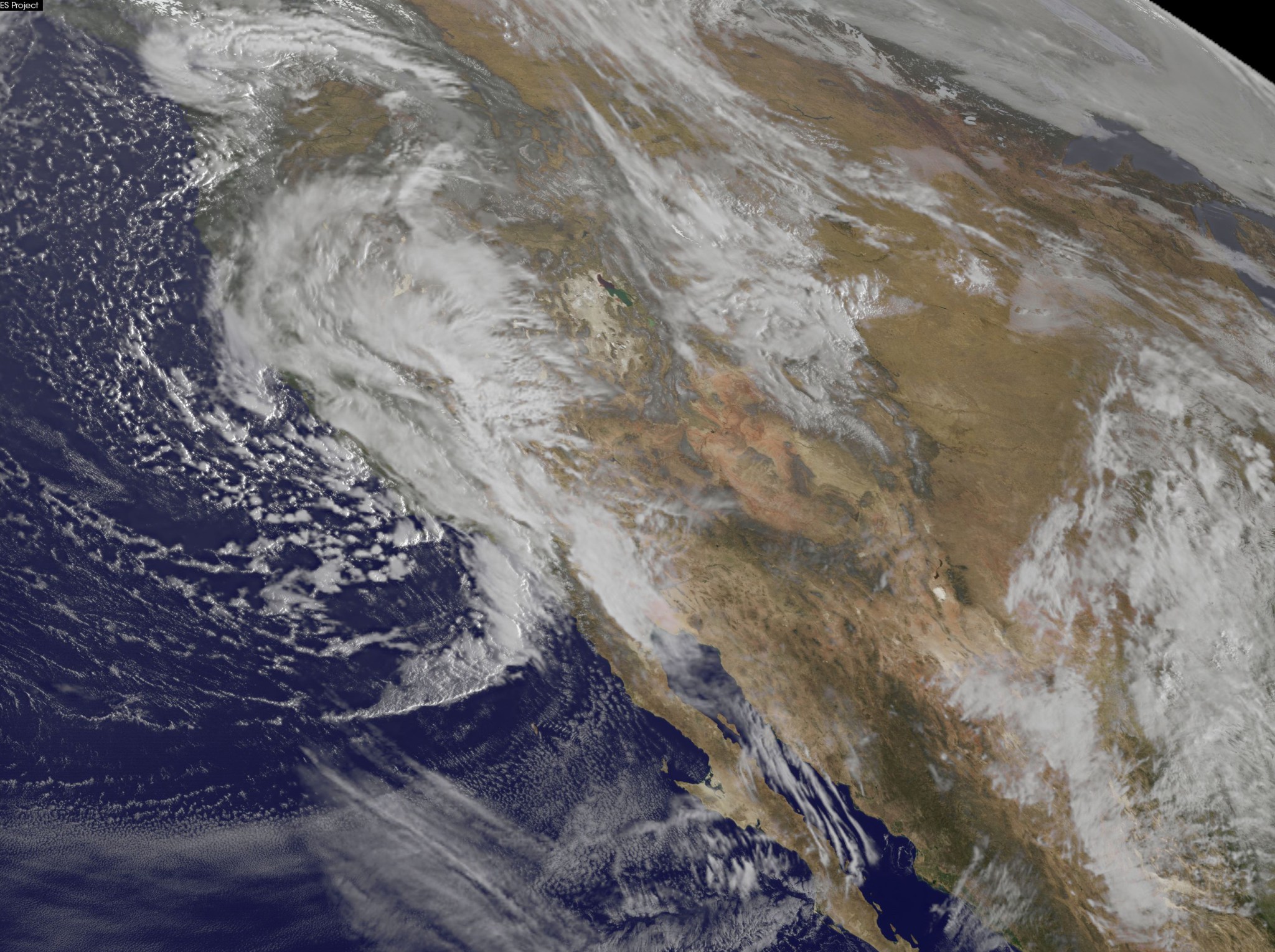
On March 7, NOAA’s GOES-West satellite captured an infrared image that showed the clouds associated with that low pressure area along the coast of the Pacific from the Northwest south to northern Baja California, Mexico. The low was centered near the border of Oregon and California and the associated cold front stretched to southern California. The image was created at NASA/NOAA GOES Project Office at NASA’s Goddard Space Flight Center in Greenbelt, Maryland.
At 10 a.m. EST, strongest sustained winds near 18.6 mph and gusting to 24.2 mph (30 kph gusting to 39 kph) appeared along the west central coast of British Columbia, Canada. Prince Rupert Airport, located on Kaien Island, Prince Rupert is a transportation hub. It is located about 800 miles (1,287 km) north of Vancouver.
Further south, the winds were not as strong. At 10 a.m. EST the Vancouver International Airport in British Columbia, Canada reported light rain with winds from the east-northeast at 8 mph (13 kph). Seattle was reporting rain with sustained southerly winds near 10 mph and gusts to 21 mph. In Portland, Oregon the winds were from the south-southwest at 8 mph.
On the southern end of the system the associated cold front has triggered many warnings an advisories from the Los Angeles to San Diego area. The National Weather Service in Los Angeles calls for heavy rain, heavy mountain snow, thunderstorms, very strong and gusty winds and flooding to the area on March 7. Along the coast, gale force winds are expected to affect the coastal waters. High surf will create very hazardous conditions in and near to the surf zone.
Current warnings and advisories include a Winter Storm Warning, High Wind Warning, Flood Advisory, Wind Advisory, Gale Warning and High Surf Advisory.
In San Diego, the advisories include a High Surf Warning, Coastal Flood Advisory,
High Surf Advisory, Wind Advisory and a Beach Hazards Statement. Heavy rain, thunderstorms and hail are in the forecast. Winds are forecast from the west from 10 to 15 mph increasing to 15 to 20 mph in the afternoon. Winds could gust as high as 35 mph.
NOAA’s National Weather Service Weather Prediction Center (WPC) in College Park, Maryland, noted in the forecast discussion issued on March 7 at 2:25 a.m. EST that the storm system brings a continuation of rain and mountain snow to the Pacific region. Thunderstorms are also possible. WPC said that “Heavy snow is possible in areas of higher terrain, including the Sierras, San Gabriels, and the San Bernardino Mountains.
Additional snowfall amounts of 5 to 10 inches are possible in these areas. Snow will also spread into the Great Basin by later today as the system moves inland.
Northern California has been especially hard hit with heavy rainfall and strong winds being reported. Rain and snowfall in the Sierra Nevada mountains may help to alleviate the long-lasting California drought.
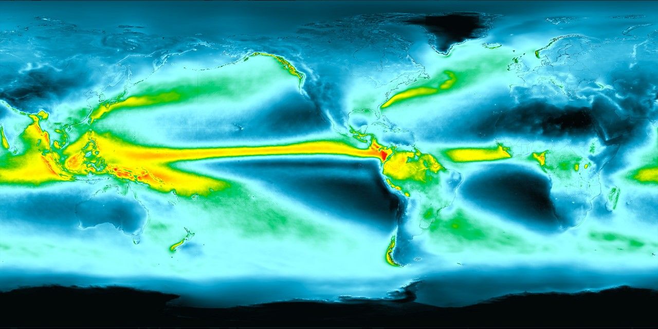
An analysis of total precipitation from February 29 to March 7, 2016 was done at NASA’s Goddard Space Flight Center in Greenbelt, Maryland, using data collected by IMERG, which creates a merged precipitation product from a Global Precipitation Measurement mission constellation of satellites.
The analysis showed heavy rainfall that occurred near the California and Oregon border over that eight day period. Rainfall totals for this period were estimated by IMERG to be over 8 inches (203 mm) in some areas.
For updated forecasts and warnings, visit the National Weather Service page at: www.weather.gov.

